

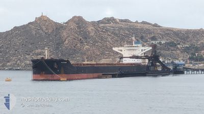
MAIRAKI
Bulk Carrier

Current Trip
ACU_BRAZIL
| Time Travelled | 22 days |
|---|---|
| Remaining Time | --- |
| Distance Travelled | 633.56 nm |
| Remaining Distance | --- |
| AVG Speed | 9 Knopen |
| MAX Speed | 11.9 Knopen |
| AVG Wind | 10.2 knots |
| MAX Wind | 22 knots |
| MIN Temp | 18.2°C / 64.76°F |
| MAX Temp | 26.8°C / 80.24°F |
| Diepgang | 10.5 M |
| Positie ontvangen | 1 m geleden |
Current Position
| Lengtegraad | --- |
|---|---|
| Breedtegraat | --- |
| Status | Under way using engine |
| Snelheid | 4.6 Knopen |
| Koers | 122° |
| Gebied | Gulf of Oman |
| Station | T-AIS |
| Positie ontvangen | 1 m geleden |
Information
The current position of MAIRAKI is in Gulf of Oman with coordinates 25.25244° / 56.51773° as reported on 2025-02-20 16:22 by AIS to our vessel tracker app. The vessel's current speed is 4.6 Knopen
The vessel MAIRAKI (IMO: 9444546, MMSI: 538004073) is a Bulk Carrier that was built in 2011 ( 14 Jaar oud ). It's sailing under the flag of [MH] Marshall Is.
In this page you can find informations about the vessels current position, last detected port calls, and current voyage information. If the vessels is not in coverage by AIS you will find the latest position.
The current position of MAIRAKI is detected by our AIS receivers and we are not responsible for the reliability of the data. The last position was recorded while the vessel was in Coverage by the Ais receivers of our vessel tracking app.
The current draught of MAIRAKI as reported by AIS is 10.5 meters
Weather
| Temperature | 23.1°C / 73.58°F |
|---|---|
| Wind Speed | 2 knots |
| Direction | 245° WSW |
| Pressure | 1012.6 hPa |
| Humidity | 61.9 % |
| Cloud Coverage | 75 % |

Featured Company
Events
| Tijd | Evenement | Details | Positie / Bestemming | Info |
|---|---|---|---|---|
| 2025-02-20 16:21 | Start beweging | 10.35 nm, North East of FUJAIRAH |
25.25363 / 56.51588
ACU_BRAZIL
|
Snelheid: 3.2 kn Koers: 124° |
| 2025-02-20 16:18 | Status Changed | Under way using engine At anchor |
25.25479 / 56.51459
ACU_BRAZIL
|
Snelheid: 0.4 kn Koers: 146° |
| 2025-02-20 16:03 | Status Changed | At anchor Default |
25.25712 / 56.51416
ACU_BRAZIL
|
Snelheid: 0.1 kn Koers: 148° |
| 2025-02-20 15:54 | Status Changed | Default At anchor |
25.25787 / 56.51380
ACU_BRAZIL
|
Snelheid: Koers: 148° |
| 2025-02-20 15:40 | Draught Changed | 10.5 9.4 |
25.25791 / 56.51375
ACU_BRAZIL
|
Snelheid: Koers: 150° |
| 2025-02-20 15:40 | Destination Changed | ACU_BRAZIL AE FJR |
25.25791 / 56.51375
ACU_BRAZIL
|
Snelheid: Koers: 150° |
| 2025-02-20 15:35 | ETA Changed | 2025/03/21 19:30 2025/02/18 19:30 |
25.25792 / 56.51370
AE FJR
|
Snelheid: Koers: 148° |
| 2025-02-20 15:33 | Status Changed | At anchor Default |
25.25792 / 56.51370
AE FJR
|
Snelheid: Koers: 146° |
| 2025-02-20 15:28 | Status Changed | Default At anchor |
25.25789 / 56.51363
AE FJR
|
Snelheid: Koers: 144° |
| 2025-02-20 14:45 | Status Changed | At anchor Default |
25.25758 / 56.51320
AE FJR
|
Snelheid: Koers: 130° |