
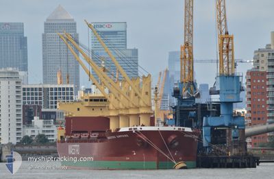
DEVBULK SERVET
Cargo
Current Trip
BRAZIL-ITAQUI
| Time Travelled | 5 days |
|---|---|
| Remaining Time | --- |
| Distance Travelled | 1675.84 nm |
| Remaining Distance | --- |
| AVG Speed | 11.7 Knopen |
| MAX Speed | 14.5 Knopen |
| AVG Wind | 12.6 knots |
| MAX Wind | 28.4 knots |
| MIN Temp | -1°C / 30.2°F |
| MAX Temp | 9.8°C / 49.64°F |
| Diepgang | 10.9 M |
| Positie ontvangen | Nu |
Current Position
| Lengtegraad | -0.45424° |
|---|---|
| Breedtegraat | 50.41825° |
| Status | Under way using engine |
| Snelheid | 11.8 Knopen |
| Koers | 255.4° |
| Gebied | English Channel |
| Station | T-AIS |
| Positie ontvangen | Nu |
Info
Information
The current position of DEVBULK SERVET is in English Channel with coordinates 50.41825° / -0.45424° as reported on 2024-04-26 19:28 by AIS to our vessel tracker app. The vessel's current speed is 11.8 Knopen
The vessel DEVBULK SERVET (IMO: 9756250, MMSI: 538008971) is a Cargo It's sailing under the flag of [MH] Marshall Is.
In this page you can find informations about the vessels current position, last detected port calls, and current voyage information. If the vessels is not in coverage by AIS you will find the latest position.
The current position of DEVBULK SERVET is detected by our AIS receivers and we are not responsible for the reliability of the data. The last position was recorded while the vessel was in Coverage by the Ais receivers of our vessel tracking app.
The current draught of DEVBULK SERVET as reported by AIS is 10.9 meters
Weather
| Temperature | 9.5°C / 49.1°F |
|---|---|
| Wind Speed | 19 knots |
| Direction | 84° E |
| Pressure | 1002.4 hPa |
| Humidity | 87.9 % |
| Cloud Coverage | 100 % |
Featured Company
Last Port Calls
| Port | Arrival | Departure | Time In Port |
|---|---|---|---|
| 2024-04-17 03:01 | 2024-04-20 22:59 | 3 d | |
| 2024-04-04 22:56 | 2024-04-10 14:43 | 5 d | |
| 2024-03-29 09:36 | 2024-04-04 18:39 | 6 d | |
| 2024-03-12 18:17 | 2024-03-15 08:34 | 2 d | |
| 2024-02-25 13:56 | 2024-02-26 23:49 | 1 d | |
| 2024-02-20 09:03 | 2024-02-22 23:30 | 2 d | |
| 2024-02-03 13:17 |
Last Trips
| Origin | Departure | Destination | Arrival | Distance | |
|---|---|---|---|---|---|
| 2024-04-10 16:43 | 2024-04-17 06:01 | 1361.60 nm | |||
| 2024-04-04 20:39 | 2024-04-05 00:56 | 51.15 nm | |||
| 2024-03-15 04:34 | 2024-03-29 10:36 | 4023.33 nm | |||
| 2024-02-26 18:49 | 2024-03-12 14:17 | 940.53 nm | |||
| 2024-02-22 18:30 | 2024-02-25 08:56 | 688.90 nm | |||
| 2024-02-03 14:17 | 2024-02-20 04:03 | 4663.25 nm |
Events
| Tijd | Evenement | Details | Positie / Bestemming | Info |
|---|---|---|---|---|
| 2024-04-26 16:12 | Status Changed | Under way using engine Default |
50.61493 / .64972
BRAZIL-ITAQUI
|
Snelheid: 13.3 kn Koers: 232° |
| 2024-04-26 15:52 | Status Changed | Default Under way using engine |
50.66025 / .73811
BRAZIL-ITAQUI
|
Snelheid: 13 kn Koers: 231° |
| 2024-04-26 12:31 | Gevonden in zee | United Kingdom part of the English Channel |
51.07360 / 1.47288
English Channel
BRAZIL-ITAQUI
|
Snelheid: 10.7 kn Koers: 232.3° |
| 2024-04-26 08:47 | Wijzig zee gebeid | United Kingdom part of the North Sea Belgian part of the North Sea |
51.68269 / 2.33595
North Sea
BRAZIL-ITAQUI
|
Snelheid: 14.1 kn Koers: 219.7° |
| 2024-04-26 07:50 | Wijzig zee gebeid | Belgian part of the North Sea Dutch part of the North Sea |
51.85200 / 2.55296
North Sea
BRAZIL-ITAQUI
|
Snelheid: 13.1 kn Koers: 202.8° |
| 2024-04-26 07:23 | Wijzig zee gebeid | Dutch part of the North Sea United Kingdom part of the North Sea |
51.94329 / 2.60180
North Sea
BRAZIL-ITAQUI
|
Snelheid: 12.6 kn Koers: 187.3° |
| 2024-04-26 06:25 | Status Changed | Under way using engine Default |
52.13658 / 2.63561
BRAZIL-ITAQUI
|
Snelheid: 11.6 kn Koers: 186° |
| 2024-04-26 06:19 | Status Changed | Default Under way using engine |
52.15481 / 2.63841
BRAZIL-ITAQUI
|
Snelheid: 11.5 kn Koers: 183.6° |
| 2024-04-26 06:15 | Gevonden in zee | United Kingdom part of the North Sea |
52.16776 / 2.64017
North Sea
BRAZIL-ITAQUI
|
Snelheid: 11.5 kn Koers: 183.6° |
| 2024-04-26 06:15 | Status Changed | Under way using engine Default |
52.16776 / 2.64017
BRAZIL-ITAQUI
|
Snelheid: 11.4 kn Koers: 184° |