
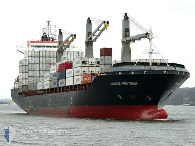
MAERSK NEW DELHI
Container Ship
Current Trip
COSMR
| Time Travelled | 8 days |
|---|---|
| Remaining Time | --- |
| Distance Travelled | 2964.43 nm |
| Remaining Distance | --- |
| AVG Speed | 15.7 Knopen |
| MAX Speed | 21.5 Knopen |
| AVG Wind | 18 knots |
| MAX Wind | 27 knots |
| MIN Temp | 12.1°C / 53.78°F |
| MAX Temp | 26.9°C / 80.42°F |
| Diepgang | 10.7 M |
| Positie ontvangen | 8 d geleden |
Current Position
| Lengtegraad | --- |
|---|---|
| Breedtegraat | --- |
| Status | Under way using engine |
| Snelheid | 18.9 Knopen |
| Koers | 40.9° |
| Gebied | Caribbean Sea |
| Station | T-AIS |
| Positie ontvangen | 8 d geleden |
Info
Information
The current position of MAERSK NEW DELHI is in Caribbean Sea with coordinates 11.43225° / -74.17586° as reported on 2025-03-10 00:20 by AIS to our vessel tracker app. The vessel's current speed is 18.9 Knopen
The vessel MAERSK NEW DELHI (IMO: 9402627, MMSI: 477207300) is a Container Ship that was built in 2009 ( 16 Jaar oud ). It's sailing under the flag of [HK] Hong Kong.
In this page you can find informations about the vessels current position, last detected port calls, and current voyage information. If the vessels is not in coverage by AIS you will find the latest position.
The current position of MAERSK NEW DELHI is detected by our AIS receivers and we are not responsible for the reliability of the data. The last position was recorded while the vessel was in Coverage by the Ais receivers of our vessel tracking app.
The current draught of MAERSK NEW DELHI as reported by AIS is 10.7 meters
Weather
| Temperature | 12.1°C / 53.78°F |
|---|---|
| Wind Speed | 17 knots |
| Direction | 322° NW |
| Pressure | 1020.1 hPa |
| Humidity | 66.6 % |
| Cloud Coverage | 100 % |
Featured Company
Last Port Calls
| Port | Arrival | Departure | Time In Port |
|---|---|---|---|
| 2025-03-09 00:23 | 2025-03-09 18:26 | 18 h | |
| 2025-03-03 18:07 | 2025-03-08 03:43 | 4 d | |
| 2025-03-01 06:10 | 2025-03-02 13:47 | 1 d | |
| 2025-02-20 21:55 | 2025-02-21 11:44 | 13 h | |
| 2025-02-07 17:50 | 2025-02-08 14:50 | 21 h | |
| 2025-02-05 23:55 | 2025-02-06 14:55 | 15 h | |
| 2025-02-03 10:13 | 2025-02-04 18:51 | 1 d | |
| 2025-02-01 11:58 | 2025-02-02 13:00 | 1 d | |
| 2025-01-18 23:25 | 2025-01-19 21:19 | 21 h | |
| 2025-01-13 21:03 | 2025-01-17 23:18 | 4 d |
Most Visited Ports (Last year)
| Port | Arrivals | |
|---|---|---|
| 6 | ||
| 6 | ||
| 5 | ||
| 5 | ||
| 5 | ||
| 5 |
Last Trips
| Origin | Departure | Destination | Arrival | Distance | |
|---|---|---|---|---|---|
| 2025-03-08 03:43 | 2025-03-09 00:23 | 282.88 nm | |||
| 2025-03-02 13:47 | 2025-03-03 18:07 | 251.75 nm | |||
| 2025-02-21 11:44 | 2025-03-01 06:10 | 1858.14 nm | |||
| 2025-02-08 14:50 | 2025-02-20 21:55 | 5986.55 nm | |||
| 2025-02-06 14:55 | 2025-02-07 17:50 | 130.04 nm | |||
| 2025-02-04 18:51 | 2025-02-05 23:55 | 450.24 nm | |||
| 2025-02-02 13:00 | 2025-02-03 10:13 | 261.19 nm | |||
| 2025-01-19 21:19 | 2025-02-01 11:58 | 4423.82 nm | |||
| 2025-01-17 23:18 | 2025-01-18 23:25 | 283.62 nm | |||
| 2025-01-12 12:23 | 2025-01-13 21:03 | 259.14 nm |
Events
| Tijd | Evenement | Details | Positie / Bestemming | Info |
|---|---|---|---|---|
| 2025-03-10 00:21 | Status Changed | Default Under way using engine |
11.43746 / -74.17130
COSMR
|
Snelheid: 18.9 kn Koers: 40.9° |
| 2025-03-10 00:20 | Buitenbereik |
11.43225 / -74.17586
Caribbean Sea
|
Snelheid: 18.9 kn Koers: 40.9° |
|
| 2025-03-10 00:12 | Status Changed | Under way using engine Default |
11.40219 / -74.20053
COSMR
|
Snelheid: 17.4 kn Koers: 38° |
| 2025-03-09 23:30 | Status Changed | Default Under way using engine |
11.24461 / -74.22916
COSMR
|
Snelheid: 4.8 kn Koers: 250° |
| 2025-03-09 23:26 | Vertrekhaven |
|
11.24646 / -74.22368
COSMR
|
Snelheid: 4.3 kn Koers: 251° |
| 2025-03-09 23:20 | Start beweging |
11.24961 / -74.21737
[CO] SANTA MARTA
|
Snelheid: 3.1 kn Koers: 232° |
|
| 2025-03-09 23:14 | Status Changed | Under way using engine Default |
11.25080 / -74.21575
[CO] SANTA MARTA
|
Snelheid: Koers: 205° |
| 2025-03-09 22:57 | Binnenbereik |
11.25080 / -74.21575
Caribbean Sea
[CO] SANTA MARTA
|
Snelheid: 0.3 kn Koers: 234.1° |
|
| 2025-03-09 21:01 | Buitenbereik |
11.25077 / -74.21567
Caribbean Sea
[CO] SANTA MARTA
|
Snelheid: Koers: 358.4° |
|
| 2025-03-09 18:22 | Status Changed | Moored Default |
11.25079 / -74.21567
[CO] SANTA MARTA
|
Snelheid: Koers: 205° |