

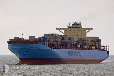
MAERSK ALGOL
Container Ship

Current Trip
| Time Travelled | 6 h, 49 mins |
|---|---|
| Remaining Time | 1 day |
| Distance Travelled | 76.01 nm |
| Remaining Distance | 424.00 nm |
| AVG Speed | 11.5 Knopen |
| MAX Speed | 12.6 Knopen |
| AVG Wind | 5.9 knots |
| MAX Wind | 9 knots |
| MIN Temp | 9.9°C / 49.82°F |
| MAX Temp | 12.8°C / 55.04°F |
| Diepgang | 10.6 M |
| Positie ontvangen | 1 d geleden |
Current Position
| Lengtegraad | --- |
|---|---|
| Breedtegraat | --- |
| Status | Under way using engine |
| Snelheid | 7 Knopen |
| Koers | 354.2° |
| Gebied | Japan Sea |
| Station | T-AIS |
| Positie ontvangen | 1 d geleden |
Information
The current position of MAERSK ALGOL is in Japan Sea with coordinates 34.93144° / 128.85937° as reported on 2025-02-26 16:25 by AIS to our vessel tracker app. The vessel's current speed is 7 Knopen and is heading at the port of QINGDAO. The estimated time of arrival as calculated by MyShipTracking vessel tracking app is 2025-03-01 21:24 LT
The vessel MAERSK ALGOL (IMO: 9342528, MMSI: 565819000) is a Container Ship that was built in 2008 ( 17 Jaar oud ). It's sailing under the flag of [SG] Singapore.
In this page you can find informations about the vessels current position, last detected port calls, and current voyage information. If the vessels is not in coverage by AIS you will find the latest position.
The current position of MAERSK ALGOL is detected by our AIS receivers and we are not responsible for the reliability of the data. The last position was recorded while the vessel was in Coverage by the Ais receivers of our vessel tracking app.
The current draught of MAERSK ALGOL as reported by AIS is 10.6 meters
Weather
| Temperature | 12.3°C / 54.14°F |
|---|---|
| Wind Speed | 4 knots |
| Direction | 243° WSW |
| Pressure | 1020.7 hPa |
| Humidity | 81.5 % |
| Cloud Coverage | 100 % |


Featured Company
Last Port Calls
| Port | Arrival | Departure | Time In Port |
|---|---|---|---|
| 2025-02-26 17:42 | 2025-02-28 02:43 | 1 d | |
| 2025-02-22 22:21 | 2025-02-24 09:25 | 1 d | |
| 2025-02-03 20:27 | 2025-02-06 16:37 | 2 d | |
| 2025-01-26 14:37 | 2025-01-31 03:22 | 4 d | |
| 2025-01-13 09:12 | 2025-01-14 08:32 | 23 h | |
| 2025-01-07 02:18 | 2025-01-08 04:27 | 1 d | |
| 2024-12-29 11:00 | 2024-12-30 10:56 | 23 h | |
| 2024-12-26 00:41 | 2024-12-27 08:44 | 1 d | |
| 2024-12-07 13:17 | 2024-12-09 13:22 | 2 d | |
| 2024-12-05 04:01 |
Most Visited Ports (Last year)
| Port | Arrivals | |
|---|---|---|
| 8 | ||
| 7 | ||
| 7 | ||
| 6 | ||
| 6 |
Last Trips
| Origin | Departure | Destination | Arrival | Distance | |
|---|---|---|---|---|---|
| 2025-02-24 17:25 | 2025-02-27 02:42 | 543.03 nm | |||
| 2025-02-06 08:37 | 2025-02-23 06:21 | 5653.45 nm | |||
| 2025-01-30 19:22 | 2025-02-03 12:27 | 567.76 nm | |||
| 2025-01-14 17:32 | 2025-01-26 06:37 | 5348.26 nm | |||
| 2025-01-08 13:27 | 2025-01-13 18:12 | 33.51 nm | |||
| 2024-12-30 18:56 | 2025-01-07 11:18 | 684.96 nm | |||
| 2024-12-27 16:44 | 2024-12-29 19:00 | 482.86 nm | |||
| 2024-12-09 05:22 | 2024-12-26 08:41 | 5628.21 nm | |||
| 2024-12-04 20:01 | 2024-12-07 05:17 | 435.71 nm |
Events
| Tijd | Evenement | Details | Positie / Bestemming | Info |
|---|---|---|---|---|
| 2025-02-28 02:43 | Vertrekhaven |
|
35.03303 / 128.78200
USOAK>CNQDG
|
Snelheid: 9.8 kn Koers: 201° |
| 2025-02-28 02:24 | Start beweging |
35.07162 / 128.80516
[KR] BUSAN NEW PORT
|
Snelheid: 4.2 kn Koers: 249° |
|
| 2025-02-26 17:46 | Stop beweging |
35.07729 / 128.80377
[KR] BUSAN NEW PORT
|
Snelheid: Koers: 90° |
|
| 2025-02-26 17:42 | Aankomsthaven |
|
35.07711 / 128.80368
[KR] BUSAN NEW PORT
|
Snelheid: 0.7 kn Koers: 83° |
| 2025-02-26 16:25 | Status Changed | Default Under way using engine |
34.93209 / 128.85928
USOAK>CNQDG
|
Snelheid: 7 kn Koers: 354.2° |
| 2025-02-26 16:25 | Status Changed | Under way using engine Default |
34.93144 / 128.85937
USOAK>CNQDG
|
Snelheid: 7.2 kn Koers: 3° |
| 2025-02-26 16:25 | Buitenbereik |
34.93144 / 128.85937
Japan Sea
|
Snelheid: 7 kn Koers: 354.2° |
|
| 2025-02-26 16:01 | Status Changed | Default Under way using engine |
34.88042 / 128.85779
USOAK>CNQDG
|
Snelheid: 8.9 kn Koers: 2.1° |
| 2025-02-26 15:54 | Status Changed | Under way using engine Default |
34.86126 / 128.85763
USOAK>CNQDG
|
Snelheid: 8.6 kn Koers: 359° |
| 2025-02-26 15:13 | Status Changed | Default Under way using engine |
34.77152 / 128.85934
USOAK>CNQDG
|
Snelheid: 9.2 kn Koers: 359.4° |