
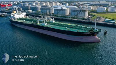
LYRIC CAMELLIA
Tanker
Current Trip
| Time Travelled | 57 days |
|---|---|
| Remaining Time | --- |
| Distance Travelled | 8467.16 nm |
| Remaining Distance | --- |
| AVG Speed | 11.9 Knopen |
| MAX Speed | 11.9 Knopen |
| AVG Wind | 12.1 knots |
| MAX Wind | 31.9 knots |
| MIN Temp | 10.6°C / 51.08°F |
| MAX Temp | 31.6°C / 88.88°F |
| Diepgang | 8.7 M |
| Positie ontvangen | 10 h, 21 m geleden |
Current Position
| Lengtegraad | 14.75589° |
|---|---|
| Breedtegraat | 35.91362° |
| Status | At anchor |
| Snelheid | 0.1 Knopen |
| Koers | 81° |
| Gebied | Mediterranean Sea - Eastern Basin |
| Station | T-AIS |
| Positie ontvangen | 10 h, 21 m geleden |
Info
Information
The current position of LYRIC CAMELLIA is in Mediterranean Sea - Eastern Basin with coordinates 35.91362° / 14.75589° as reported on 2024-05-20 00:48 by AIS to our vessel tracker app. The vessel's current speed is 0.1 Knopen
The vessel LYRIC CAMELLIA (IMO: 9730933, MMSI: 311000359) is a Tanker It's sailing under the flag of [BS] Bahamas.
In this page you can find informations about the vessels current position, last detected port calls, and current voyage information. If the vessels is not in coverage by AIS you will find the latest position.
The current position of LYRIC CAMELLIA is detected by our AIS receivers and we are not responsible for the reliability of the data. The last position was recorded while the vessel was in Coverage by the Ais receivers of our vessel tracking app.
The current draught of LYRIC CAMELLIA as reported by AIS is 8.7 meters
Weather
| Temperature | 20.1°C / 68.18°F |
|---|---|
| Wind Speed | 13 knots |
| Direction | 124° SE |
| Pressure | 1008.6 hPa |
| Humidity | 89.7 % |
| Cloud Coverage | 22 % |
Featured Company
Last Port Calls
| Port | Arrival | Departure | Time In Port |
|---|---|---|---|
| 2024-05-06 07:31 | 2024-05-06 16:56 | 9 h | |
| 2024-04-25 13:12 | 2024-04-25 21:21 | 8 h | |
| 2024-04-12 08:17 | 2024-04-12 17:42 | 9 h | |
| 2024-03-22 17:15 | 2024-03-24 02:00 | 1 d | |
| 2024-03-04 10:44 | 2024-03-04 20:04 | 9 h |
Most Visited Ports (Last year)
| Port | Arrivals | |
|---|---|---|
| 14 | ||
| 4 | ||
| 3 | ||
| 2 | ||
| 2 | ||
| 1 |
Last Trips
| Origin | Departure | Destination | Arrival | Distance | |
|---|---|---|---|---|---|
| 2024-03-24 02:00 | 2024-05-06 07:31 | 6070.79 nm | |||
| 2024-03-24 02:00 | 2024-04-25 13:12 | 4453.45 nm | |||
| 2024-03-24 02:00 | 2024-04-12 08:17 | 1553.58 nm | |||
| 2024-01-18 02:50 | 2024-03-22 17:15 | 6231.91 nm | |||
| 2024-01-18 02:50 | 2024-03-04 10:44 | 4911.68 nm |
Events
| Tijd | Evenement | Details | Positie / Bestemming | Info |
|---|---|---|---|---|
| 2024-05-20 04:19 | Start beweging | 11.69 nm, East of VALLETTA |
35.91660 / 14.76134
MALTA OPL
|
Snelheid: 3.8 kn Koers: 110° |
| 2024-05-20 00:54 | Status Changed | Default At anchor |
35.91370 / 14.75601
MALTA OPL
|
Snelheid: 0.1 kn Koers: 81° |
| 2024-05-20 00:48 | Status Changed | At anchor Default |
35.91362 / 14.75589
MALTA OPL
|
Snelheid: 0.1 kn Koers: 86° |
| 2024-05-20 00:48 | Buitenbereik |
35.91362 / 14.75589
Mediterranean Sea - Eastern Basin
|
Snelheid: 0.1 kn Koers: 18.3° |
|
| 2024-05-20 00:33 | Binnenbereik |
35.91362 / 14.75589
Mediterranean Sea - Eastern Basin
|
Snelheid: 0.1 kn Koers: 18.3° |
|
| 2024-05-19 09:18 | Status Changed | Default At anchor |
35.91428 / 14.75596
MALTA OPL
|
Snelheid: 0.1 kn Koers: 72° |
| 2024-05-19 09:15 | Buitenbereik |
35.91447 / 14.75596
Mediterranean Sea - Eastern Basin
MALTA OPL
|
Snelheid: 0.1 kn Koers: 196.9° |
|
| 2024-05-19 09:06 | Status Changed | At anchor Default |
35.91478 / 14.75572
MALTA OPL
|
Snelheid: 0.2 kn Koers: 68° |
| 2024-05-19 08:42 | Status Changed | Default At anchor |
35.91428 / 14.75780
MALTA OPL
|
Snelheid: 0.6 kn Koers: 36° |
| 2024-05-19 08:39 | Status Changed | At anchor Under way using engine |
35.91403 / 14.75834
MALTA OPL
|
Snelheid: 0.6 kn Koers: 37° |