
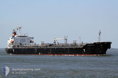
LYDERHORN
Oil/Chemical Tanker
Current Trip
IT AUG
| Time Travelled | 17 days |
|---|---|
| Remaining Time | --- |
| Distance Travelled | 2076.51 nm |
| Remaining Distance | --- |
| AVG Speed | 9 Knopen |
| MAX Speed | 13.8 Knopen |
| AVG Wind | 9.9 knots |
| MAX Wind | 27 knots |
| MIN Temp | 14.7°C / 58.46°F |
| MAX Temp | 20°C / 68°F |
| Diepgang | 10 M |
| Positie ontvangen | 2 m geleden |
Current Position
| Lengtegraad | 16.00124° |
|---|---|
| Breedtegraat | 37.25900° |
| Status | Under way using engine |
| Snelheid | 0.4 Knopen |
| Koers | 275° |
| Gebied | Ionian Sea |
| Station | T-AIS |
| Positie ontvangen | 2 m geleden |
Info
Information
The current position of LYDERHORN is in Ionian Sea with coordinates 37.25900° / 16.00124° as reported on 2024-05-12 02:41 by AIS to our vessel tracker app. The vessel's current speed is 0.4 Knopen
The vessel LYDERHORN (IMO: 9325855, MMSI: 257710000) is a Oil/Chemical Tanker that was built in 2006 ( 18 Jaar oud ). It's sailing under the flag of [NO] Norway.
In this page you can find informations about the vessels current position, last detected port calls, and current voyage information. If the vessels is not in coverage by AIS you will find the latest position.
The current position of LYDERHORN is detected by our AIS receivers and we are not responsible for the reliability of the data. The last position was recorded while the vessel was in Coverage by the Ais receivers of our vessel tracking app.
The current draught of LYDERHORN as reported by AIS is 10 meters
Weather
| Temperature | 18.3°C / 64.94°F |
|---|---|
| Wind Speed | 7 knots |
| Direction | 324° NW |
| Pressure | 1017.6 hPa |
| Humidity | 74.2 % |
| Cloud Coverage | --- |
Featured Company
Last Port Calls
| Port | Arrival | Departure | Time In Port |
|---|---|---|---|
| 2024-04-23 23:38 | 2024-04-25 00:07 | 1 d | |
| 2024-03-27 09:48 | 2024-03-28 13:40 | 1 d | |
| 2024-03-08 12:09 | 2024-03-09 18:25 | 1 d | |
| 2024-03-07 18:41 | 2024-03-08 10:45 | 16 h |
Most Visited Ports (Last year)
| Port | Arrivals | |
|---|---|---|
| 3 | ||
| 3 | ||
| 3 | ||
| 3 | ||
| 2 | ||
| 2 |
Last Trips
| Origin | Departure | Destination | Arrival | Distance | |
|---|---|---|---|---|---|
| 2024-03-28 16:40 | 2024-04-24 00:38 | 7147.87 nm | |||
| 2024-03-10 02:25 | 2024-03-27 12:48 | 4359.08 nm | |||
| 2024-03-08 18:45 | 2024-03-08 20:09 | 9.72 nm | |||
| 2024-02-13 15:20 | 2024-03-08 02:41 | 3276.33 nm |
Events
| Tijd | Evenement | Details | Positie / Bestemming | Info |
|---|---|---|---|---|
| 2024-05-12 02:43 | Stop beweging |
37.25894 / 16.00138
IT AUG
|
Snelheid: 0.3 kn Koers: 276° |
|
| 2024-05-12 02:34 | Status Changed | Under way using engine Default |
37.25931 / 16.00050
IT AUG
|
Snelheid: 0.4 kn Koers: 271° |
| 2024-05-12 02:32 | Status Changed | Default Under way using engine |
37.25939 / 16.00028
IT AUG
|
Snelheid: 0.4 kn Koers: 268° |
| 2024-05-12 02:08 | Status Changed | Under way using engine Default |
37.26053 / 15.99713
IT AUG
|
Snelheid: 0.5 kn Koers: 257° |
| 2024-05-12 02:04 | Status Changed | Default Under way using engine |
37.26071 / 15.99672
IT AUG
|
Snelheid: 0.5 kn Koers: 255° |
| 2024-05-12 01:30 | Status Changed | Under way using engine Default |
37.26261 / 15.99140
IT AUG
|
Snelheid: 0.5 kn Koers: 239° |
| 2024-05-12 00:57 | Status Changed | Default Under way using engine |
37.26327 / 15.98589
IT AUG
|
Snelheid: 0.5 kn Koers: 218° |
| 2024-05-12 00:06 | Status Changed | Under way using engine Default |
37.26417 / 15.97649
IT AUG
|
Snelheid: 0.7 kn Koers: 219° |
| 2024-05-11 23:36 | Status Changed | Default Under way using engine |
37.26510 / 15.96960
IT AUG
|
Snelheid: 0.6 kn Koers: 244° |
| 2024-05-11 22:42 | Status Changed | Under way using engine Default |
37.26411 / 15.95845
IT AUG
|
Snelheid: 0.5 kn Koers: 285° |