
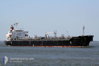
LYDERHORN
Oil/Chemical Tanker
Current Trip
| Time Travelled | 8 days |
|---|---|
| Remaining Time | --- |
| Distance Travelled | 1849.94 nm |
| Remaining Distance | --- |
| AVG Speed | 9.8 Noeuds |
| MAX Speed | 13.8 Noeuds |
| AVG Wind | 12.1 knots |
| MAX Wind | 25.9 knots |
| MIN Temp | 15.5°C / 59.9°F |
| MAX Temp | 20°C / 68°F |
| Tirant d eau | 10 m |
| Position reçue | 1 h, 19 m depuis |
Current Position
| Longitude | 15.83801° |
|---|---|
| Latitude | 37.22387° |
| Etat | Under way using engine |
| Vitesse | 1 Noeuds |
| Parcours | 84° |
| Zone | Ionian Sea |
| Station | T-AIS |
| Position reçue | 1 h, 19 m depuis |
Info
Information
The current position of LYDERHORN is in Ionian Sea with coordinates 37.22387° / 15.83801° as reported on 2024-05-03 15:55 by AIS to our vessel tracker app. The vessel's current speed is 1 Noeuds
The vessel LYDERHORN (IMO: 9325855, MMSI: 257710000) is a Oil/Chemical Tanker that was built in 2006 ( 18 Age ). It's sailing under the flag of [NO] Norway.
In this page you can find informations about the vessels current position, last detected port calls, and current voyage information. If the vessels is not in coverage by AIS you will find the latest position.
The current position of LYDERHORN is detected by our AIS receivers and we are not responsible for the reliability of the data. The last position was recorded while the vessel was in Coverage by the Ais receivers of our vessel tracking app.
The current draught of LYDERHORN as reported by AIS is 10 meters
Weather
| Temperature | 17.6°C / 63.68°F |
|---|---|
| Wind Speed | 14 knots |
| Direction | 9° N |
| Pressure | 1015.9 hPa |
| Humidity | 68.4 % |
| Cloud Coverage | 6 % |
Featured Company
Last Port Calls
| Port | Arrival | Departure | Time In Port |
|---|---|---|---|
| 2024-04-23 23:38 | 2024-04-25 00:07 | 1 d | |
| 2024-03-27 09:48 | 2024-03-28 13:40 | 1 d | |
| 2024-03-08 12:09 | 2024-03-09 18:25 | 1 d | |
| 2024-03-07 18:41 | 2024-03-08 10:45 | 16 h |
Most Visited Ports (Last year)
| Port | Arrivals | |
|---|---|---|
| 3 | ||
| 3 | ||
| 3 | ||
| 3 | ||
| 2 | ||
| 2 |
Last Trips
| Origin | Departure | Destination | Arrival | Distance | |
|---|---|---|---|---|---|
| 2024-03-28 16:40 | 2024-04-24 00:38 | 7147.87 nm | |||
| 2024-03-10 02:25 | 2024-03-27 12:48 | 4359.08 nm | |||
| 2024-03-08 18:45 | 2024-03-08 20:09 | 9.72 nm | |||
| 2024-02-13 15:20 | 2024-03-08 02:41 | 3276.33 nm |
Events
| Heure | Evenement | Détails | Position/ Destination | Info |
|---|---|---|---|---|
| 2024-05-03 16:13 | Etat Changé | Default Under way using engine |
37.21928 / 15.83909
IT AUG
|
Vitesse: 1 kn Parcours: 84° |
| 2024-05-03 15:55 | Hors de la zone couverte |
37.22387 / 15.83801
Ionian Sea
|
Vitesse: 1 kn Parcours: 166.5° |
|
| 2024-05-03 15:14 | Etat Changé | Under way using engine Default |
37.23467 / 15.83529
IT AUG
|
Vitesse: 0.9 kn Parcours: 83° |
| 2024-05-03 15:01 | Dans la zone couverte |
37.23402 / 15.83541
Ionian Sea
|
Vitesse: 1 kn Parcours: 170.3° |
|
| 2024-05-03 12:08 | Etat Changé | Default Under way using engine |
37.24220 / 15.83326
IT AUG
|
Vitesse: 0.3 kn Parcours: 36° |
| 2024-05-03 11:58 | Hors de la zone couverte |
37.24179 / 15.83229
Ionian Sea
|
Vitesse: 0.3 kn Parcours: 68.1° |
|
| 2024-05-03 10:46 | Etat Changé | Under way using engine Default |
37.24096 / 15.82483
IT AUG
|
Vitesse: 0.5 kn Parcours: 348° |
| 2024-05-03 10:43 | Etat Changé | Default Under way using engine |
37.24096 / 15.82438
IT AUG
|
Vitesse: 0.6 kn Parcours: 347° |
| 2024-05-03 10:36 | Etat Changé | Under way using engine Default |
37.24099 / 15.82305
IT AUG
|
Vitesse: 0.5 kn Parcours: 346° |
| 2024-05-03 10:28 | Etat Changé | Default Under way using engine |
37.24101 / 15.82157
IT AUG
|
Vitesse: 0.5 kn Parcours: 344° |