
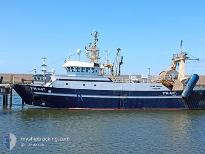
LOUWE SENIOR
Trawler
Current Trip
VLISSINGEN
| Time Travelled | 1 day |
|---|---|
| Remaining Time | --- |
| Distance Travelled | 306.24 nm |
| Remaining Distance | --- |
| AVG Speed | 8.1 Knopen |
| MAX Speed | 13.6 Knopen |
| AVG Wind | 5.6 knots |
| MAX Wind | 12 knots |
| MIN Temp | 12°C / 53.6°F |
| MAX Temp | 14.6°C / 58.28°F |
| Diepgang | 5.4 M |
| Positie ontvangen | 1 m geleden |
Current Position
| Lengtegraad | 3.10079° |
|---|---|
| Breedtegraat | 51.40079° |
| Status | Under way using engine |
| Snelheid | 11.5 Knopen |
| Koers | 84.6° |
| Gebied | North Sea |
| Station | T-AIS |
| Positie ontvangen | 1 m geleden |
Info
Information
The current position of LOUWE SENIOR is in North Sea with coordinates 51.40079° / 3.10079° as reported on 2024-05-16 20:50 by AIS to our vessel tracker app. The vessel's current speed is 11.5 Knopen
The vessel LOUWE SENIOR (IMO: 9242003, MMSI: 235003170) is a Trawler that was built in 2002 ( 22 Jaar oud ). It's sailing under the flag of [GB] United Kingdom.
In this page you can find informations about the vessels current position, last detected port calls, and current voyage information. If the vessels is not in coverage by AIS you will find the latest position.
The current position of LOUWE SENIOR is detected by our AIS receivers and we are not responsible for the reliability of the data. The last position was recorded while the vessel was in Coverage by the Ais receivers of our vessel tracking app.
The current draught of LOUWE SENIOR as reported by AIS is 5.4 meters
Weather
| Temperature | 13.8°C / 56.84°F |
|---|---|
| Wind Speed | 3 knots |
| Direction | 212° SSW |
| Pressure | 1006.7 hPa |
| Humidity | 88.2 % |
| Cloud Coverage | 6 % |
Featured Company
Last Port Calls
| Port | Arrival | Departure | Time In Port |
|---|---|---|---|
| 2024-05-14 21:27 | 2024-05-14 21:59 | 31 m | |
| 2024-04-11 20:18 | 2024-05-12 23:29 | ||
| 2024-04-06 01:11 | 2024-04-08 00:31 | 1 d | |
| 2024-04-04 01:10 | 2024-04-04 02:01 | 50 m | |
| 2024-03-29 02:13 | 2024-04-01 20:30 | 3 d | |
| 2024-03-28 12:30 | 2024-03-28 15:01 | 2 h | |
| 2024-03-21 22:06 | 2024-03-25 01:33 | 3 d | |
| 2024-03-15 13:39 | 2024-03-18 02:19 | 2 d | |
| 2024-03-07 23:01 | 2024-03-11 01:34 | 3 d | |
| 2024-03-06 23:48 | 2024-03-07 01:43 | 1 h |
Most Visited Ports (Last year)
| Port | Arrivals | |
|---|---|---|
| 37 | ||
| 16 | ||
| 9 | ||
| 1 | ||
| 1 | ||
| 1 |
Last Trips
| Origin | Departure | Destination | Arrival | Distance | |
|---|---|---|---|---|---|
| 2024-05-13 01:29 | 2024-05-14 23:27 | 289.07 nm | |||
| 2024-04-08 02:31 | 2024-04-11 22:18 | 358.24 nm | |||
| 2024-04-04 04:01 | 2024-04-06 03:11 | 222.18 nm | |||
| 2024-04-01 22:30 | 2024-04-04 03:10 | 188.76 nm | |||
| 2024-03-28 15:01 | 2024-03-29 03:13 | 102.59 nm | |||
| 2024-03-25 02:33 | 2024-03-28 12:30 | 503.58 nm | |||
| 2024-03-18 03:19 | 2024-03-21 23:06 | 521.28 nm | |||
| 2024-03-11 02:34 | 2024-03-15 14:39 | 611.62 nm | |||
| 2024-03-07 02:43 | 2024-03-08 00:01 | 115.98 nm | |||
| 2024-03-04 02:34 | 2024-03-07 00:48 | 394.86 nm |
Events
| Tijd | Evenement | Details | Positie / Bestemming | Info |
|---|---|---|---|---|
| 2024-05-16 18:26 | Wijzig zee gebeid | Belgian part of the North Sea French part of the North Sea |
51.31530 / 2.37081
North Sea
|
Snelheid: 11.7 kn Koers: 67.9° |
| 2024-05-16 16:26 | Wijzig zee gebeid | French part of the North Sea United Kingdom part of the North Sea |
51.16396 / 1.83238
North Sea
|
Snelheid: 11.6 kn Koers: 65.9° |
| 2024-05-16 16:20 | Start beweging | 11.36 nm, North of CALAIS |
51.15600 / 1.80708
VLISSINGEN
|
Snelheid: 8.6 kn Koers: 54.6° |
| 2024-05-16 16:17 | Stop beweging | 11.34 nm, North of CALAIS |
51.15538 / 1.80405
VLISSINGEN
|
Snelheid: 0.3 kn Koers: 82° |
| 2024-05-16 14:04 | Start beweging | 12.88 nm, South East of RAMSGATE |
51.17267 / 1.66055
VLISSINGEN
|
Snelheid: 4.4 kn Koers: 135° |
| 2024-05-16 13:35 | Stop beweging | 12.77 nm, South East of RAMSGATE |
51.17392 / 1.65841
VLISSINGEN
|
Snelheid: 0.2 kn Koers: 256° |
| 2024-05-16 10:06 | Start beweging | 13.08 nm, East of DOVER |
51.15673 / 1.66962
VLISSINGEN
|
Snelheid: 3.9 kn Koers: 58° |
| 2024-05-16 09:14 | Stop beweging | 12.62 nm, East of DOVER |
51.14938 / 1.65911
VLISSINGEN
|
Snelheid: 0.3 kn Koers: 70° |
| 2024-05-16 07:58 | Wijzig zee gebeid | United Kingdom part of the North Sea United Kingdom part of the English Channel |
51.05295 / 1.53296
North Sea
|
Snelheid: 13.1 kn Koers: 47° |
| 2024-05-16 07:28 | Wijzig zee gebeid | United Kingdom part of the English Channel French part of the English Channel |
50.97978 / 1.41708
English Channel
|
Snelheid: 11.7 kn Koers: 38.6° |