
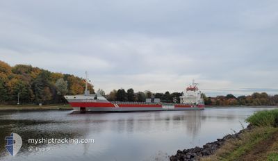
LOIREBORG
General Cargo
Current Trip
| Time Travelled | 5 days |
|---|---|
| Remaining Time | 1 h, 41 mins |
| Distance Travelled | 1163.92 nm |
| Remaining Distance | 22.56 nm |
| AVG Speed | 9.4 Knopen |
| MAX Speed | 13.7 Knopen |
| AVG Wind | 9.2 knots |
| MAX Wind | 16 knots |
| MIN Temp | 2.9°C / 37.22°F |
| MAX Temp | 19.3°C / 66.74°F |
| Diepgang | 4.4 M |
| Positie ontvangen | 18 m geleden |
Current Position
| Lengtegraad | 19.45693° |
|---|---|
| Breedtegraat | 62.99132° |
| Status | Under way using engine |
| Snelheid | 11.7 Knopen |
| Koers | 343.6° |
| Gebied | Gulf of Bothnia |
| Station | T-AIS |
| Positie ontvangen | 18 m geleden |
Info
Information
The current position of LOIREBORG is in Gulf of Bothnia with coordinates 62.99132° / 19.45693° as reported on 2024-05-02 10:47 by AIS to our vessel tracker app. The vessel's current speed is 11.7 Knopen and is heading at the port of HUSUM. The estimated time of arrival as calculated by MyShipTracking vessel tracking app is 2024-05-02 12:47 LT
The vessel LOIREBORG (IMO: 9399404, MMSI: 245535000) is a General Cargo that was built in 2008 ( 16 Jaar oud ). It's sailing under the flag of [NL] Netherlands.
In this page you can find informations about the vessels current position, last detected port calls, and current voyage information. If the vessels is not in coverage by AIS you will find the latest position.
The current position of LOIREBORG is detected by our AIS receivers and we are not responsible for the reliability of the data. The last position was recorded while the vessel was in Coverage by the Ais receivers of our vessel tracking app.
The current draught of LOIREBORG as reported by AIS is 4.4 meters
Weather
| Temperature | 3.5°C / 38.3°F |
|---|---|
| Wind Speed | 5 knots |
| Direction | 214° SW |
| Pressure | 1024.4 hPa |
| Humidity | 85.2 % |
| Cloud Coverage | 97 % |
Featured Company
Last Port Calls
| Port | Arrival | Departure | Time In Port |
|---|---|---|---|
| 2024-04-23 05:07 | 2024-04-26 19:01 | 3 d | |
| 2024-04-17 18:29 | |||
| 2024-04-16 03:11 | 2024-04-17 07:16 | 1 d | |
| 2024-03-25 00:26 | 2024-03-25 01:58 | 1 h | |
| 2024-03-21 18:20 | 2024-03-23 05:23 | 1 d | |
| 2024-03-16 08:49 | 2024-03-16 19:03 | 10 h | |
| 2024-03-14 03:10 | 2024-03-15 20:00 | 1 d | |
| 2024-03-07 12:29 | 2024-03-08 09:59 | 21 h | |
| 2024-03-04 09:41 | 2024-03-06 23:15 | 2 d | |
| 2024-03-01 08:37 |
Last Trips
| Origin | Departure | Destination | Arrival | Distance | |
|---|---|---|---|---|---|
| 2024-04-17 09:16 | 2024-04-17 20:29 | 128.33 nm | |||
| 2024-03-25 02:58 | 2024-04-16 05:11 | 1660.76 nm | |||
| 2024-03-23 06:23 | 2024-03-25 01:26 | 402.83 nm | |||
| 2024-03-16 21:03 | 2024-03-21 19:20 | 476.97 nm | |||
| 2024-03-15 22:00 | 2024-03-16 10:49 | 96.87 nm | |||
| 2024-03-08 10:59 | 2024-03-14 05:10 | 1366.29 nm | |||
| 2024-03-07 00:15 | 2024-03-07 13:29 | 163.01 nm | |||
| 2024-03-01 09:37 | 2024-03-04 10:41 | 802.99 nm |
Events
| Tijd | Evenement | Details | Positie / Bestemming | Info |
|---|---|---|---|---|
| 2024-05-02 10:52 | Status Changed | Default Under way using engine |
63.00695 / 19.44723
SEHUS
|
Snelheid: 11.7 kn Koers: 343.6° |
| 2024-05-02 10:29 | Status Changed | Under way using engine Default |
62.93425 / 19.49374
SEHUS
|
Snelheid: 11.6 kn Koers: 344° |
| 2024-05-02 09:52 | Status Changed | Default Under way using engine |
62.82167 / 19.56328
SEHUS
|
Snelheid: 11.2 kn Koers: 343.6° |
| 2024-05-02 09:45 | Status Changed | Under way using engine Default |
62.80041 / 19.57692
SEHUS
|
Snelheid: 11.2 kn Koers: 343° |
| 2024-05-02 09:44 | Status Changed | Default Under way using engine |
62.79788 / 19.57859
SEHUS
|
Snelheid: 11.2 kn Koers: 343.5° |
| 2024-05-02 09:34 | Wijzig zee gebeid | Swedish part of the Gulf of Bothnia Finnish part of the Gulf of Bothnia |
62.76857 / 19.59749
Gulf of Bothnia
SEHUS
|
Snelheid: 11.2 kn Koers: 343.6° |
| 2024-05-02 09:27 | Status Changed | Under way using engine Default |
62.74509 / 19.61277
SEHUS
|
Snelheid: 11.3 kn Koers: 342° |
| 2024-05-02 09:25 | Status Changed | Default Under way using engine |
62.73907 / 19.61692
SEHUS
|
Snelheid: 11.3 kn Koers: 342.4° |
| 2024-05-02 09:24 | Status Changed | Under way using engine Default |
62.73857 / 19.61726
SEHUS
|
Snelheid: 11.2 kn Koers: 343° |
| 2024-05-02 09:17 | Status Changed | Default Under way using engine |
62.71503 / 19.63302
SEHUS
|
Snelheid: 11.2 kn Koers: 341.7° |