
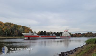
LOIREBORG
General Cargo
Current Trip
| Time Travelled | 3 days |
|---|---|
| Remaining Time | 1 day |
| Distance Travelled | 856.65 nm |
| Remaining Distance | 343.14 nm |
| AVG Speed | 8.5 Noeuds |
| MAX Speed | 11.6 Noeuds |
| AVG Wind | 8.9 knots |
| MAX Wind | 25 knots |
| MIN Temp | -3.2°C / 26.24°F |
| MAX Temp | 5.2°C / 41.36°F |
| Tirant d eau | 6.6 m |
| Position reçue | 7 h, 53 m depuis |
Current Position
| Longitude | --- |
|---|---|
| Latitude | --- |
| Etat | Under way using engine |
| Vitesse | 10.3 Noeuds |
| Parcours | 34° |
| Zone | Baltic Sea |
| Station | T-AIS |
| Position reçue | 7 h, 53 m depuis |
Info
Information
The current position of LOIREBORG is in Baltic Sea with coordinates 58.21442° / 18.65825° as reported on 2025-02-16 11:30 by AIS to our vessel tracker app. The vessel's current speed is 10.3 Noeuds and is heading at the port of KOKKOLA. The estimated time of arrival as calculated by MyShipTracking vessel tracking app is 2025-02-18 03:56 LT
The vessel LOIREBORG (IMO: 9399404, MMSI: 245535000) is a General Cargo that was built in 2008 ( 17 Age ). It's sailing under the flag of [NL] Netherlands.
In this page you can find informations about the vessels current position, last detected port calls, and current voyage information. If the vessels is not in coverage by AIS you will find the latest position.
The current position of LOIREBORG is detected by our AIS receivers and we are not responsible for the reliability of the data. The last position was recorded while the vessel was in Coverage by the Ais receivers of our vessel tracking app.
The current draught of LOIREBORG as reported by AIS is 6.6 meters
Weather
| Temperature | -1.7°C / 28.94°F |
|---|---|
| Wind Speed | 20 knots |
| Direction | 319° NW |
| Pressure | 1018 hPa |
| Humidity | 87.2 % |
| Cloud Coverage | 100 % |
Featured Company
Last Port Calls
| Port | Arrival | Departure | Time In Port |
|---|---|---|---|
| 2025-02-11 00:30 | 2025-02-12 22:51 | 1 d | |
| 2025-02-05 16:36 | 2025-02-10 12:51 | 4 d | |
| 2025-01-13 06:37 | 2025-01-14 19:13 | 1 d | |
| 2025-01-10 05:06 | 2025-01-10 21:53 | 16 h | |
| 2025-01-07 23:05 | 2025-01-09 23:10 | 2 d | |
| 2024-12-20 23:49 | 2024-12-22 09:25 | 1 d | |
| 2024-12-19 07:29 | 2024-12-20 08:01 | 1 d | |
| 2024-12-14 21:53 | 2024-12-17 16:01 | 2 d | |
| 2024-12-05 21:31 | 2024-12-09 08:03 | 3 d | |
| 2024-12-02 07:58 | 2024-12-05 15:22 | 3 d |
Most Visited Ports (Last year)
| Port | Arrivals | |
|---|---|---|
| 3 | ||
| 3 | ||
| 2 | ||
| 2 | ||
| 2 | ||
| 2 |
Last Trips
| Origin | Departure | Destination | Arrival | Distance | |
|---|---|---|---|---|---|
| 2025-02-10 13:51 | 2025-02-11 01:30 | 105.01 nm | |||
| 2025-01-14 22:13 | 2025-02-05 17:36 | 3669.26 nm | |||
| 2025-01-11 00:53 | 2025-01-13 09:37 | 459.66 nm | |||
| 2025-01-10 02:10 | 2025-01-10 08:06 | 59.65 nm | |||
| 2024-12-22 10:25 | 2025-01-08 02:05 | 3230.81 nm | |||
| 2024-12-20 09:01 | 2024-12-21 00:49 | 132.84 nm | |||
| 2024-12-17 17:01 | 2024-12-19 08:29 | 1.65 nm | |||
| 2024-12-09 09:03 | 2024-12-14 22:53 | 765.34 nm | |||
| 2024-12-05 16:22 | 2024-12-05 22:31 | 60.02 nm | |||
| 2024-11-24 11:30 | 2024-12-02 08:58 | 1735.14 nm |
Events
| Heure | Evenement | Détails | Position/ Destination | Info |
|---|---|---|---|---|
| 2025-02-16 11:37 | Etat Changé | Default Under way using engine |
58.23163 / 18.68003
FIKOK
|
Vitesse: 10.3 kn Parcours: 34° |
| 2025-02-16 11:30 | Hors de la zone couverte |
58.21442 / 18.65825
Baltic Sea
FIKOK
|
Vitesse: 10.3 kn Parcours: 34° |
|
| 2025-02-16 11:27 | Etat Changé | Under way using engine Default |
58.20697 / 18.64872
FIKOK
|
Vitesse: 10.2 kn Parcours: 35° |
| 2025-02-16 11:25 | Etat Changé | Default Under way using engine |
58.20301 / 18.64357
FIKOK
|
Vitesse: 10.2 kn Parcours: 33.5° |
| 2025-02-16 11:25 | Etat Changé | Under way using engine Default |
58.20182 / 18.64206
FIKOK
|
Vitesse: 10.2 kn Parcours: 34° |
| 2025-02-16 11:21 | Etat Changé | Default Under way using engine |
58.19331 / 18.63108
FIKOK
|
Vitesse: 10.2 kn Parcours: 33.2° |
| 2025-02-16 11:07 | Etat Changé | Under way using engine Default |
58.16059 / 18.58846
FIKOK
|
Vitesse: 10.1 kn Parcours: 35° |
| 2025-02-16 11:05 | Etat Changé | Default Under way using engine |
58.15633 / 18.58287
FIKOK
|
Vitesse: 10.1 kn Parcours: 33.8° |
| 2025-02-16 10:59 | Etat Changé | Under way using engine Default |
58.14230 / 18.56449
FIKOK
|
Vitesse: 10.1 kn Parcours: 33° |
| 2025-02-16 10:57 | Etat Changé | Default Under way using engine |
58.13761 / 18.55851
FIKOK
|
Vitesse: 10.2 kn Parcours: 37.2° |