
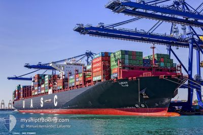
LINAH
Cargo A
Current Trip
| Time Travelled | 31 days |
|---|---|
| Remaining Time | 2 days |
| Distance Travelled | 11824.26 nm |
| Remaining Distance | 433.58 nm |
| AVG Speed | 15.5 Knopen |
| MAX Speed | 22.6 Knopen |
| AVG Wind | 12.1 knots |
| MAX Wind | 33 knots |
| MIN Temp | 12.3°C / 54.14°F |
| MAX Temp | 28.5°C / 83.3°F |
| Diepgang | 15.9 M |
| Positie ontvangen | 10 h, 34 m geleden |
Current Position
| Lengtegraad | --- |
|---|---|
| Breedtegraat | --- |
| Status | Under way using engine |
| Snelheid | 8.5 Knopen |
| Koers | 105° |
| Gebied | Mediterranean Sea - Eastern Basin |
| Station | T-AIS |
| Positie ontvangen | 10 h, 34 m geleden |
Info
Information
The current position of LINAH is in Mediterranean Sea - Eastern Basin with coordinates 36.42273° / 14.66941° as reported on 2025-02-17 17:01 by AIS to our vessel tracker app. The vessel's current speed is 8.5 Knopen and is heading at the port of PIRAEUS. The estimated time of arrival as calculated by MyShipTracking vessel tracking app is 2025-02-20 06:06 LT
The vessel LINAH (IMO: 9708801, MMSI: 211887090) is a Cargo A It's sailing under the flag of [DE] Germany.
In this page you can find informations about the vessels current position, last detected port calls, and current voyage information. If the vessels is not in coverage by AIS you will find the latest position.
The current position of LINAH is detected by our AIS receivers and we are not responsible for the reliability of the data. The last position was recorded while the vessel was in Coverage by the Ais receivers of our vessel tracking app.
The current draught of LINAH as reported by AIS is 15.9 meters
Weather
| Temperature | 14.7°C / 58.46°F |
|---|---|
| Wind Speed | 5 knots |
| Direction | 255° WSW |
| Pressure | 1017 hPa |
| Humidity | 72.6 % |
| Cloud Coverage | 98 % |
Featured Company
Last Port Calls
| Port | Arrival | Departure | Time In Port |
|---|---|---|---|
| 2025-01-15 17:28 | 2025-01-17 08:58 | 1 d | |
| 2025-01-09 15:48 | 2025-01-10 22:13 | 1 d | |
| 2025-01-07 14:09 | 2025-01-08 07:00 | 16 h | |
| 2024-12-27 11:54 | 2024-12-28 23:34 | 1 d | |
| 2024-12-18 18:11 | 2024-12-19 16:23 | 22 h | |
| 2024-12-13 02:19 | 2024-12-14 17:18 | 1 d |
Last Trips
| Origin | Departure | Destination | Arrival | Distance | |
|---|---|---|---|---|---|
| 2025-01-11 06:13 | 2025-01-16 01:28 | 1474.23 nm | |||
| 2025-01-08 15:00 | 2025-01-09 23:48 | 369.21 nm | |||
| 2024-12-29 08:34 | 2025-01-07 22:09 | 1319.60 nm | |||
| 2024-12-20 00:23 | 2024-12-27 20:54 | 1248.16 nm | |||
| 2024-12-15 01:18 | 2024-12-19 02:11 | 1477.79 nm | |||
| 2024-11-09 12:54 | 2024-12-13 10:19 | 11293.14 nm |
Events
| Tijd | Evenement | Details | Positie / Bestemming | Info |
|---|---|---|---|---|
| 2025-02-17 17:08 | Status Changed | Default Under way using engine |
36.41855 / 14.68822
GRPIR
|
Snelheid: 8.5 kn Koers: 105° |
| 2025-02-17 17:01 | Buitenbereik |
36.42273 / 14.66941
Mediterranean Sea - Eastern Basin
GRPIR
|
Snelheid: 8.5 kn Koers: 105° |
|
| 2025-02-17 14:47 | ETA Changed | 2025/02/20 08:00 2025/02/19 04:00 |
36.50860 / 14.28890
GRPIR
|
Snelheid: 8.4 kn Koers: 105° |
| 2025-02-17 14:30 | Status Changed | Under way using engine Default |
36.51948 / 14.23873
GRPIR
|
Snelheid: 8.4 kn Koers: 105° |
| 2025-02-17 13:55 | Status Changed | Default Under way using engine |
36.54009 / 14.14198
GRPIR
|
Snelheid: 8.4 kn Koers: 105° |
| 2025-02-17 13:37 | Status Changed | Under way using engine Default |
36.55116 / 14.08968
GRPIR
|
Snelheid: 8.6 kn Koers: 106° |
| 2025-02-17 13:02 | Status Changed | Default Under way using engine |
36.57452 / 13.99045
GRPIR
|
Snelheid: 8.6 kn Koers: 105.9° |
| 2025-02-17 12:17 | Gevonden in zee | Italian part of the Mediterranean Sea - Eastern Basin |
36.60332 / 13.86201
Mediterranean Sea - Eastern Basin
GRPIR
|
Snelheid: 8.5 kn Koers: 105.7° |
| 2025-02-17 12:17 | Status Changed | Under way using engine Default |
36.60332 / 13.86201
GRPIR
|
Snelheid: 8.3 kn Koers: 104° |
| 2025-02-17 12:17 | Binnenbereik |
36.60332 / 13.86201
Mediterranean Sea - Eastern Basin
GRPIR
|
Snelheid: 8.5 kn Koers: 105.7° |