

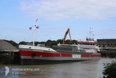
LAURIERBORG
General Cargo

Current Trip
| Time Travelled | 14 days |
|---|---|
| Remaining Time | --- |
| Distance Travelled | 2461.81 nm |
| Remaining Distance | --- |
| AVG Speed | 9 Knopen |
| MAX Speed | 22.4 Knopen |
| AVG Wind | 10.9 knots |
| MAX Wind | 26 knots |
| MIN Temp | -8.6°C / 16.52°F |
| MAX Temp | 8.6°C / 47.48°F |
| Diepgang | 5.2 M |
| Positie ontvangen | Nu |
Current Position
| Lengtegraad | --- |
|---|---|
| Breedtegraat | --- |
| Status | Under way using engine |
| Snelheid | 9.1 Knopen |
| Koers | 254.2° |
| Gebied | Gulf of Finland |
| Station | T-AIS |
| Positie ontvangen | Nu |
Information
The current position of LAURIERBORG is in Gulf of Finland with coordinates 59.62997° / 23.38654° as reported on 2025-02-22 19:45 by AIS to our vessel tracker app. The vessel's current speed is 9.1 Knopen and is heading at the port of KARLSTAD. The estimated time of arrival as calculated by MyShipTracking vessel tracking app is 2025-02-25 12:00 LT
The vessel LAURIERBORG (IMO: 9279070, MMSI: 246924000) is a General Cargo that was built in 2006 ( 19 Jaar oud ). It's sailing under the flag of [NL] Netherlands.
In this page you can find informations about the vessels current position, last detected port calls, and current voyage information. If the vessels is not in coverage by AIS you will find the latest position.
The current position of LAURIERBORG is detected by our AIS receivers and we are not responsible for the reliability of the data. The last position was recorded while the vessel was in Coverage by the Ais receivers of our vessel tracking app.
The current draught of LAURIERBORG as reported by AIS is 5.2 meters
Weather
| Temperature | 0.7°C / 33.26°F |
|---|---|
| Wind Speed | 18 knots |
| Direction | 183° S |
| Pressure | 1025.6 hPa |
| Humidity | 86.2 % |
| Cloud Coverage | 100 % |


Featured Company
Last Port Calls
| Port | Arrival | Departure | Time In Port |
|---|---|---|---|
| 2025-02-08 05:00 | 2025-02-08 05:28 | 28 m | |
| 2025-02-05 17:52 | 2025-02-08 04:40 | 2 d | |
| 2025-02-05 17:01 | 2025-02-05 17:31 | 29 m | |
| 2025-01-30 20:57 | 2025-01-31 11:45 | 14 h | |
| 2025-01-26 13:05 | 2025-01-30 15:21 | 4 d | |
| 2025-01-16 07:10 | 2025-01-17 16:19 | 1 d | |
| 2025-01-15 05:30 | 2025-01-15 15:54 | 10 h | |
| 2025-01-13 08:44 | 2025-01-14 15:35 | 1 d | |
| 2025-01-09 23:10 | 2025-01-11 11:52 | 1 d | |
| 2025-01-08 19:26 | 2025-01-09 22:08 | 1 d |
Last Trips
| Origin | Departure | Destination | Arrival | Distance | |
|---|---|---|---|---|---|
| 2025-02-08 04:40 | 2025-02-08 05:00 | 1.95 nm | |||
| 2025-02-05 17:31 | 2025-02-05 17:52 | 1.93 nm | |||
| 2025-01-31 12:45 | 2025-02-05 17:01 | 1091.55 nm | |||
| 2025-01-30 16:21 | 2025-01-30 21:57 | 58.05 nm | |||
| 2025-01-17 17:19 | 2025-01-26 14:05 | 1364.80 nm | |||
| 2025-01-15 16:54 | 2025-01-16 08:10 | 162.91 nm | |||
| 2025-01-14 16:35 | 2025-01-15 06:30 | 131.64 nm | |||
| 2025-01-11 12:52 | 2025-01-13 09:44 | 385.49 nm | |||
| 2025-01-09 23:08 | 2025-01-10 00:10 | 9.34 nm | |||
| 2024-12-30 13:40 | 2025-01-08 20:26 | 1503.37 nm |
Events
| Tijd | Evenement | Details | Positie / Bestemming | Info |
|---|---|---|---|---|
| 2025-02-22 18:13 | Status Changed | Under way using engine Default |
59.69777 / 23.85062
KARLSTAD
|
Snelheid: 9.8 kn Koers: 252° |
| 2025-02-22 18:09 | Status Changed | Default Under way using engine |
59.70071 / 23.86851
KARLSTAD
|
Snelheid: 9.8 kn Koers: 252° |
| 2025-02-22 17:54 | Status Changed | Under way using engine Default |
59.71337 / 23.94499
KARLSTAD
|
Snelheid: 9.7 kn Koers: 252° |
| 2025-02-22 17:29 | Status Changed | Default Under way using engine |
59.73237 / 24.07328
KARLSTAD
|
Snelheid: 9.8 kn Koers: 255.6° |
| 2025-02-22 15:32 | Wijzig zee gebeid | Finnish part of the Gulf of Finland Estonian part of the Gulf of Finland |
59.80779 / 24.68493
Gulf of Finland
KARLSTAD
|
Snelheid: 9.8 kn Koers: 257.2° |
| 2025-02-22 13:30 | Gevonden in zee | Estonian part of the Gulf of Finland |
59.88164 / 25.32592
Gulf of Finland
KARLSTAD
|
Snelheid: 9.8 kn Koers: 256.9° |
| 2025-02-22 11:32 | Status Changed | Under way using engine Default |
59.97601 / 25.91847
KARLSTAD
|
Snelheid: 9.6 kn Koers: 227° |
| 2025-02-22 11:18 | Binnenbereik |
59.97601 / 25.91847
Gulf of Finland
KARLSTAD
|
Snelheid: 9.7 kn Koers: 228.1° |
|
| 2025-02-22 10:25 | Status Changed | Default Under way using engine |
60.09755 / 26.18083
KARLSTAD
|
Snelheid: 9.5 kn Koers: 227.2° |
| 2025-02-22 10:20 | Buitenbereik |
60.10671 / 26.20119
Gulf of Finland
KARLSTAD
|
Snelheid: 9.5 kn Koers: 227.2° |