
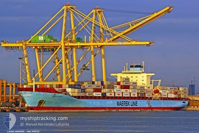
LOUIS MAERSK
Container Ship
Current Trip
| Time Travelled | 6 days |
|---|---|
| Remaining Time | --- |
| Distance Travelled | 2650.53 nm |
| Remaining Distance | --- |
| AVG Speed | 17.9 Knopen |
| MAX Speed | 20 Knopen |
| AVG Wind | 13.5 knots |
| MAX Wind | 18.9 knots |
| MIN Temp | 18.8°C / 65.84°F |
| MAX Temp | 30.7°C / 87.26°F |
| Diepgang | 13.5 M |
| Positie ontvangen | 6 d geleden |
Current Position
| Lengtegraad | -79.65754° |
|---|---|
| Breedtegraat | 9.73234° |
| Status | Under way using engine |
| Snelheid | 16.9 Knopen |
| Koers | 49° |
| Gebied | Caribbean Sea |
| Station | T-AIS |
| Positie ontvangen | 6 d geleden |
Info
Information
The current position of LOUIS MAERSK is in Caribbean Sea with coordinates 9.73234° / -79.65754° as reported on 2024-04-20 20:18 by AIS to our vessel tracker app. The vessel's current speed is 16.9 Knopen and is heading at the port of BALBOA. The estimated time of arrival as calculated by MyShipTracking vessel tracking app is 2024-04-17 14:00 LT
The vessel LOUIS MAERSK (IMO: 9190731, MMSI: 477664600) is a Container Ship that was built in 2001 ( 23 Jaar oud ). It's sailing under the flag of [HK] Hong Kong.
In this page you can find informations about the vessels current position, last detected port calls, and current voyage information. If the vessels is not in coverage by AIS you will find the latest position.
The current position of LOUIS MAERSK is detected by our AIS receivers and we are not responsible for the reliability of the data. The last position was recorded while the vessel was in Coverage by the Ais receivers of our vessel tracking app.
The current draught of LOUIS MAERSK as reported by AIS is 13.5 meters
Weather
| Temperature | 18.7°C / 65.66°F |
|---|---|
| Wind Speed | 18 knots |
| Direction | 68° ENE |
| Pressure | 1024.3 hPa |
| Humidity | 80.2 % |
| Cloud Coverage | 30 % |
Featured Company
Last Port Calls
| Port | Arrival | Departure | Time In Port |
|---|---|---|---|
| 2024-04-19 03:25 | 2024-04-20 18:30 | 1 d | |
| 2024-04-17 15:48 | 2024-04-18 05:14 | 13 h | |
| 2024-04-13 04:10 | 2024-04-13 20:50 | 16 h | |
| 2024-04-09 21:24 | 2024-04-10 20:36 | 23 h | |
| 2024-04-07 20:48 | 2024-04-08 17:56 | 21 h | |
| 2024-04-05 00:23 | 2024-04-06 01:31 | 1 d | |
| 2024-03-29 13:45 | 2024-03-30 12:16 | 22 h | |
| 2024-03-20 00:06 | 2024-03-20 22:02 | 21 h | |
| 2024-03-12 15:57 | 2024-03-13 20:35 | 1 d | |
| 2024-03-09 17:10 | 2024-03-11 07:16 | 1 d |
Most Visited Ports (Last year)
| Port | Arrivals | |
|---|---|---|
| 12 | ||
| 12 | ||
| 11 | ||
| 9 | ||
| 6 | ||
| 6 |
Last Trips
| Origin | Departure | Destination | Arrival | Distance | |
|---|---|---|---|---|---|
| 2024-04-18 00:14 | 2024-04-18 22:25 | 57.98 nm | |||
| 2024-04-13 15:50 | 2024-04-17 10:48 | 865.70 nm | |||
| 2024-04-10 15:36 | 2024-04-12 23:10 | 794.42 nm | |||
| 2024-04-08 12:56 | 2024-04-09 16:24 | 361.97 nm | |||
| 2024-04-05 20:31 | 2024-04-07 15:48 | 438.16 nm | |||
| 2024-03-30 08:16 | 2024-04-04 19:23 | 1994.11 nm | |||
| 2024-03-20 23:02 | 2024-03-29 09:45 | 3248.32 nm | |||
| 2024-03-13 23:35 | 2024-03-20 01:06 | 1951.43 nm | |||
| 2024-03-11 10:16 | 2024-03-12 18:57 | 81.56 nm | |||
| 2024-03-08 02:11 | 2024-03-09 20:10 | 64.78 nm |
Events
| Tijd | Evenement | Details | Positie / Bestemming | Info |
|---|---|---|---|---|
| 2024-04-23 17:25 | Start beweging |
21.12645 / -64.05679
ECGYE>PABLB
|
Snelheid: 15.8 kn Koers: 59° |
|
| 2024-04-23 16:53 | Stop beweging |
21.11667 / -64.07500
ECGYE>PABLB
|
Snelheid: Koers: -1° |
|
| 2024-04-20 20:23 | Status Changed | Default Under way using engine |
9.74667 / -79.63834
ECGYE>PABLB
|
Snelheid: 16.9 kn Koers: 49° |
| 2024-04-20 20:18 | Buitenbereik |
9.73234 / -79.65754
Caribbean Sea
|
Snelheid: 16.9 kn Koers: 49° |
|
| 2024-04-20 18:32 | Status Changed | Under way using engine Default |
9.37316 / -79.89632
ECGYE>PABLB
|
Snelheid: 4.1 kn Koers: 332° |
| 2024-04-20 18:30 | Status Changed | Default Under way using engine |
9.37220 / -79.89571
ECGYE>PABLB
|
Snelheid: 2.6 kn Koers: 259° |
| 2024-04-20 18:30 | Start beweging | 0.34 nm, West of COLON |
9.37220 / -79.89571
ECGYE>PABLB
|
Snelheid: 4.1 kn Koers: 332° |
| 2024-04-20 18:30 | Vertrekhaven |
|
9.37220 / -79.89571
ECGYE>PABLB
|
Snelheid: 2.6 kn Koers: 259° |
| 2024-04-20 18:16 | Status Changed | Under way using engine Default |
9.36961 / -79.88571
[PA] COLON
|
Snelheid: Koers: 246° |
| 2024-04-20 18:14 | Binnenbereik |
9.36961 / -79.88571
Caribbean Sea
[PA] COLON
|
Snelheid: 0.1 kn Koers: 289.8° |