
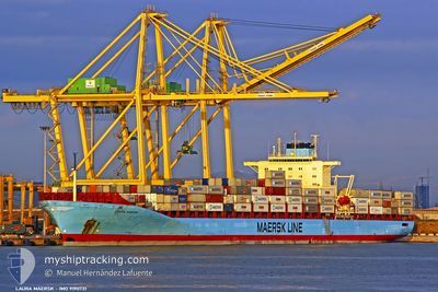
LOUIS MAERSK
Container Ship
Current Trip
| Time Travelled | 4 h, 30 mins |
|---|---|
| Remaining Time | --- |
| Distance Travelled | 57.52 nm |
| Remaining Distance | --- |
| AVG Speed | 13.3 Knots |
| MAX Speed | 15.3 Knots |
| AVG Wind | 8.4 knots |
| MAX Wind | 12 knots |
| MIN Temp | 7.5°C / 45.5°F |
| MAX Temp | 13.7°C / 56.66°F |
| Dybgang | 13 m |
| Position Modtaget | 1 m siden |
Current Position
| Longitude | 28.45736° |
|---|---|
| Latitude | 40.69783° |
| Status | Under way using engine |
| Fart | 15.1 Knots |
| Kurs | 282.5° |
| Område | Sea of Marmara |
| Station | T-AIS |
| Position Modtaget | 1 m siden |
Info
Information
The current position of LOUIS MAERSK is in Sea of Marmara with coordinates 40.69783° / 28.45736° as reported on 2024-05-15 02:56 by AIS to our vessel tracker app. The vessel's current speed is 15.1 Knots and is heading at the port of TANGER MED. The estimated time of arrival as calculated by MyShipTracking vessel tracking app is 2024-05-20 00:00 LT
The vessel LOUIS MAERSK (IMO: 9190731, MMSI: 477664600) is a Container Ship that was built in 2001 ( 23 år gamle ). It's sailing under the flag of [HK] Hong Kong.
In this page you can find informations about the vessels current position, last detected port calls, and current voyage information. If the vessels is not in coverage by AIS you will find the latest position.
The current position of LOUIS MAERSK is detected by our AIS receivers and we are not responsible for the reliability of the data. The last position was recorded while the vessel was in Coverage by the Ais receivers of our vessel tracking app.
The current draught of LOUIS MAERSK as reported by AIS is 13 meters
Weather
| Temperature | 13.7°C / 56.66°F |
|---|---|
| Wind Speed | 12 knots |
| Direction | 74° ENE |
| Pressure | 1016.9 hPa |
| Humidity | 57 % |
| Cloud Coverage | 12 % |
Featured Company
Last Port Calls
| Port | Arrival | Departure | Time In Port |
|---|---|---|---|
| 2024-05-14 02:59 | 2024-05-15 01:27 | 22 h | |
| 2024-05-12 07:54 | 2024-05-13 21:32 | 1 d | |
| 2024-05-09 05:49 | 2024-05-09 22:12 | 16 h | |
| 2024-05-07 13:33 | 2024-05-08 08:39 | 19 h | |
| 2024-05-02 00:43 | 2024-05-02 20:19 | 19 h | |
| 2024-04-30 22:39 | 2024-05-01 14:35 | 15 h | |
| 2024-04-18 22:25 | 2024-04-20 13:30 | 1 d | |
| 2024-04-17 10:48 | 2024-04-18 00:14 | 13 h | |
| 2024-04-12 23:10 | 2024-04-13 15:50 | 16 h | |
| 2024-04-09 16:24 | 2024-04-10 15:36 | 23 h |
Last Trips
| Origin | Departure | Destination | Arrival | Distance | |
|---|---|---|---|---|---|
| 2024-05-13 21:32 | 2024-05-14 02:59 | 60.13 nm | |||
| 2024-05-09 22:12 | 2024-05-12 07:54 | 383.81 nm | |||
| 2024-05-08 08:39 | 2024-05-09 05:49 | 295.90 nm | |||
| 2024-05-02 20:19 | 2024-05-07 13:33 | 1532.43 nm | |||
| 2024-05-01 14:35 | 2024-05-02 00:43 | 75.87 nm | |||
| 2024-04-20 13:30 | 2024-04-30 22:39 | 4342.47 nm | |||
| 2024-04-18 00:14 | 2024-04-18 22:25 | 57.98 nm | |||
| 2024-04-13 15:50 | 2024-04-17 10:48 | 865.70 nm | |||
| 2024-04-10 15:36 | 2024-04-12 23:10 | 794.42 nm | |||
| 2024-04-08 12:56 | 2024-04-09 16:24 | 361.97 nm |
Events
| Tid | Hændelsen | Detaljer | Position / Dest | Info |
|---|---|---|---|---|
| 2024-05-14 22:27 | Afsejlet fra sidste havn |
|
40.75833 / 29.73666
TRIZT-MAPTM
|
Fart: 3.3 kn Kurs: 255° |
| 2024-05-14 22:27 | START Sejllads |
40.75845 / 29.73732
[TR] KORFEZ
|
Fart: 3.3 kn Kurs: 255° |
|
| 2024-05-14 22:04 | Status er ændret | Under way using engine Moored |
40.76258 / 29.74363
[TR] KORFEZ
|
Fart: Kurs: 66° |
| 2024-05-14 21:28 | Dybgangen er ændret | 13 12.2 |
40.76259 / 29.74363
[TR] KORFEZ
|
Fart: Kurs: 66° |
| 2024-05-14 21:28 | Destination er ændret | TRIZT-MAPTM TRAMR>TRIZT |
40.76259 / 29.74363
[TR] KORFEZ
|
Fart: Kurs: 66° |
| 2024-05-14 21:28 | ETA er ændret | 2024/05/19 23:00 2024/05/13 21:00 |
40.76259 / 29.74363
[TR] KORFEZ
|
Fart: Kurs: 66° |
| 2024-05-14 00:11 | Status er ændret | Moored Under way using engine |
40.76261 / 29.74361
[TR] KORFEZ
|
Fart: Kurs: 67° |
| 2024-05-13 23:59 | STOP Sejllads |
40.76292 / 29.74364
[TR] KORFEZ
|
Fart: 0.2 kn Kurs: 70° |
|
| 2024-05-13 23:59 | Skibe i havn |
|
40.76292 / 29.74364
[TR] KORFEZ
|
Fart: 0.9 kn Kurs: 70° |
| 2024-05-13 18:46 | START Sejllads | 0.63 nm, South East of AMBARLI |
40.95004 / 28.67994
TRAMR>TRIZT
|
Fart: 3.2 kn Kurs: 191° |