
KURTARMA 15
Tug
Current Trip
CANAKKALE
| Time Travelled | 1 day |
|---|---|
| Remaining Time | --- |
| Distance Travelled | 103.57 nm |
| Remaining Distance | --- |
| AVG Speed | 10 Knopen |
| MAX Speed | 15.3 Knopen |
| AVG Wind | 15.5 knots |
| MAX Wind | 19.9 knots |
| MIN Temp | 11.7°C / 53.06°F |
| MAX Temp | 19.4°C / 66.92°F |
| Diepgang | 6.2 M |
| Positie ontvangen | 6 m geleden |
Current Position
| Lengtegraad | 26.49970° |
|---|---|
| Breedtegraat | 40.26007° |
| Status | Under way using engine |
| Snelheid | 10.3 Knopen |
| Koers | 51.5° |
| Gebied | Sea of Marmara |
| Station | T-AIS |
| Positie ontvangen | 6 m geleden |
Info
Information
The current position of KURTARMA 15 is in Sea of Marmara with coordinates 40.26007° / 26.49970° as reported on 2024-05-01 15:07 by AIS to our vessel tracker app. The vessel's current speed is 10.3 Knopen
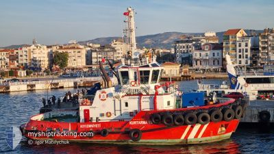
The vessel KURTARMA 15 (IMO: 9915040, MMSI: 271048881) is a Tug It's sailing under the flag of [TR] Turkey.
In this page you can find informations about the vessels current position, last detected port calls, and current voyage information. If the vessels is not in coverage by AIS you will find the latest position.
The current position of KURTARMA 15 is detected by our AIS receivers and we are not responsible for the reliability of the data. The last position was recorded while the vessel was in Coverage by the Ais receivers of our vessel tracking app.
The current draught of KURTARMA 15 as reported by AIS is 6.2 meters
Weather
| Temperature | 16.4°C / 61.52°F |
|---|---|
| Wind Speed | 13 knots |
| Direction | 59° ENE |
| Pressure | 1016.1 hPa |
| Humidity | 72.1 % |
| Cloud Coverage | 91 % |
Featured Company
Last Port Calls
| Port | Arrival | Departure | Time In Port |
|---|---|---|---|
| 2024-04-30 12:52 | 2024-04-30 13:55 | 1 h | |
| 2024-04-29 18:52 | 2024-04-30 10:04 | 15 h | |
| 2024-04-29 07:19 | 2024-04-29 16:53 | 9 h | |
| 2024-04-28 16:46 | 2024-04-29 03:31 | 10 h | |
| 2024-04-27 12:22 | 2024-04-28 12:49 | 1 d | |
| 2024-04-21 16:13 | 2024-04-22 08:16 | 16 h | |
| 2024-04-19 08:13 | 2024-04-21 02:33 | 1 d | |
| 2024-04-18 07:15 | 2024-04-19 02:48 | 19 h | |
| 2024-04-17 17:25 | 2024-04-18 02:14 | 8 h | |
| 2024-04-16 15:51 | 2024-04-17 06:50 | 14 h |
Last Trips
| Origin | Departure | Destination | Arrival | Distance | |
|---|---|---|---|---|---|
| 2024-04-30 13:04 | 2024-04-30 15:52 | 19.41 nm | |||
| 2024-04-29 19:53 | 2024-04-29 21:52 | 22.39 nm | |||
| 2024-04-29 06:31 | 2024-04-29 10:19 | 37.24 nm | |||
| 2024-04-28 15:49 | 2024-04-28 19:46 | 40.43 nm | |||
| 2024-04-22 11:16 | 2024-04-27 15:22 | 116.80 nm | |||
| 2024-04-21 05:33 | 2024-04-21 19:13 | 70.86 nm | |||
| 2024-04-19 05:48 | 2024-04-19 11:13 | 35.01 nm | |||
| 2024-04-18 05:14 | 2024-04-18 10:15 | 51.65 nm | |||
| 2024-04-17 09:50 | 2024-04-17 20:25 | 110.95 nm | |||
| 2024-04-16 13:48 | 2024-04-16 18:51 | 55.65 nm |
Events
| Tijd | Evenement | Details | Positie / Bestemming | Info |
|---|---|---|---|---|
| 2024-05-01 13:33 | Status Changed | Under way using engine Default |
40.08072 / 26.29181
CANAKKALE
|
Snelheid: 8 kn Koers: 57° |
| 2024-05-01 13:31 | Status Changed | Default Under way using engine |
40.07667 / 26.28500
CANAKKALE
|
Snelheid: 7 kn Koers: 57.1° |
| 2024-05-01 13:29 | Status Changed | Under way using engine Default |
40.07499 / 26.28064
CANAKKALE
|
Snelheid: 3.9 kn Koers: 56° |
| 2024-05-01 13:18 | Binnenbereik |
40.08072 / 26.29181
Sea of Marmara
CANAKKALE
|
Snelheid: 8.4 kn Koers: 58.3° |
|
| 2024-05-01 12:48 | Start beweging | 10.35 nm, North of AKCANSA |
40.04703 / 26.21044
CANAKKALE
|
Snelheid: 8.4 kn Koers: 111° |
| 2024-05-01 08:37 | Stop beweging | 10.27 nm, North of AKCANSA |
40.04666 / 26.20500
CANAKKALE
|
Snelheid: Koers: -1° |
| 2024-05-01 08:12 | Status Changed | Default Under way using engine |
40.05065 / 26.26377
CANAKKALE
|
Snelheid: 15.2 kn Koers: 235.3° |
| 2024-05-01 08:10 | Buitenbereik |
40.05582 / 26.27421
Sea of Marmara
CANAKKALE
|
Snelheid: 15.2 kn Koers: 235.3° |
|
| 2024-05-01 06:30 | Binnenbereik |
40.26303 / 26.52250
Sea of Marmara
CANAKKALE
|
Snelheid: 9.4 kn Koers: 230° |
|
| 2024-05-01 06:29 | Status Changed | Under way using engine Default |
40.26488 / 26.52555
CANAKKALE
|
Snelheid: 9.7 kn Koers: 231° |