
KURTARMA 15
Tug
Current Trip
| Trip Time | 7 h, 52 mins |
|---|---|
| Trip Distance | 65.47 nm |
| AVG Speed | 11.3 Knots |
| MAX Speed | 13.1 Knots |
| Dybgang | 6.2 m |
| AVG Wind | 5.7 knots |
| MAX Wind | 9 knots |
| MIN Temp | 18.2°C / 64.76°F |
| MAX Temp | 27.2°C / 80.96°F |
| Position Modtaget | 1 h, 11 m siden |
Current Position
| Longitude | 26.56069° |
|---|---|
| Latitude | 40.28889° |
| Status | Under way using engine |
| Fart | 11.1 Knots |
| Kurs | 45° |
| Område | Sea of Marmara |
| Station | T-AIS |
| Position Modtaget | 1 h, 11 m siden |
Info
Information
The current position of KURTARMA 15 is in Sea of Marmara with coordinates 40.28889° / 26.56069° as reported on 2024-05-22 14:55 by AIS to our vessel tracker app. The vessel's current speed is 11.1 Knots and is currently inside the port of GELIBOLU.
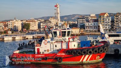
The vessel KURTARMA 15 (IMO: 9915040, MMSI: 271048881) is a Tug It's sailing under the flag of [TR] Turkey.
In this page you can find informations about the vessels current position, last detected port calls, and current voyage information. If the vessels is not in coverage by AIS you will find the latest position.
The current position of KURTARMA 15 is detected by our AIS receivers and we are not responsible for the reliability of the data. The last position was recorded while the vessel was in Coverage by the Ais receivers of our vessel tracking app.
The current draught of KURTARMA 15 as reported by AIS is 6.2 meters
Weather
| Temperature | 18.6°C / 65.48°F |
|---|---|
| Wind Speed | 6 knots |
| Direction | 120° ESE |
| Pressure | 1010 hPa |
| Humidity | 77 % |
| Cloud Coverage | --- |
Featured Company
Last Port Calls
| Port | Arrival | Departure | Time In Port |
|---|---|---|---|
| 2024-05-22 15:47 | |||
| 2024-05-21 06:27 | 2024-05-22 07:55 | 1 d | |
| 2024-05-20 17:29 | 2024-05-21 02:08 | 8 h | |
| 2024-05-20 11:34 | 2024-05-20 13:20 | 1 h | |
| 2024-05-20 04:15 | 2024-05-20 05:17 | 1 h | |
| 2024-05-19 10:14 | 2024-05-20 00:54 | 14 h | |
| 2024-05-18 14:59 | 2024-05-19 03:29 | 12 h | |
| 2024-05-16 17:33 | 2024-05-18 04:32 | 1 d | |
| 2024-05-16 08:29 | 2024-05-16 13:31 | 5 h | |
| 2024-05-15 15:52 | 2024-05-16 04:37 | 12 h |
Last Trips
| Origin | Departure | Destination | Arrival | Distance | |
|---|---|---|---|---|---|
| 2024-05-22 10:55 | 2024-05-22 18:47 | 65.47 nm | |||
| 2024-05-21 05:08 | 2024-05-21 09:27 | 39.50 nm | |||
| 2024-05-20 16:20 | 2024-05-20 20:29 | 39.88 nm | |||
| 2024-05-20 08:17 | 2024-05-20 14:34 | 57.00 nm | |||
| 2024-05-20 03:54 | 2024-05-20 07:15 | 7.74 nm | |||
| 2024-05-19 06:29 | 2024-05-19 13:14 | 62.45 nm | |||
| 2024-05-18 07:32 | 2024-05-18 17:59 | 67.09 nm | |||
| 2024-05-16 16:31 | 2024-05-16 20:33 | 39.47 nm | |||
| 2024-05-16 07:37 | 2024-05-16 11:29 | 40.61 nm | |||
| 2024-05-15 13:15 | 2024-05-15 18:52 | 38.54 nm |
Events
| Tid | Hændelsen | Detaljer | Position / Dest | Info |
|---|---|---|---|---|
| 2024-05-22 15:48 | STOP Sejllads |
40.40476 / 26.66941
[TR] GELIBOLU
|
Fart: Kurs: 105° |
|
| 2024-05-22 15:47 | Skibe i havn |
|
40.40476 / 26.66941
[TR] GELIBOLU
|
Fart: 9.4 kn Kurs: 19° |
| 2024-05-22 15:03 | Status er ændret | Default Under way using engine |
40.30577 / 26.58657
CANAKKALE
|
Fart: 11.1 kn Kurs: 45° |
| 2024-05-22 14:55 | Udenfor Dækning |
40.28889 / 26.56069
Sea of Marmara
[TR] GELIBOLU
|
Fart: 11.1 kn Kurs: 45° |
|
| 2024-05-22 12:49 | START Sejllads | 10.31 nm, North of AKCANSA |
40.04624 / 26.21126
CANAKKALE
|
Fart: 8.6 kn Kurs: 109.1° |
| 2024-05-22 12:48 | Status er ændret | Under way using engine Default |
40.04685 / 26.20846
CANAKKALE
|
Fart: Kurs: 324° |
| 2024-05-22 12:41 | Indenfor Dækning |
40.04673 / 26.20909
Sea of Marmara
|
Fart: 7.4 kn Kurs: 104.3° |
|
| 2024-05-22 11:01 | Status er ændret | Default Under way using engine |
40.04666 / 26.20667
CANAKKALE
|
Fart: 0.1 kn Kurs: 246° |
| 2024-05-22 10:55 | Status er ændret | Under way using engine Default |
40.04739 / 26.20711
CANAKKALE
|
Fart: 0.6 kn Kurs: 281° |
| 2024-05-22 10:55 | Udenfor Dækning |
40.04739 / 26.20711
Sea of Marmara
|
Fart: 0.1 kn Kurs: 114.9° |