
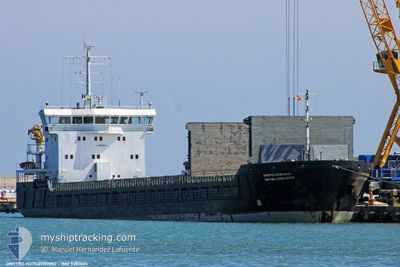
KAREWOOD GLORY
General Cargo
Current Trip
| Time Travelled | 8 days |
|---|---|
| Remaining Time | --- |
| Distance Travelled | 1328.39 nm |
| Remaining Distance | --- |
| AVG Speed | 6.8 Knopen |
| MAX Speed | 12.1 Knopen |
| AVG Wind | 14.3 knots |
| MAX Wind | 34.8 knots |
| MIN Temp | 6.3°C / 43.34°F |
| MAX Temp | 18.4°C / 65.12°F |
| Diepgang | 9 M |
| Positie ontvangen | Nu |
Current Position
| Lengtegraad | -7.22944° |
|---|---|
| Breedtegraat | 36.13081° |
| Status | Under way using engine |
| Snelheid | 7.7 Knopen |
| Koers | 109° |
| Gebied | North Atlantic Ocean |
| Station | T-AIS |
| Positie ontvangen | Nu |
Info
Information
The current position of KAREWOOD GLORY is in North Atlantic Ocean with coordinates 36.13081° / -7.22944° as reported on 2024-05-06 10:43 by AIS to our vessel tracker app. The vessel's current speed is 7.7 Knopen
The vessel KAREWOOD GLORY (IMO: 9281504, MMSI: 311000613) is a General Cargo that was built in 2006 ( 18 Jaar oud ). It's sailing under the flag of [BS] Bahamas.
In this page you can find informations about the vessels current position, last detected port calls, and current voyage information. If the vessels is not in coverage by AIS you will find the latest position.
The current position of KAREWOOD GLORY is detected by our AIS receivers and we are not responsible for the reliability of the data. The last position was recorded while the vessel was in Coverage by the Ais receivers of our vessel tracking app.
The current draught of KAREWOOD GLORY as reported by AIS is 9 meters
Weather
| Temperature | 17.3°C / 63.14°F |
|---|---|
| Wind Speed | 11 knots |
| Direction | 313° NW |
| Pressure | 1016.9 hPa |
| Humidity | 82.2 % |
| Cloud Coverage | 55 % |
Featured Company
Last Port Calls
| Port | Arrival | Departure | Time In Port |
|---|---|---|---|
| 2024-04-24 15:22 | 2024-04-27 17:16 | 3 d | |
| 2024-04-19 07:20 | 2024-04-21 13:20 | 2 d | |
| 2024-04-13 08:23 | 2024-04-17 05:46 | 3 d | |
| 2024-03-18 05:52 | 2024-03-26 10:42 | 8 d | |
| 2024-03-07 02:14 | 2024-03-07 06:45 | 4 h |
Last Trips
| Origin | Departure | Destination | Arrival | Distance | |
|---|---|---|---|---|---|
| 2024-04-21 14:20 | 2024-04-24 17:22 | 328.08 nm | |||
| 2024-04-17 07:46 | 2024-04-19 08:20 | 321.98 nm | |||
| 2024-03-26 11:42 | 2024-04-13 10:23 | 3105.82 nm | |||
| 2024-03-07 07:45 | 2024-03-18 06:52 | 1696.09 nm | |||
| 2024-02-27 07:47 | 2024-03-07 03:14 | 1432.44 nm |
Events
| Tijd | Evenement | Details | Positie / Bestemming | Info |
|---|---|---|---|---|
| 2024-05-06 09:49 | Draught Changed | 9 5 |
36.16826 / -7.38294
CADIZ FOR ORDERS
|
Snelheid: 7.7 kn Koers: 104.6° |
| 2024-05-06 09:49 | Destination Changed | CADIZ FOR ORDERS ITMNF |
36.16826 / -7.38294
CADIZ FOR ORDERS
|
Snelheid: 7.7 kn Koers: 104.6° |
| 2024-05-06 09:49 | ETA Changed | 2024/05/15 06:01 2024/05/15 06:00 |
36.16826 / -7.38294
CADIZ FOR ORDERS
|
Snelheid: 7.7 kn Koers: 104.6° |
| 2024-05-06 09:15 | Gevonden in zee | Spanish part of the North Atlantic Ocean |
36.18245 / -7.45483
North Atlantic Ocean
ITMNF
|
Snelheid: 7.8 kn Koers: 101.2° |
| 2024-05-06 07:27 | Status Changed | Under way using engine Default |
36.23642 / -7.72511
ITMNF
|
Snelheid: 7.7 kn Koers: 105° |
| 2024-05-06 06:59 | Status Changed | Default Under way using engine |
36.25205 / -7.79037
ITMNF
|
Snelheid: 7.6 kn Koers: 106.9° |
| 2024-05-06 06:19 | Status Changed | Under way using engine Default |
36.27905 / -7.90707
ITMNF
|
Snelheid: 8.1 kn Koers: 108° |
| 2024-05-06 06:10 | Status Changed | Default Under way using engine |
36.28071 / -7.91390
ITMNF
|
Snelheid: 7.8 kn Koers: 106.6° |
| 2024-05-06 06:01 | Status Changed | Under way using engine Default |
36.28892 / -7.94850
ITMNF
|
Snelheid: 7.6 kn Koers: 105° |
| 2024-05-06 05:34 | Status Changed | Default Under way using engine |
36.30296 / -8.00606
ITMNF
|
Snelheid: 7.8 kn Koers: 105.8° |