
KAREWOOD GLORY
General Cargo
Current Trip
| Trip Time | 9 days |
|---|---|
| Trip Distance | 1434.11 nm |
| AVG Speed | 6.8 Knots |
| MAX Speed | 12.1 Knots |
| Dybgang | 4.8 m |
| AVG Wind | 14.2 knots |
| MAX Wind | 34.8 knots |
| MIN Temp | 6.3°C / 43.34°F |
| MAX Temp | 18.4°C / 65.12°F |
| Position Modtaget | 3 h, 52 m siden |
Current Position
| Longitude | -5.31031° |
|---|---|
| Latitude | 35.89606° |
| Status | Under way using engine |
| Fart | 4.1 Knots |
| Kurs | 135° |
| Område | Strait of Gibraltar |
| Station | T-AIS |
| Position Modtaget | 3 h, 52 m siden |
Info
Information
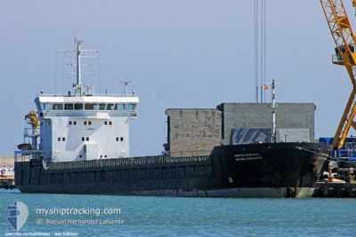
The current position of KAREWOOD GLORY is in Strait of Gibraltar with coordinates 35.89606° / -5.31031° as reported on 2024-05-06 23:30 by AIS to our vessel tracker app. The vessel's current speed is 4.1 Knots and is currently inside the port of CEUTA.
The vessel KAREWOOD GLORY (IMO: 9281504, MMSI: 311000613) is a General Cargo that was built in 2006 ( 18 år gamle ). It's sailing under the flag of [BS] Bahamas.
In this page you can find informations about the vessels current position, last detected port calls, and current voyage information. If the vessels is not in coverage by AIS you will find the latest position.
The current position of KAREWOOD GLORY is detected by our AIS receivers and we are not responsible for the reliability of the data. The last position was recorded while the vessel was in Coverage by the Ais receivers of our vessel tracking app.
The current draught of KAREWOOD GLORY as reported by AIS is 4.8 meters
Weather
| Temperature | 16.9°C / 62.42°F |
|---|---|
| Wind Speed | 13 knots |
| Direction | 264° W |
| Pressure | 1015.2 hPa |
| Humidity | 84.4 % |
| Cloud Coverage | --- |
Featured Company
Last Port Calls
| Port | Arrival | Departure | Time In Port |
|---|---|---|---|
| 2024-05-06 23:30 | |||
| 2024-04-24 15:22 | 2024-04-27 17:16 | 3 d | |
| 2024-04-19 07:20 | 2024-04-21 13:20 | 2 d | |
| 2024-04-13 08:23 | 2024-04-17 05:46 | 3 d | |
| 2024-03-18 05:52 | 2024-03-26 10:42 | 8 d | |
| 2024-03-07 02:14 | 2024-03-07 06:45 | 4 h |
Last Trips
| Origin | Departure | Destination | Arrival | Distance | |
|---|---|---|---|---|---|
| 2024-04-27 19:16 | 2024-05-07 01:30 | 1434.11 nm | |||
| 2024-04-21 14:20 | 2024-04-24 17:22 | 328.08 nm | |||
| 2024-04-17 07:46 | 2024-04-19 08:20 | 321.98 nm | |||
| 2024-03-26 11:42 | 2024-04-13 10:23 | 3105.82 nm | |||
| 2024-03-07 07:45 | 2024-03-18 06:52 | 1696.09 nm | |||
| 2024-02-27 07:47 | 2024-03-07 03:14 | 1432.44 nm |
Events
| Tid | Hændelsen | Detaljer | Position / Dest | Info |
|---|---|---|---|---|
| 2024-05-06 23:40 | Status er ændret | Default Under way using engine |
35.89460 / -5.30621
[ES] CEUTA
|
Fart: 4.1 kn Kurs: 135° |
| 2024-05-06 23:40 | STOP Sejllads |
35.89460 / -5.30621
[ES] CEUTA
|
Fart: Kurs: 96° |
|
| 2024-05-06 23:30 | Udenfor Dækning |
35.89606 / -5.31031
Strait of Gibraltar
[ES] CEUTA
|
Fart: 4.1 kn Kurs: 155.1° |
|
| 2024-05-06 23:30 | Skibe i havn |
|
35.89606 / -5.31031
[ES] CEUTA
|
Fart: 4.8 kn Kurs: 159° |
| 2024-05-06 23:20 | Status er ændret | Under way using engine Default |
35.90706 / -5.31166
ITMNF
|
Fart: 4 kn Kurs: 166° |
| 2024-05-06 23:15 | Status er ændret | Default Under way using engine |
35.91170 / -5.31309
ITMNF
|
Fart: 0.7 kn Kurs: 202° |
| 2024-05-06 23:15 | START Sejllads | 1.08 nm, North of CEUTA |
35.91170 / -5.31309
ITMNF
|
Fart: 4 kn Kurs: 166° |
| 2024-05-06 22:52 | STOP Sejllads | 1.21 nm, North of CEUTA |
35.91354 / -5.31659
ITMNF
|
Fart: 0.3 kn Kurs: 201° |
| 2024-05-06 22:44 | Status er ændret | Under way using engine Default |
35.91494 / -5.31834
ITMNF
|
Fart: 2.1 kn Kurs: 75° |
| 2024-05-06 22:30 | Status er ændret | Default Under way using engine |
35.91278 / -5.32562
ITMNF
|
Fart: 3.2 kn Kurs: 142° |