
KANG SHENG KOU
Heavy Lift Vessel
Current Trip
| Time Travelled | 31 days |
|---|---|
| Remaining Time | --- |
| Distance Travelled | 2085.84 nm |
| Remaining Distance | --- |
| AVG Speed | 7.1 Knopen |
| MAX Speed | 10.7 Knopen |
| AVG Wind | 15.4 knots |
| MAX Wind | 29 knots |
| MIN Temp | 2°C / 35.6°F |
| MAX Temp | 26.9°C / 80.42°F |
| Diepgang | 6.3 M |
| Positie ontvangen | 2025-01-15 23:42 |
Current Position
| Lengtegraad | --- |
|---|---|
| Breedtegraat | --- |
| Status | Under way using engine |
| Snelheid | 7.5 Knopen |
| Koers | 118.1° |
| Gebied | Gulf of Mexico |
| Station | T-AIS |
| Positie ontvangen | 2025-01-15 23:42 |
Info
Information
The current position of KANG SHENG KOU is in Gulf of Mexico with coordinates 29.34374° / -94.77385° as reported on 2025-01-15 23:42 by AIS to our vessel tracker app. The vessel's current speed is 7.5 Knopen and is heading at the port of FOURCHON.
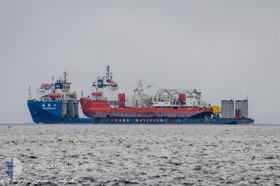
The vessel KANG SHENG KOU (IMO: 9223289, MMSI: 412055000) is a Heavy Lift Vessel that was built in 2003 ( 22 Jaar oud ). It's sailing under the flag of [CN] China.
In this page you can find informations about the vessels current position, last detected port calls, and current voyage information. If the vessels is not in coverage by AIS you will find the latest position.
The current position of KANG SHENG KOU is detected by our AIS receivers and we are not responsible for the reliability of the data. The last position was recorded while the vessel was in Coverage by the Ais receivers of our vessel tracking app.
The current draught of KANG SHENG KOU as reported by AIS is 6.3 meters
Weather
| Temperature | 26.2°C / 79.16°F |
|---|---|
| Wind Speed | 18 knots |
| Direction | 91° E |
| Pressure | 1011.7 hPa |
| Humidity | 78.7 % |
| Cloud Coverage | 6 % |
Featured Company
Most Visited Ports (Last year)
| Port | Arrivals | |
|---|---|---|
| 3 | ||
| 2 | ||
| 1 | ||
| 1 | ||
| 1 | ||
| 1 |
Events
| Tijd | Evenement | Details | Positie / Bestemming | Info |
|---|---|---|---|---|
| 2025-02-16 15:31 | Start beweging | 2.54 nm, South West of WILLEMSTAD |
12.08005 / -68.97435
FOURCHON
|
Snelheid: 3.4 kn Koers: 115° |
| 2025-02-15 02:39 | Stop beweging | 14.23 nm, South West of WILLEMSTAD |
11.97786 / -69.14407
FOURCHON
|
Snelheid: 0.2 kn Koers: 96° |
| 2025-02-14 23:39 | Start beweging | 8.4 nm, South West of WILLEMSTAD |
12.02814 / -69.05909
FOURCHON
|
Snelheid: 4 kn Koers: 202° |
| 2025-02-14 14:43 | Stop beweging | 9.45 nm, South West of BULLENBAY |
12.04500 / -69.09405
FOURCHON
|
Snelheid: 0.3 kn Koers: 85° |