

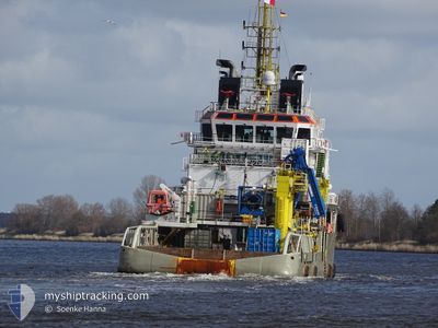
KAMARA
Anchor Handling Vessel

Current Trip
HORNSEA 3 OWF
| Time Travelled | 26 days |
|---|---|
| Remaining Time | --- |
| Distance Travelled | 703.93 nm |
| Remaining Distance | --- |
| AVG Speed | 8.4 Knopen |
| MAX Speed | 13.4 Knopen |
| AVG Wind | 11.7 knots |
| MAX Wind | 24 knots |
| MIN Temp | 4°C / 39.2°F |
| MAX Temp | 10.8°C / 51.44°F |
| Diepgang | 5.2 M |
| Positie ontvangen | Nu |
Current Position
| Lengtegraad | --- |
|---|---|
| Breedtegraat | --- |
| Status | Under way using engine |
| Snelheid | 9.1 Knopen |
| Koers | 1.7° |
| Gebied | North Sea |
| Station | T-AIS |
| Positie ontvangen | Nu |
Information
The current position of KAMARA is in North Sea with coordinates 52.60294° / 1.76567° as reported on 2025-03-26 17:12 by AIS to our vessel tracker app. The vessel's current speed is 9.1 Knopen
The vessel KAMARA (IMO: 9322607, MMSI: 215088000) is a Anchor Handling Vessel that was built in 2005 ( 20 Jaar oud ). It's sailing under the flag of [MT] Malta.
In this page you can find informations about the vessels current position, last detected port calls, and current voyage information. If the vessels is not in coverage by AIS you will find the latest position.
The current position of KAMARA is detected by our AIS receivers and we are not responsible for the reliability of the data. The last position was recorded while the vessel was in Coverage by the Ais receivers of our vessel tracking app.
The current draught of KAMARA as reported by AIS is 5.2 meters
Weather
| Temperature | 9.9°C / 49.82°F |
|---|---|
| Wind Speed | 10 knots |
| Direction | 166° SSE |
| Pressure | 1023.6 hPa |
| Humidity | 76.2 % |
| Cloud Coverage | 52 % |


Featured Company
Last Port Calls
| Port | Arrival | Departure | Time In Port |
|---|---|---|---|
| 2025-02-27 19:11 | 2025-02-28 16:42 | 21 h | |
| 2025-02-22 19:24 | 2025-02-27 18:55 | 4 d | |
| 2025-02-11 20:29 | 2025-02-18 23:48 | 7 d | |
| 2025-02-09 04:24 |
Most Visited Ports (Last year)
| Port | Arrivals | |
|---|---|---|
| 15 | ||
| 10 | ||
| 7 | ||
| 4 | ||
| 3 | ||
| 1 |
Last Trips
| Origin | Departure | Destination | Arrival | Distance | |
|---|---|---|---|---|---|
| 2025-02-27 18:55 | 2025-02-27 19:11 | 0.51 nm | |||
| 2025-02-18 23:48 | 2025-02-22 19:24 | 288.37 nm | |||
| 2025-02-09 04:24 | 2025-02-11 20:29 | 66.59 nm |
Events
| Tijd | Evenement | Details | Positie / Bestemming | Info |
|---|---|---|---|---|
| 2025-03-26 16:44 | Status Changed | Under way using engine Moored |
52.57811 / 1.74393
HORNSEA 3 OWF
|
Snelheid: 4.7 kn Koers: 118° |
| 2025-03-26 16:43 | Start beweging | 0.97 nm, South East of GREAT YARMOUTH |
52.57854 / 1.74238
HORNSEA 3 OWF
|
Snelheid: 3.6 kn Koers: 118° |
| 2025-03-26 16:39 | Status Changed | Moored Default |
52.57946 / 1.73999
HORNSEA 3 OWF
|
Snelheid: Koers: 274° |
| 2025-03-26 16:36 | Status Changed | Default Moored |
52.57984 / 1.74004
HORNSEA 3 OWF
|
Snelheid: Koers: 274° |
| 2025-03-26 16:10 | Draught Changed | 5.2 5 |
52.57984 / 1.74004
HORNSEA 3 OWF
|
Snelheid: Koers: 274° |
| 2025-03-26 16:06 | Status Changed | Moored Default |
52.57984 / 1.74004
HORNSEA 3 OWF
|
Snelheid: Koers: 274° |
| 2025-03-26 16:00 | Status Changed | Default Moored |
52.57984 / 1.74003
HORNSEA 3 OWF
|
Snelheid: Koers: 274° |
| 2025-03-26 15:51 | Destination Changed | HORNSEA 3 OWF GB GTY |
52.57984 / 1.74003
HORNSEA 3 OWF
|
Snelheid: Koers: 274° |
| 2025-03-26 15:51 | ETA Changed | 2025/03/27 01:00 2025/03/26 06:15 |
52.57984 / 1.74003
HORNSEA 3 OWF
|
Snelheid: Koers: 274° |
| 2025-03-26 15:12 | Status Changed | Moored Default |
52.57983 / 1.74005
GB GTY
|
Snelheid: 0.1 kn Koers: 274° |