
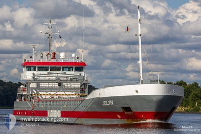
JOLYN
General Cargo
Current Trip
| Time Travelled | 3 days |
|---|---|
| Remaining Time | 1 day |
| Distance Travelled | 838.25 nm |
| Remaining Distance | 405.94 nm |
| AVG Speed | 9.9 Knopen |
| MAX Speed | 12.1 Knopen |
| AVG Wind | 12.2 knots |
| MAX Wind | 30 knots |
| MIN Temp | -0.3°C / 31.46°F |
| MAX Temp | 7.5°C / 45.5°F |
| Diepgang | 4.7 M |
| Positie ontvangen | 1 m geleden |
Current Position
| Lengtegraad | --- |
|---|---|
| Breedtegraat | --- |
| Status | Under way using engine |
| Snelheid | 7.6 Knopen |
| Koers | 190.1° |
| Gebied | Baltic Sea |
| Station | T-AIS |
| Positie ontvangen | 1 m geleden |
Info
Information
The current position of JOLYN is in Baltic Sea with coordinates 54.39303° / 10.19732° as reported on 2025-03-08 06:51 by AIS to our vessel tracker app. The vessel's current speed is 7.6 Knopen and is heading at the port of ROTTERDAM. The estimated time of arrival as calculated by MyShipTracking vessel tracking app is 2025-03-10 00:59 LT
The vessel JOLYN (IMO: 9374686, MMSI: 246544000) is a General Cargo that was built in 2007 ( 18 Jaar oud ). It's sailing under the flag of [NL] Netherlands.
In this page you can find informations about the vessels current position, last detected port calls, and current voyage information. If the vessels is not in coverage by AIS you will find the latest position.
The current position of JOLYN is detected by our AIS receivers and we are not responsible for the reliability of the data. The last position was recorded while the vessel was in Coverage by the Ais receivers of our vessel tracking app.
The current draught of JOLYN as reported by AIS is 4.7 meters
Weather
| Temperature | 6.9°C / 44.42°F |
|---|---|
| Wind Speed | 5 knots |
| Direction | 149° SSE |
| Pressure | 1017.5 hPa |
| Humidity | 75.6 % |
| Cloud Coverage | 5 % |
Featured Company
Last Port Calls
| Port | Arrival | Departure | Time In Port |
|---|---|---|---|
| 2025-02-28 22:21 | 2025-03-04 16:17 | 3 d | |
| 2025-02-27 05:33 | 2025-02-28 10:01 | 1 d | |
| 2025-02-20 09:36 | 2025-02-21 17:36 | 1 d | |
| 2025-02-18 12:36 | 2025-02-19 13:15 | 1 d | |
| 2025-02-08 19:15 | 2025-02-11 11:15 | 2 d | |
| 2025-02-03 01:53 | 2025-02-04 11:11 | 1 d | |
| 2025-01-25 12:06 | 2025-01-28 09:14 | 2 d | |
| 2025-01-22 19:38 | 2025-01-22 20:15 | 36 m | |
| 2025-01-20 03:51 | 2025-01-22 13:26 | 2 d | |
| 2025-01-19 19:57 | 2025-01-19 20:20 | 22 m |
Last Trips
| Origin | Departure | Destination | Arrival | Distance | |
|---|---|---|---|---|---|
| 2025-02-28 11:01 | 2025-02-28 23:21 | 83.27 nm | |||
| 2025-02-21 18:36 | 2025-02-27 06:33 | 1289.52 nm | |||
| 2025-02-19 13:15 | 2025-02-20 10:36 | 157.21 nm | |||
| 2025-02-11 11:15 | 2025-02-18 12:36 | 655.86 nm | |||
| 2025-02-04 12:11 | 2025-02-08 19:15 | 926.59 nm | |||
| 2025-01-28 10:14 | 2025-02-03 02:53 | 793.43 nm | |||
| 2025-01-22 21:15 | 2025-01-25 13:06 | 369.94 nm | |||
| 2025-01-22 14:26 | 2025-01-22 20:38 | 64.87 nm | |||
| 2025-01-19 21:20 | 2025-01-20 04:51 | 66.05 nm | |||
| 2025-01-17 17:35 | 2025-01-19 20:57 | 516.76 nm |
Events
| Tijd | Evenement | Details | Positie / Bestemming | Info |
|---|---|---|---|---|
| 2025-03-08 05:05 | Wijzig zee gebeid | German part of the Baltic Sea Danish part of the Baltic Sea |
54.56513 / 10.55758
Baltic Sea
NLRTM
|
Snelheid: 9.9 kn Koers: 246.9° |
| 2025-03-08 04:14 | Wijzig zee gebeid | Danish part of the Baltic Sea German part of the Baltic Sea |
54.58234 / 10.79108
Baltic Sea
NLRTM
|
Snelheid: 9.3 kn Koers: 265.9° |
| 2025-03-08 02:20 | Wijzig zee gebeid | German part of the Baltic Sea Danish part of the Baltic Sea |
54.55233 / 11.34475
Baltic Sea
NLRTM
|
Snelheid: 11.6 kn Koers: 295.5° |
| 2025-03-07 20:23 | Wijzig zee gebeid | Danish part of the Baltic Sea German part of the Baltic Sea |
54.85064 / 12.94667
Baltic Sea
NLRTM
|
Snelheid: 11.9 kn Koers: 246.7° |
| 2025-03-07 17:55 | Wijzig zee gebeid | German part of the Baltic Sea Swedish part of the Baltic Sea |
55.01803 / 13.74051
Baltic Sea
NLRTM
|
Snelheid: 11.6 kn Koers: 246.9° |
| 2025-03-07 13:40 | Wijzig zee gebeid | Swedish part of the Baltic Sea Danish part of the Kattegat |
55.52439 / 14.78348
Baltic Sea
NLRTM
|
Snelheid: 11.7 kn Koers: 237° |
| 2025-03-07 12:22 | Wijzig zee gebeid | Danish part of the Kattegat Swedish part of the Baltic Sea |
55.65816 / 15.17113
Kattegat
NLRTM
|
Snelheid: 11.5 kn Koers: 241.6° |
| 2025-03-07 08:06 | ETA Changed | 2025/03/09 20:00 2025/03/10 03:00 |
56.06304 / 16.46146
NLRTM
|
Snelheid: 11.7 kn Koers: 239.5° |
| 2025-03-07 01:58 | Status Changed | Under way using engine Default |
57.10316 / 17.38811
NLRTM
|
Snelheid: 11.5 kn Koers: 201° |
| 2025-03-07 01:58 | Status Changed | Default Under way using engine |
57.10570 / 17.38989
NLRTM
|
Snelheid: 11.5 kn Koers: 200.1° |