

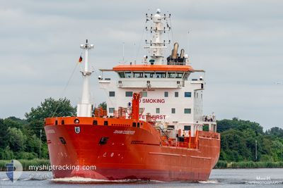
JOHANN ESSBERGER
Oil/Chemical Tanker

Current Trip
| Time Travelled | 13 h, 32 mins |
|---|---|
| Remaining Time | 8 h, 25 mins |
| Distance Travelled | 105.07 nm |
| Remaining Distance | 101.24 nm |
| AVG Speed | 9.6 Knopen |
| MAX Speed | 11.7 Knopen |
| AVG Wind | 12.3 knots |
| MAX Wind | 17.1 knots |
| MIN Temp | -1°C / 30.2°F |
| MAX Temp | 0.2°C / 32.36°F |
| Diepgang | 6.7 M |
| Positie ontvangen | 7 h, 50 m geleden |
Current Position
| Lengtegraad | --- |
|---|---|
| Breedtegraat | --- |
| Status | Under way using engine |
| Snelheid | 9.4 Knopen |
| Koers | 104.2° |
| Gebied | Baltic Sea |
| Station | T-AIS |
| Positie ontvangen | 7 h, 50 m geleden |
Information
The current position of JOHANN ESSBERGER is in Baltic Sea with coordinates 55.90648° / 16.72992° as reported on 2025-02-14 16:31 by AIS to our vessel tracker app. The vessel's current speed is 9.4 Knopen and is heading at the port of LIEPAJA. The estimated time of arrival as calculated by MyShipTracking vessel tracking app is 2025-02-15 08:46 LT
The vessel JOHANN ESSBERGER (IMO: 9480980, MMSI: 255804460) is a Oil/Chemical Tanker that was built in 2011 ( 14 Jaar oud ). It's sailing under the flag of [PT] Portugal.
In this page you can find informations about the vessels current position, last detected port calls, and current voyage information. If the vessels is not in coverage by AIS you will find the latest position.
The current position of JOHANN ESSBERGER is detected by our AIS receivers and we are not responsible for the reliability of the data. The last position was recorded while the vessel was in Coverage by the Ais receivers of our vessel tracking app.
The current draught of JOHANN ESSBERGER as reported by AIS is 6.7 meters
Weather
| Temperature | -0.4°C / 31.28°F |
|---|---|
| Wind Speed | 12 knots |
| Direction | 332° NNW |
| Pressure | 1024.1 hPa |
| Humidity | 67.5 % |
| Cloud Coverage | 100 % |


Featured Company
Last Port Calls
| Port | Arrival | Departure | Time In Port |
|---|---|---|---|
| 2025-02-14 02:33 | 2025-02-14 10:49 | 8 h | |
| 2025-02-12 23:56 | 2025-02-12 23:59 | 2 m | |
| 2025-02-10 01:57 | 2025-02-11 10:09 | 1 d | |
| 2025-02-09 09:50 | 2025-02-10 00:59 | 15 h | |
| 2025-02-07 07:49 | 2025-02-08 00:54 | 17 h | |
| 2025-01-25 08:10 | 2025-01-26 08:34 | 1 d | |
| 2025-01-19 01:10 | 2025-01-20 18:43 | 1 d | |
| 2025-01-16 11:57 | 2025-01-17 12:28 | 1 d | |
| 2025-01-13 21:38 | 2025-01-15 09:50 | 1 d | |
| 2025-01-10 21:21 | 2025-01-12 07:21 | 1 d |
Most Visited Ports (Last year)
| Port | Arrivals | |
|---|---|---|
| 17 | ||
| 9 | ||
| 8 | ||
| 5 | ||
| 5 | ||
| 5 |
Last Trips
| Origin | Departure | Destination | Arrival | Distance | |
|---|---|---|---|---|---|
| 2025-02-13 00:59 | 2025-02-14 03:33 | 291.39 nm | |||
| 2025-02-11 11:09 | 2025-02-13 00:56 | 350.54 nm | |||
| 2025-02-10 01:59 | 2025-02-10 02:57 | 9.61 nm | |||
| 2025-02-08 01:54 | 2025-02-09 10:50 | 321.83 nm | |||
| 2025-01-26 08:34 | 2025-02-07 08:49 | 2160.98 nm | |||
| 2025-01-20 19:43 | 2025-01-25 08:10 | 763.89 nm | |||
| 2025-01-17 12:28 | 2025-01-19 02:10 | 208.35 nm | |||
| 2025-01-15 10:50 | 2025-01-16 11:57 | 208.30 nm | |||
| 2025-01-12 08:21 | 2025-01-13 22:38 | 365.13 nm | |||
| 2025-01-10 20:34 | 2025-01-10 22:21 | 47.18 nm |
Events
| Tijd | Evenement | Details | Positie / Bestemming | Info |
|---|---|---|---|---|
| 2025-02-14 16:37 | Status Changed | Default Under way using engine |
55.90229 / 16.75880
LV LPX
|
Snelheid: 9.4 kn Koers: 104.2° |
| 2025-02-14 16:31 | Buitenbereik |
55.90648 / 16.72992
Baltic Sea
LV LPX
|
Snelheid: 9.4 kn Koers: 104.2° |
|
| 2025-02-14 12:21 | Draught Changed | 6.7 6.9 |
56.41249 / 16.25446
LV LPX
|
Snelheid: 10 kn Koers: 195.6° |
| 2025-02-14 12:21 | Destination Changed | LV LPX SE KLR |
56.41249 / 16.25446
LV LPX
|
Snelheid: 10 kn Koers: 195.6° |
| 2025-02-14 12:21 | ETA Changed | 2025/02/15 08:00 2025/02/14 02:00 |
56.41249 / 16.25446
LV LPX
|
Snelheid: 10 kn Koers: 195.6° |
| 2025-02-14 11:41 | Status Changed | Under way using engine Default |
56.52297 / 16.29302
SE KLR
|
Snelheid: 10.2 kn Koers: 191° |
| 2025-02-14 11:37 | Status Changed | Default Under way using engine |
56.53204 / 16.29619
SE KLR
|
Snelheid: 10.2 kn Koers: 199.4° |
| 2025-02-14 11:22 | Status Changed | Under way using engine Default |
56.57289 / 16.31796
SE KLR
|
Snelheid: 10.2 kn Koers: 202° |
| 2025-02-14 11:17 | Binnenbereik |
56.57289 / 16.31796
Baltic Sea
|
Snelheid: 10.1 kn Koers: 202° |
|
| 2025-02-14 10:49 | Start beweging | 0.62 nm, South of KALMAR |
56.65150 / 16.37412
SE KLR
|
Snelheid: 8.5 kn Koers: 199° |