
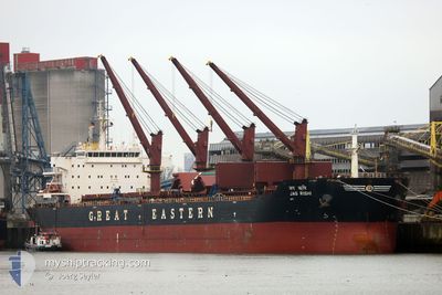
JAG RISHI
Cargo
Current Trip
| Time Travelled | 15 days |
|---|---|
| Remaining Time | --- |
| Distance Travelled | 3310.62 nm |
| Remaining Distance | --- |
| AVG Speed | 9.3 Knopen |
| MAX Speed | 12.2 Knopen |
| AVG Wind | 8 knots |
| MAX Wind | 24 knots |
| MIN Temp | 25.9°C / 78.62°F |
| MAX Temp | 31.6°C / 88.88°F |
| Diepgang | 12 M |
| Positie ontvangen | 6 d geleden |
Current Position
| Lengtegraad | --- |
|---|---|
| Breedtegraat | --- |
| Status | Under way using engine |
| Snelheid | 10.8 Knopen |
| Koers | 98° |
| Gebied | Laccadive Sea |
| Station | T-AIS |
| Positie ontvangen | 6 d geleden |
Info
Information
The current position of JAG RISHI is in Laccadive Sea with coordinates 5.73212° / 80.20082° as reported on 2024-10-21 07:53 by AIS to our vessel tracker app. The vessel's current speed is 10.8 Knopen
The vessel JAG RISHI (IMO: 9456343, MMSI: 419000242) is a Cargo It's sailing under the flag of [IN] India.
In this page you can find informations about the vessels current position, last detected port calls, and current voyage information. If the vessels is not in coverage by AIS you will find the latest position.
The current position of JAG RISHI is detected by our AIS receivers and we are not responsible for the reliability of the data. The last position was recorded while the vessel was in Coverage by the Ais receivers of our vessel tracking app.
The current draught of JAG RISHI as reported by AIS is 12 meters
Weather
| Temperature | 28.4°C / 83.12°F |
|---|---|
| Wind Speed | 11 knots |
| Direction | 125° SE |
| Pressure | 1005.1 hPa |
| Humidity | 78.9 % |
| Cloud Coverage | 40 % |
Featured Company
Last Port Calls
| Port | Arrival | Departure | Time In Port |
|---|---|---|---|
| 2024-10-01 17:11 | 2024-10-11 15:02 | 9 d | |
| 2024-09-19 22:11 | 2024-09-24 11:01 | 4 d | |
| 2024-09-04 11:14 | 2024-09-13 15:50 | 9 d | |
| 2024-08-27 09:10 | 2024-08-31 13:22 | 4 d | |
| 2024-08-19 04:12 | 2024-08-22 14:39 | 3 d | |
| 2024-08-06 21:33 |
Last Trips
| Origin | Departure | Destination | Arrival | Distance | |
|---|---|---|---|---|---|
| 2024-09-24 16:31 | 2024-10-01 20:11 | 1757.72 nm | |||
| 2024-09-13 21:20 | 2024-09-20 03:41 | 1396.65 nm | |||
| 2024-08-31 18:52 | 2024-09-04 16:44 | 436.07 nm | |||
| 2024-08-22 20:09 | 2024-08-27 14:40 | 770.82 nm | |||
| 2024-07-23 13:38 | 2024-08-07 03:03 | 2841.86 nm |
Events
| Tijd | Evenement | Details | Positie / Bestemming | Info |
|---|---|---|---|---|
| 2024-10-26 10:52 | Stop beweging | 13.02 nm, North East of DHAMRA |
20.99213 / 87.11915
DHAMRA
|
Snelheid: 0.3 kn Koers: 165° |
| 2024-10-25 10:46 | Stop beweging |
18.20922 / 86.80572
DHAMRA
|
Snelheid: 0.3 kn Koers: 266° |
|
| 2024-10-21 07:54 | Status Changed | Default Under way using engine |
5.73152 / 80.20589
DHAMRA
|
Snelheid: 10.8 kn Koers: 98° |
| 2024-10-21 07:53 | Status Changed | Under way using engine Default |
5.73212 / 80.20082
DHAMRA
|
Snelheid: 11.1 kn Koers: 98° |
| 2024-10-21 07:53 | Buitenbereik |
5.73212 / 80.20082
Laccadive Sea
DHAMRA
|
Snelheid: 10.8 kn Koers: 98° |
|
| 2024-10-21 07:39 | Status Changed | Default Under way using engine |
5.73818 / 80.15953
DHAMRA
|
Snelheid: 11.2 kn Koers: 99° |
| 2024-10-21 07:30 | Wijzig zee gebeid | Sri Lankan part of the Laccadive Sea Indian part of the Laccadive Sea |
5.74237 / 80.13210
Laccadive Sea
DHAMRA
|
Snelheid: 11.4 kn Koers: 98° |
| 2024-10-21 07:29 | Status Changed | Under way using engine Default |
5.74275 / 80.12947
DHAMRA
|
Snelheid: 11.6 kn Koers: 99° |
| 2024-10-21 07:29 | Binnenbereik |
5.74237 / 80.13210
Laccadive Sea
DHAMRA
|
Snelheid: 11.4 kn Koers: 98° |
|
| 2024-10-20 12:56 | Buitenbereik |
7.55040 / 77.25568
Laccadive Sea
DHAMRA
|
Snelheid: 11.5 kn Koers: 130° |