

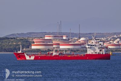
IVER BLESSING
Asphalt/Bitumen Tanker

Current Trip
| Trip Time | 3 days |
|---|---|
| Trip Distance | 682.02 nm |
| AVG Speed | 9.3 Knopen |
| MAX Speed | 12.2 Knopen |
| Diepgang | 6.2 M |
| AVG Wind | 8.7 knots |
| MAX Wind | 16 knots |
| MIN Temp | 11.6°C / 52.88°F |
| MAX Temp | 17.3°C / 63.14°F |
| Positie ontvangen | 2 m geleden |
Current Position
| Lengtegraad | --- |
|---|---|
| Breedtegraat | --- |
| Status | Moored |
| Snelheid | |
| Koers | 52° |
| Gebied | North Atlantic Ocean |
| Station | T-AIS |
| Positie ontvangen | 2 m geleden |
Information
The current position of IVER BLESSING is in North Atlantic Ocean with coordinates 33.71391° / -7.39803° as reported on 2025-02-24 02:49 by AIS to our vessel tracker app. The vessel's current speed is 0 Knopen and is currently inside the port of MOHAMMEDIA.
The vessel IVER BLESSING (IMO: 9588287, MMSI: 236623000) is a Asphalt/Bitumen Tanker that was built in 2011 ( 14 Jaar oud ). It's sailing under the flag of [GI] Gibraltar.
In this page you can find informations about the vessels current position, last detected port calls, and current voyage information. If the vessels is not in coverage by AIS you will find the latest position.
The current position of IVER BLESSING is detected by our AIS receivers and we are not responsible for the reliability of the data. The last position was recorded while the vessel was in Coverage by the Ais receivers of our vessel tracking app.
The current draught of IVER BLESSING as reported by AIS is 6.2 meters
Weather
| Temperature | 14.5°C / 58.1°F |
|---|---|
| Wind Speed | 12 knots |
| Direction | 65° ENE |
| Pressure | 1027.2 hPa |
| Humidity | 80.1 % |
| Cloud Coverage | 8 % |


Featured Company
Last Port Calls
| Port | Arrival | Departure | Time In Port |
|---|---|---|---|
| 2025-02-23 09:38 | |||
| 2025-02-18 23:36 | 2025-02-19 21:23 | 21 h | |
| 2025-02-15 09:29 | 2025-02-15 13:25 | 3 h | |
| 2025-02-12 16:49 | 2025-02-14 15:38 | 1 d | |
| 2025-02-07 10:50 | 2025-02-10 00:45 | 2 d | |
| 2025-01-31 06:44 | 2025-02-02 09:46 | 2 d | |
| 2025-01-29 10:38 | 2025-01-29 11:36 | 57 m | |
| 2025-01-27 23:37 | |||
| 2025-01-23 08:37 |
Last Trips
| Origin | Departure | Destination | Arrival | Distance | |
|---|---|---|---|---|---|
| 2025-02-19 21:23 | 2025-02-23 09:38 | 682.02 nm | |||
| 2025-02-15 13:25 | 2025-02-18 23:36 | 499.49 nm | |||
| 2025-02-14 15:38 | 2025-02-15 09:29 | 197.25 nm | |||
| 2025-02-10 00:45 | 2025-02-12 16:49 | 705.10 nm | |||
| 2025-02-02 09:46 | 2025-02-07 10:50 | 1052.33 nm | |||
| 2025-01-29 11:36 | 2025-01-31 06:44 | 376.32 nm | |||
| 2025-01-23 08:37 | 2025-01-29 10:38 | 514.76 nm | |||
| 2025-01-23 08:37 | 2025-01-27 23:37 | 513.93 nm |
Events
| Tijd | Evenement | Details | Positie / Bestemming | Info |
|---|---|---|---|---|
| 2025-02-23 17:16 | Status Changed | Moored Default |
33.71394 / -7.39797
[MA] MOHAMMEDIA
|
Snelheid: 0.1 kn Koers: 52° |
| 2025-02-23 17:13 | Status Changed | Default Moored |
33.71389 / -7.39805
[MA] MOHAMMEDIA
|
Snelheid: 0.1 kn Koers: 52° |
| 2025-02-23 17:04 | Status Changed | Moored Default |
33.71397 / -7.39803
[MA] MOHAMMEDIA
|
Snelheid: 0.1 kn Koers: 52° |
| 2025-02-23 16:40 | Status Changed | Default Moored |
33.71392 / -7.39804
[MA] MOHAMMEDIA
|
Snelheid: Koers: 52° |
| 2025-02-23 10:13 | Status Changed | Moored Under way using engine |
33.71397 / -7.39799
[MA] MOHAMMEDIA
|
Snelheid: 0.1 kn Koers: 52° |
| 2025-02-23 10:00 | Stop beweging |
33.71379 / -7.39599
[MA] MOHAMMEDIA
|
Snelheid: 0.3 kn Koers: 286° |
|
| 2025-02-23 09:38 | Aankomsthaven |
|
33.72325 / -7.37699
[MA] MOHAMMEDIA
|
Snelheid: 4.5 kn Koers: 223° |
| 2025-02-23 09:14 | Start beweging | 2.12 nm, North East of MOHAMMEDIA |
33.74414 / -7.35606
ESTAR >> MAMOH
|
Snelheid: 3.2 kn Koers: 228° |
| 2025-02-23 08:54 | Status Changed | Under way using engine At anchor |
33.74465 / -7.35240
ESTAR >> MAMOH
|
Snelheid: 0.4 kn Koers: 267° |
| 2025-02-23 03:47 | Status Changed | At anchor Default |
33.74448 / -7.35240
ESTAR >> MAMOH
|
Snelheid: 0.8 kn Koers: 283° |