
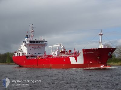
IVER BLESSING
Asphalt/Bitumen Tanker
Current Trip
| Time Travelled | 1 day |
|---|---|
| Remaining Time | 25 mins |
| Distance Travelled | 371.58 nm |
| Remaining Distance | 7.64 nm |
| AVG Speed | 11.4 Knop |
| MAX Speed | 13.3 Knop |
| AVG Wind | 16.1 knots |
| MAX Wind | 27 knots |
| MIN Temp | 2.2°C / 35.96°F |
| MAX Temp | 7.8°C / 46.04°F |
| Djupgående | 5.6 m |
| Position mottagen | 1 m sen |
Current Position
| Longitud | 9.03291° |
|---|---|
| Latitude | 53.86288° |
| Status | Under way using engine |
| Fart | 8.1 Knop |
| Kurs | 41° |
| Område | North Sea |
| Station | T-AIS |
| Position mottagen | 1 m sen |
Info
Information
The current position of IVER BLESSING is in North Sea with coordinates 53.86288° / 9.03291° as reported on 2024-04-24 21:08 by AIS to our vessel tracker app. The vessel's current speed is 8.1 Knop and is heading at the port of BRUNSBUETTEL. The estimated time of arrival as calculated by MyShipTracking vessel tracking app is 2024-04-24 21:34 LT
The vessel IVER BLESSING (IMO: 9588287, MMSI: 236623000) is a Asphalt/Bitumen Tanker that was built in 2011 ( 13 År gammal ). It's sailing under the flag of [GI] Gibraltar.
In this page you can find informations about the vessels current position, last detected port calls, and current voyage information. If the vessels is not in coverage by AIS you will find the latest position.
The current position of IVER BLESSING is detected by our AIS receivers and we are not responsible for the reliability of the data. The last position was recorded while the vessel was in Coverage by the Ais receivers of our vessel tracking app.
The current draught of IVER BLESSING as reported by AIS is 5.6 meters
Weather
| Temperature | 2.1°C / 35.78°F |
|---|---|
| Wind Speed | 4 knots |
| Direction | 54° NE |
| Pressure | 1004.2 hPa |
| Humidity | 92.5 % |
| Cloud Coverage | 36 % |
Featured Company
Last Port Calls
| Port | Arrival | Departure | Time In Port |
|---|---|---|---|
| 2024-04-22 11:54 | 2024-04-23 13:54 | 1 d | |
| 2024-04-15 11:32 | 2024-04-15 16:12 | 4 h | |
| 2024-04-12 11:47 | 2024-04-13 15:26 | 1 d | |
| 2024-03-30 05:08 | 2024-04-02 15:02 | 3 d | |
| 2024-03-27 04:23 | 2024-03-28 12:05 | 1 d | |
| 2024-03-26 14:46 | 2024-03-26 15:36 | 50 m | |
| 2024-03-25 00:47 | 2024-03-25 19:53 | 19 h | |
| 2024-03-17 19:59 | 2024-03-20 13:37 | 2 d | |
| 2024-03-13 03:55 | 2024-03-14 09:46 | 1 d | |
| 2024-03-06 08:13 | 2024-03-06 12:30 | 4 h |
Last Trips
| Origin | Departure | Destination | Arrival | Distance | |
|---|---|---|---|---|---|
| 2024-04-15 18:12 | 2024-04-22 12:54 | 1629.04 nm | |||
| 2024-04-13 17:26 | 2024-04-15 13:32 | 490.95 nm | |||
| 2024-04-02 16:02 | 2024-04-12 13:47 | 2164.52 nm | |||
| 2024-03-28 13:05 | 2024-03-30 05:08 | 379.32 nm | |||
| 2024-03-26 16:36 | 2024-03-27 05:23 | 49.20 nm | |||
| 2024-03-25 20:53 | 2024-03-26 15:46 | 164.09 nm | |||
| 2024-03-20 14:37 | 2024-03-25 01:47 | 1099.66 nm | |||
| 2024-03-14 09:46 | 2024-03-17 20:59 | 843.37 nm | |||
| 2024-03-06 13:30 | 2024-03-13 03:55 | 1620.88 nm | |||
| 2024-03-04 12:15 | 2024-03-06 09:13 | 461.84 nm |
Events
| Tid | Event | Detaljer | Position / Dest | Information |
|---|---|---|---|---|
| 2024-04-24 18:47 | Status ändrad | Under way using engine Default |
53.98039 / 8.41337
GBTEE>DEBRB
|
Fart: 10.5 kn Kurs: 100° |
| 2024-04-24 18:40 | Status ändrad | Default Under way using engine |
53.98363 / 8.38179
GBTEE>DEBRB
|
Fart: 10.1 kn Kurs: 102.4° |
| 2024-04-24 17:34 | Djupgående ändrat | 5.6 5.3 |
53.99467 / 8.05731
GBTEE>DEBRB
|
Fart: 11.8 kn Kurs: 105.3° |
| 2024-04-24 17:31 | Status ändrad | Under way using engine Default |
53.99838 / 8.04068
GBTEE>DEBRB
|
Fart: 12.5 kn Kurs: 130° |
| 2024-04-24 17:27 | Status ändrad | Default Under way using engine |
54.00603 / 8.02221
GBTEE>DEBRB
|
Fart: 12.5 kn Kurs: 133.9° |
| 2024-04-24 17:23 | Byter havsområde | German part of the North Sea United Kingdom part of the North Sea |
54.01531 / 8.00344
North Sea
GBTEE>DEBRB
|
Fart: 12.5 kn Kurs: 133.9° |
| 2024-04-24 17:23 | Status ändrad | Under way using engine Default |
54.01531 / 8.00344
GBTEE>DEBRB
|
Fart: 12.1 kn Kurs: 110° |
| 2024-04-24 17:05 | I täckningsområde |
54.01531 / 8.00344
North Sea
GBTEE>DEBRB
|
Fart: 12.5 kn Kurs: 133.9° |
|
| 2024-04-23 23:23 | Status ändrad | Default Under way using engine |
54.15837 / 1.99455
GBTEE>DEBRB
|
Fart: 11.7 kn Kurs: 96.3° |
| 2024-04-23 23:09 | UTANFÖR täckningsområde |
54.16141 / 1.91827
North Sea
GBTEE>DEBRB
|
Fart: 11.7 kn Kurs: 96.3° |