
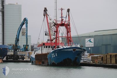
ISLA S DS1
Fishing
Current Trip
| Time Travelled | 6 days |
|---|---|
| Remaining Time | 3 days |
| Distance Travelled | 321.97 nm |
| Remaining Distance | 240.93 nm |
| AVG Speed | 4.5 Knopen |
| MAX Speed | 9.3 Knopen |
| AVG Wind | 16.3 knots |
| MAX Wind | 32.8 knots |
| MIN Temp | 8.2°C / 46.76°F |
| MAX Temp | 12.8°C / 55.04°F |
| Diepgang | 5.4 M |
| Positie ontvangen | 2 m geleden |
Current Position
| Lengtegraad | 0.42296° |
|---|---|
| Breedtegraat | 50.18878° |
| Status | Engaged in Fishing |
| Snelheid | 1.8 Knopen |
| Koers | 318° |
| Gebied | English Channel |
| Station | T-AIS |
| Positie ontvangen | 2 m geleden |
Info
Information
The current position of ISLA S DS1 is in English Channel with coordinates 50.18878° / 0.42296° as reported on 2024-05-03 16:01 by AIS to our vessel tracker app. The vessel's current speed is 1.8 Knopen and is heading at the port of DEN HELDER. The estimated time of arrival as calculated by MyShipTracking vessel tracking app is 2024-05-07 03:54 LT
The vessel ISLA S DS1 (MMSI: 235089665) is a Fishing It's sailing under the flag of [GB] United Kingdom.
In this page you can find informations about the vessels current position, last detected port calls, and current voyage information. If the vessels is not in coverage by AIS you will find the latest position.
The current position of ISLA S DS1 is detected by our AIS receivers and we are not responsible for the reliability of the data. The last position was recorded while the vessel was in Coverage by the Ais receivers of our vessel tracking app.
The current draught of ISLA S DS1 as reported by AIS is 5.4 meters
Weather
| Temperature | 11.6°C / 52.88°F |
|---|---|
| Wind Speed | 9 knots |
| Direction | 249° WSW |
| Pressure | 1012.1 hPa |
| Humidity | 83.4 % |
| Cloud Coverage | 100 % |
Featured Company
Last Port Calls
| Port | Arrival | Departure | Time In Port |
|---|---|---|---|
| 2024-04-26 10:53 | 2024-04-27 12:33 | 1 d | |
| 2024-04-18 07:47 | 2024-04-19 08:46 | 1 d | |
| 2024-04-09 23:47 | 2024-04-11 00:22 | 1 d | |
| 2024-04-02 02:58 | 2024-04-03 05:34 | 1 d | |
| 2024-03-24 10:40 | 2024-03-26 00:22 | 1 d | |
| 2024-03-16 15:18 | 2024-03-17 03:52 | 12 h | |
| 2024-03-10 09:44 | 2024-03-11 11:10 | 1 d | |
| 2024-03-02 14:25 | 2024-03-03 04:06 | 13 h |
Last Trips
| Origin | Departure | Destination | Arrival | Distance | |
|---|---|---|---|---|---|
| 2024-04-19 09:46 | 2024-04-26 11:53 | 318.39 nm | |||
| 2024-04-11 01:22 | 2024-04-18 08:47 | 458.11 nm | |||
| 2024-04-03 06:34 | 2024-04-10 00:47 | 253.25 nm | |||
| 2024-03-26 00:22 | 2024-04-02 03:58 | 501.18 nm | |||
| 2024-03-17 03:52 | 2024-03-24 10:40 | 429.85 nm | |||
| 2024-03-11 11:10 | 2024-03-16 15:18 | 311.46 nm | |||
| 2024-03-03 04:06 | 2024-03-10 09:44 | 390.55 nm | |||
| 2024-02-27 01:20 | 2024-03-02 14:25 | 127.85 nm |
Events
| Tijd | Evenement | Details | Positie / Bestemming | Info |
|---|---|---|---|---|
| 2024-05-02 23:47 | Start beweging | 18.86 nm, North West of FECAMP |
49.96137 / -.00305
FISHING GROUNDS
|
Snelheid: 4 kn Koers: 144° |
| 2024-05-02 23:41 | Stop beweging | 18.96 nm, North West of FECAMP |
49.96178 / -.00590
FISHING GROUNDS
|
Snelheid: 0.2 kn Koers: 332° |
| 2024-05-02 22:54 | Start beweging | 18.08 nm, North of ANTIFER |
49.94572 / -.00447
FISHING GROUNDS
|
Snelheid: 3.7 kn Koers: 8° |
| 2024-05-02 22:46 | Stop beweging | 17.91 nm, North of ANTIFER |
49.94275 / -.00439
FISHING GROUNDS
|
Snelheid: 0.2 kn Koers: 340° |
| 2024-05-02 16:33 | Start beweging | 18.86 nm, North West of ANTIFER |
49.93751 / -.08653
FISHING GROUNDS
|
Snelheid: 3.4 kn Koers: 26° |
| 2024-05-02 16:22 | Stop beweging | 18.93 nm, North West of ANTIFER |
49.93594 / -.09511
FISHING GROUNDS
|
Snelheid: 0.2 kn Koers: 83° |
| 2024-05-02 16:12 | Start beweging | 19.16 nm, North West of ANTIFER |
49.93629 / -.10646
FISHING GROUNDS
|
Snelheid: 3.1 kn Koers: 200° |
| 2024-05-02 15:55 | Stop beweging | 19.57 nm, North West of ANTIFER |
49.94288 / -.10949
FISHING GROUNDS
|
Snelheid: 0.2 kn Koers: 193° |
| 2024-05-02 15:18 | Start beweging | 20.51 nm, North West of ANTIFER |
49.95852 / -.11607
FISHING GROUNDS
|
Snelheid: 3.6 kn Koers: 308° |
| 2024-05-02 15:14 | Stop beweging | 20.5 nm, North West of ANTIFER |
49.95752 / -.11850
FISHING GROUNDS
|
Snelheid: 0.3 kn Koers: 307° |