
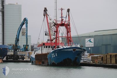
ISLA S DS1
Fishing
Current Trip
| Time Travelled | 5 days |
|---|---|
| Remaining Time | 39 mins |
| Distance Travelled | 333.14 nm |
| Remaining Distance | 4.46 nm |
| AVG Speed | 5.6 Noeuds |
| MAX Speed | 11.2 Noeuds |
| AVG Wind | 20.6 knots |
| MAX Wind | 27.5 knots |
| MIN Temp | 13.2°C / 55.76°F |
| MAX Temp | 15.5°C / 59.9°F |
| Tirant d eau | 5.4 m |
| Position reçue | 2 m depuis |
Current Position
| Longitude | --- |
|---|---|
| Latitude | --- |
| Etat | Under way using engine |
| Vitesse | 4.4 Noeuds |
| Parcours | 308° |
| Zone | English Channel |
| Station | T-AIS |
| Position reçue | 2 m depuis |
Info
Information
The current position of ISLA S DS1 is in English Channel with coordinates 50.76793° / -0.28681° as reported on 2024-10-06 07:22 by AIS to our vessel tracker app. The vessel's current speed is 4.4 Noeuds and is heading at the port of SHOREHAM. The estimated time of arrival as calculated by MyShipTracking vessel tracking app is 2024-10-06 09:04 LT
The vessel ISLA S DS1 (MMSI: 235089665) is a Fishing It's sailing under the flag of [GB] United Kingdom.
In this page you can find informations about the vessels current position, last detected port calls, and current voyage information. If the vessels is not in coverage by AIS you will find the latest position.
The current position of ISLA S DS1 is detected by our AIS receivers and we are not responsible for the reliability of the data. The last position was recorded while the vessel was in Coverage by the Ais receivers of our vessel tracking app.
The current draught of ISLA S DS1 as reported by AIS is 5.4 meters
Weather
| Temperature | 14.1°C / 57.38°F |
|---|---|
| Wind Speed | 21 knots |
| Direction | 135° SE |
| Pressure | 1002.2 hPa |
| Humidity | 81.8 % |
| Cloud Coverage | 100 % |
Featured Company
Last Port Calls
| Port | Arrival | Departure | Time In Port |
|---|---|---|---|
| 2024-09-29 11:26 | 2024-09-30 08:56 | 21 h | |
| 2024-09-24 13:44 | 2024-09-27 08:33 | 2 d | |
| 2024-09-18 06:27 | 2024-09-19 08:26 | 1 d | |
| 2024-09-08 00:40 | 2024-09-10 16:52 | 2 d | |
| 2024-09-06 14:15 | 2024-09-07 04:29 | 14 h | |
| 2024-09-06 13:22 |
Most Visited Ports (Last year)
| Port | Arrivals | |
|---|---|---|
| 26 | ||
| 3 | ||
| 2 | ||
| 1 |
Last Trips
| Origin | Departure | Destination | Arrival | Distance | |
|---|---|---|---|---|---|
| 2024-09-27 08:33 | 2024-09-29 11:26 | 85.44 nm | |||
| 2024-09-19 08:26 | 2024-09-24 13:44 | 144.88 nm | |||
| 2024-09-10 16:52 | 2024-09-18 06:27 | 441.11 nm | |||
| 2024-09-07 04:29 | 2024-09-08 00:40 | 203.25 nm | |||
| 2024-09-06 13:22 | 2024-09-06 14:15 | 4.97 nm |
Events
| Heure | Evenement | Détails | Position/ Destination | Info |
|---|---|---|---|---|
| 2024-10-06 06:07 | Démarrage | 6.51 nm, South West of BRIGHTON MARINA |
50.72191 / -.20468
SHOREHAM
|
Vitesse: 3.5 kn Parcours: 100° |
| 2024-10-06 06:02 | Arret | 6.52 nm, South of SHOREHAM |
50.72216 / -.20764
SHOREHAM
|
Vitesse: 0.1 kn Parcours: 103° |
| 2024-10-06 02:08 | Changement de destination | SHOREHAM FISHING GROUNDS |
50.67617 / .15839
SHOREHAM
|
Vitesse: 7.1 kn Parcours: 277.6° |
| 2024-10-05 22:36 | Dans la zone couverte |
50.50819 / .65872
English Channel
|
Vitesse: 5.3 kn Parcours: 291.1° |
|
| 2024-10-04 19:44 | Hors de la zone couverte |
50.46775 / .81741
English Channel
|
Vitesse: 2.6 kn Parcours: 349° |
|
| 2024-10-04 19:44 | Dans la zone couverte |
50.46775 / .81741
English Channel
|
Vitesse: 2.6 kn Parcours: 349° |
|
| 2024-10-04 11:27 | Hors de la zone couverte |
50.47361 / .83303
English Channel
|
Vitesse: 2.9 kn Parcours: 247.9° |
|
| 2024-10-04 08:58 | Dans la zone couverte |
50.47878 / .83298
English Channel
|
Vitesse: 3.2 kn Parcours: 67.1° |
|
| 2024-10-04 08:00 | Hors de la zone couverte |
50.48182 / .85541
English Channel
|
Vitesse: 2.9 kn Parcours: 250.9° |
|
| 2024-10-04 07:56 | Dans la zone couverte |
50.48237 / .85705
English Channel
|
Vitesse: 1.9 kn Parcours: 236.9° |