
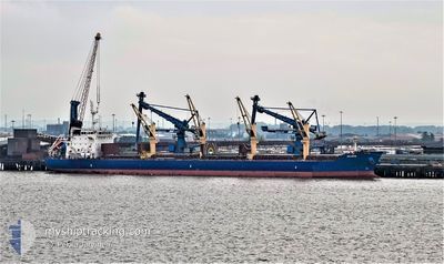
IMAVERE
Cargo
Current Trip
| Time Travelled | 10 days |
|---|---|
| Remaining Time | 2 days |
| Distance Travelled | 1503.60 nm |
| Remaining Distance | 659.45 nm |
| AVG Speed | 12.6 Knopen |
| MAX Speed | 15.1 Knopen |
| AVG Wind | 13.1 knots |
| MAX Wind | 26.1 knots |
| MIN Temp | 1°C / 33.8°F |
| MAX Temp | 10.1°C / 50.18°F |
| Diepgang | 10.3 M |
| Positie ontvangen | 1 m geleden |
Current Position
| Lengtegraad | 13.30871° |
|---|---|
| Breedtegraat | 54.90769° |
| Status | Under way using engine |
| Snelheid | 11.1 Knopen |
| Koers | 246.4° |
| Gebied | Baltic Sea |
| Station | T-AIS |
| Positie ontvangen | 1 m geleden |
Info
Information
The current position of IMAVERE is in Baltic Sea with coordinates 54.90769° / 13.30871° as reported on 2024-04-27 20:03 by AIS to our vessel tracker app. The vessel's current speed is 11.1 Knopen and is heading at the port of IMMINGHAM. The estimated time of arrival as calculated by MyShipTracking vessel tracking app is 2024-04-30 04:59 LT
The vessel IMAVERE (IMO: 9612325, MMSI: 209184000) is a Cargo It's sailing under the flag of [CY] Cyprus.
In this page you can find informations about the vessels current position, last detected port calls, and current voyage information. If the vessels is not in coverage by AIS you will find the latest position.
The current position of IMAVERE is detected by our AIS receivers and we are not responsible for the reliability of the data. The last position was recorded while the vessel was in Coverage by the Ais receivers of our vessel tracking app.
The current draught of IMAVERE as reported by AIS is 10.3 meters
Weather
| Temperature | 7.5°C / 45.5°F |
|---|---|
| Wind Speed | 18 knots |
| Direction | 99° E |
| Pressure | 1012.9 hPa |
| Humidity | 80.7 % |
| Cloud Coverage | 100 % |
Featured Company
Last Port Calls
| Port | Arrival | Departure | Time In Port |
|---|---|---|---|
| 2024-04-13 05:39 | 2024-04-17 11:04 | 4 d | |
| 2024-03-20 08:47 | 2024-03-24 20:03 | 4 d | |
| 2024-03-12 15:44 | 2024-03-16 16:26 | 4 d | |
| 2024-03-04 14:56 | 2024-03-07 21:06 | 3 d | |
| 2024-02-27 07:52 | 2024-02-29 19:13 | 2 d | |
| 2024-02-18 07:10 | 2024-02-21 11:54 | 3 d | |
| 2024-02-13 22:02 | 2024-02-13 23:30 | 1 h | |
| 2024-02-07 00:14 | 2024-02-13 20:25 | 6 d |
Most Visited Ports (Last year)
| Port | Arrivals | |
|---|---|---|
| 2 | ||
| 2 | ||
| 2 | ||
| 2 | ||
| 2 | ||
| 1 |
Last Trips
| Origin | Departure | Destination | Arrival | Distance | |
|---|---|---|---|---|---|
| 2024-03-24 22:03 | 2024-04-13 06:39 | 1312.50 nm | |||
| 2024-03-16 16:26 | 2024-03-20 10:47 | 1137.85 nm | |||
| 2024-03-07 23:06 | 2024-03-12 15:44 | 1252.79 nm | |||
| 2024-02-29 19:13 | 2024-03-04 16:56 | 1154.38 nm | |||
| 2024-02-21 13:54 | 2024-02-27 07:52 | 1300.93 nm | |||
| 2024-02-14 00:30 | 2024-02-18 09:10 | 1200.24 nm | |||
| 2024-02-13 21:25 | 2024-02-13 23:02 | 8.66 nm | |||
| 2024-01-25 00:57 | 2024-02-07 01:14 | 2433.89 nm |
Events
| Tijd | Evenement | Details | Positie / Bestemming | Info |
|---|---|---|---|---|
| 2024-04-27 18:29 | Wijzig zee gebeid | German part of the Baltic Sea Swedish part of the Baltic Sea |
55.01931 / 13.78567
Baltic Sea
GB IMM
|
Snelheid: 11.5 kn Koers: 250.5° |
| 2024-04-27 15:02 | Wijzig zee gebeid | Swedish part of the Baltic Sea Danish part of the Kattegat |
55.47756 / 14.71268
Baltic Sea
GB IMM
|
Snelheid: 12.2 kn Koers: 240.5° |
| 2024-04-27 13:26 | Gevonden in zee | Danish part of the Kattegat |
55.64442 / 15.21940
Kattegat
GB IMM
|
Snelheid: 12.3 kn Koers: 240.1° |
| 2024-04-27 07:37 | Draught Changed | 10.3 6.2 |
56.26947 / 17.04008
GB IMM
|
Snelheid: 12.2 kn Koers: 231.4° |
| 2024-04-27 07:37 | Destination Changed | GB IMM LV RIX |
56.26947 / 17.04008
GB IMM
|
Snelheid: 12.2 kn Koers: 231.4° |
| 2024-04-27 07:37 | ETA Changed | 2024/04/30 21:00 2024/04/20 20:00 |
56.26947 / 17.04008
GB IMM
|
Snelheid: 12.2 kn Koers: 231.4° |
| 2024-04-27 07:30 | Status Changed | Under way using engine Default |
56.28404 / 17.07262
LV RIX
|
Snelheid: 12.2 kn Koers: 231° |
| 2024-04-27 07:28 | Status Changed | Default Under way using engine |
56.28787 / 17.08116
LV RIX
|
Snelheid: 12.2 kn Koers: 231° |
| 2024-04-27 07:21 | Status Changed | Under way using engine Default |
56.30422 / 17.11773
LV RIX
|
Snelheid: 12.1 kn Koers: 232° |
| 2024-04-27 07:16 | Binnenbereik |
56.30035 / 17.10903
Baltic Sea
|
Snelheid: 12.2 kn Koers: 231.3° |