

IMAVERE
Cargo

Current Trip
| Time Travelled | 8 days |
|---|---|
| Remaining Time | 1 day |
| Distance Travelled | 1664.46 nm |
| Remaining Distance | 433.00 nm |
| AVG Speed | 12.3 Noeuds |
| MAX Speed | 14.8 Noeuds |
| AVG Wind | 10.1 knots |
| MAX Wind | 19 knots |
| MIN Temp | 2.1°C / 35.78°F |
| MAX Temp | 9.1°C / 48.38°F |
| Tirant d eau | 10.3 m |
| Position reçue | 1 m depuis |
Current Position
| Longitude | --- |
|---|---|
| Latitude | --- |
| Etat | Constrained by her draught |
| Vitesse | 11.8 Noeuds |
| Parcours | 54.9° |
| Zone | Kattegat |
| Station | T-AIS |
| Position reçue | 1 m depuis |
Information
The current position of IMAVERE is in Kattegat with coordinates 54.95739° / 10.93215° as reported on 2025-03-27 10:46 by AIS to our vessel tracker app. The vessel's current speed is 11.8 Noeuds and is heading at the port of IMMINGHAM. The estimated time of arrival as calculated by MyShipTracking vessel tracking app is 2025-03-29 00:11 LT
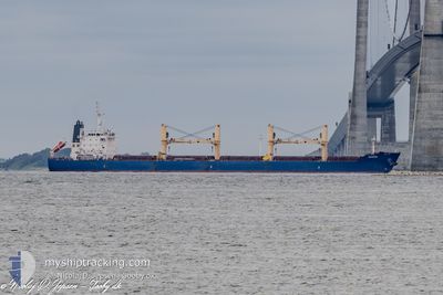
The vessel IMAVERE (IMO: 9612325, MMSI: 209184000) is a Cargo It's sailing under the flag of [CY] Cyprus.
In this page you can find informations about the vessels current position, last detected port calls, and current voyage information. If the vessels is not in coverage by AIS you will find the latest position.
The current position of IMAVERE is detected by our AIS receivers and we are not responsible for the reliability of the data. The last position was recorded while the vessel was in Coverage by the Ais receivers of our vessel tracking app.
The current draught of IMAVERE as reported by AIS is 10.3 meters
Weather
| Temperature | 6.1°C / 42.98°F |
|---|---|
| Wind Speed | 16 knots |
| Direction | 233° SW |
| Pressure | 1018.3 hPa |
| Humidity | 88 % |
| Cloud Coverage | 100 % |


Featured Company
Last Port Calls
| Port | Arrival | Departure | Time In Port |
|---|---|---|---|
| 2025-03-12 22:20 | 2025-03-19 02:23 | 6 d | |
| 2025-02-26 04:58 | 2025-02-28 13:01 | 2 d | |
| 2025-02-06 11:27 | 2025-02-14 01:43 | 7 d | |
| 2025-01-19 10:14 | 2025-02-02 01:48 | 13 d | |
| 2025-01-12 11:34 | 2025-01-15 09:57 | 2 d | |
| 2025-01-03 11:43 | 2025-01-07 17:38 | 4 d |
Last Trips
| Origin | Departure | Destination | Arrival | Distance | |
|---|---|---|---|---|---|
| 2025-02-28 13:01 | 2025-03-12 22:20 | 2433.01 nm | |||
| 2025-02-14 01:43 | 2025-02-26 04:58 | 2256.32 nm | |||
| 2025-02-02 01:48 | 2025-02-06 11:27 | 1209.27 nm | |||
| 2025-01-15 09:57 | 2025-01-19 10:14 | 1146.18 nm | |||
| 2025-01-07 17:38 | 2025-01-12 11:34 | 1288.70 nm | |||
| 2024-12-30 08:45 | 2025-01-03 11:43 | 1245.91 nm |
Events
| Heure | Evenement | Détails | Position/ Destination | Info |
|---|---|---|---|---|
| 2025-03-27 09:34 | Etat Changé | Constrained by her draught Under way using engine |
54.74867 / 10.79348
GB IMM
|
Vitesse: 11.7 kn Parcours: 24.2° |
| 2025-03-27 09:30 | Changement de zone | Danish part of the Kattegat Danish part of the Baltic Sea |
54.73791 / 10.78494
Kattegat
GB IMM
|
Vitesse: 11.6 kn Parcours: 24.7° |
| 2025-03-27 08:46 | Changement de zone | Danish part of the Baltic Sea German part of the Baltic Sea |
54.63852 / 10.90340
Baltic Sea
GB IMM
|
Vitesse: 11.7 kn Parcours: 301° |
| 2025-03-27 07:17 | Changement de zone | German part of the Baltic Sea Danish part of the Baltic Sea |
54.55175 / 11.34582
Baltic Sea
GB IMM
|
Vitesse: 11.3 kn Parcours: 296.6° |
| 2025-03-27 06:14 | Changement d'ETA | 2025/03/29 20:00 2025/03/29 17:00 |
54.46211 / 11.65268
GB IMM
|
Vitesse: 11.4 kn Parcours: 297.9° |
| 2025-03-27 04:41 | Changement de zone | Danish part of the Baltic Sea German part of the Baltic Sea |
54.43973 / 12.13835
Baltic Sea
GB IMM
|
Vitesse: 10.9 kn Parcours: 270.2° |
| 2025-03-27 04:17 | Changement de zone | German part of the Baltic Sea Danish part of the Baltic Sea |
54.49124 / 12.21082
Baltic Sea
GB IMM
|
Vitesse: 11.7 kn Parcours: 194.6° |
| 2025-03-27 03:14 | Detecté en mer | Danish part of the Baltic Sea |
54.65242 / 12.39431
Baltic Sea
GB IMM
|
Vitesse: 11.8 kn Parcours: 237.6° |
| 2025-03-27 02:38 | Changement de zone | German part of the Baltic Sea Danish part of the Baltic Sea |
54.71719 / 12.56539
Baltic Sea
GB IMM
|
Vitesse: 11.8 kn Parcours: 236.1° |
| 2025-03-27 01:41 | Changement de zone | Danish part of the Baltic Sea German part of the Baltic Sea |
54.80384 / 12.84939
Baltic Sea
GB IMM
|
Vitesse: 11.9 kn Parcours: 249.2° |