

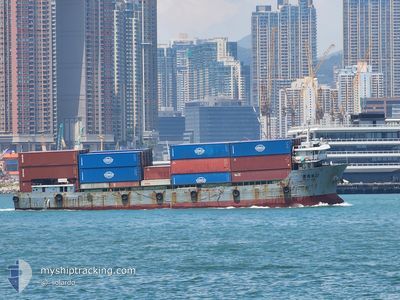
HUIHAILONG22
Cargo

Current Trip
| Time Travelled | 1 day |
|---|---|
| Remaining Time | --- |
| Distance Travelled | 162.76 nm |
| Remaining Distance | --- |
| AVG Speed | 7 Knopen |
| MAX Speed | 8.1 Knopen |
| AVG Wind | 15.8 knots |
| MAX Wind | 24 knots |
| MIN Temp | 13.6°C / 56.48°F |
| MAX Temp | 23.4°C / 74.12°F |
| Diepgang | 3.8 M |
| Positie ontvangen | 3 d geleden |
Current Position
| Lengtegraad | --- |
|---|---|
| Breedtegraat | --- |
| Status | Under way using engine |
| Snelheid | 7.1 Knopen |
| Koers | 348.3° |
| Gebied | South China Sea |
| Station | T-AIS |
| Positie ontvangen | 3 d geleden |
Information
The current position of HUIHAILONG22 is in South China Sea with coordinates 22.38932° / 113.90037° as reported on 2025-03-26 11:25 by AIS to our vessel tracker app. The vessel's current speed is 7.1 Knopen
The vessel HUIHAILONG22 (MMSI: 412470250) is a Cargo It's sailing under the flag of [CN] China.
In this page you can find informations about the vessels current position, last detected port calls, and current voyage information. If the vessels is not in coverage by AIS you will find the latest position.
The current position of HUIHAILONG22 is detected by our AIS receivers and we are not responsible for the reliability of the data. The last position was recorded while the vessel was in Coverage by the Ais receivers of our vessel tracking app.
The current draught of HUIHAILONG22 as reported by AIS is 3.8 meters
Weather
| Temperature | 14.7°C / 58.46°F |
|---|---|
| Wind Speed | 9 knots |
| Direction | 23° NNE |
| Pressure | 1021.5 hPa |
| Humidity | 71.6 % |
| Cloud Coverage | 100 % |


Featured Company
Last Port Calls
| Port | Arrival | Departure | Time In Port |
|---|---|---|---|
| 2025-03-28 03:30 | 2025-03-28 11:50 | 8 h | |
| 2025-03-26 17:36 | 2025-03-26 22:18 | 4 h | |
| 2025-03-25 12:22 | 2025-03-25 13:53 | 1 h | |
| 2025-03-24 14:57 | 2025-03-25 05:58 | 15 h | |
| 2025-03-23 01:59 | 2025-03-23 04:41 | 2 h | |
| 2025-03-22 07:42 | 2025-03-22 19:41 | 11 h | |
| 2025-03-21 00:21 | 2025-03-21 08:23 | 8 h | |
| 2025-03-20 08:39 | 2025-03-20 10:42 | 2 h | |
| 2025-03-19 17:24 | 2025-03-20 04:06 | 10 h | |
| 2025-03-18 00:49 | 2025-03-18 09:25 | 8 h |
Last Trips
| Origin | Departure | Destination | Arrival | Distance | |
|---|---|---|---|---|---|
| 2025-03-27 06:18 | 2025-03-28 11:30 | 15.73 nm | |||
| 2025-03-25 21:53 | 2025-03-27 01:36 | 155.67 nm | |||
| 2025-03-25 13:58 | 2025-03-25 20:22 | 2.82 nm | |||
| 2025-03-23 12:41 | 2025-03-24 22:57 | 158.16 nm | |||
| 2025-03-23 03:41 | 2025-03-23 09:59 | 15.84 nm | |||
| 2025-03-21 16:23 | 2025-03-22 15:42 | 82.51 nm | |||
| 2025-03-20 18:42 | 2025-03-21 08:21 | 74.45 nm | |||
| 2025-03-20 12:06 | 2025-03-20 16:39 | 14.12 nm | |||
| 2025-03-18 17:25 | 2025-03-20 01:24 | 68.78 nm | |||
| 2025-03-17 22:40 | 2025-03-18 08:49 | 68.43 nm |
Events
| Tijd | Evenement | Details | Positie / Bestemming | Info |
|---|---|---|---|---|
| 2025-03-29 10:54 | Stop beweging | 0.99 nm, North West of YANGJIANG |
21.70616 / 111.80180
YANG JIANG
|
Snelheid: 0.2 kn Koers: 264° |
| 2025-03-28 11:50 | Vertrekhaven |
|
22.65639 / 113.68360
YANG JIANG
|
Snelheid: 4 kn Koers: 170° |
| 2025-03-28 11:45 | Start beweging |
22.66112 / 113.67922
[CN] NANSHA
|
Snelheid: 4 kn Koers: 170° |
|
| 2025-03-28 03:31 | Stop beweging |
22.66126 / 113.67614
[CN] NANSHA
|
Snelheid: Koers: 68° |
|
| 2025-03-28 03:30 | Aankomsthaven |
|
22.66126 / 113.67614
[CN] NANSHA
|
Snelheid: 3.3 kn Koers: 259° |
| 2025-03-28 02:38 | Start beweging | 2.2 nm, South East of NANSHA |
22.64768 / 113.70471
YANG JIANG
|
Snelheid: 3.1 kn Koers: 264° |
| 2025-03-27 00:13 | Stop beweging | 2.17 nm, South East of NANSHA |
22.64932 / 113.70557
YANG JIANG
|
Snelheid: 0.1 kn Koers: 129° |
| 2025-03-26 22:18 | Vertrekhaven |
|
22.52627 / 113.85302
YANG JIANG
|
Snelheid: 3.5 kn Koers: 206° |
| 2025-03-26 22:14 | Start beweging |
22.53257 / 113.85228
[CN] DA CHAN BAY
|
Snelheid: 3.5 kn Koers: 206° |
|
| 2025-03-26 17:41 | Stop beweging |
22.53057 / 113.85488
[CN] DA CHAN BAY
|
Snelheid: Koers: 342° |