
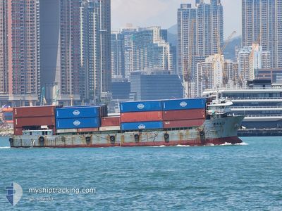
HUIHAILONG22
Cargo
Current Trip
NAN SHA
| Time Travelled | 1 day |
|---|---|
| Remaining Time | --- |
| Distance Travelled | 192.09 nm |
| Remaining Distance | --- |
| AVG Speed | 6 Knots |
| MAX Speed | 8.3 Knots |
| AVG Wind | 9.5 knots |
| MAX Wind | 15.8 knots |
| MIN Temp | 25.5°C / 77.9°F |
| MAX Temp | 28.4°C / 83.12°F |
| Dybgang | 3.8 m |
| Position Modtaget | 20 h, 40 m siden |
Current Position
| Longitude | 113.73870° |
|---|---|
| Latitude | 22.33207° |
| Status | Under way using engine |
| Fart | 5.8 Knots |
| Kurs | 10.7° |
| Område | South China Sea |
| Station | T-AIS |
| Position Modtaget | 20 h, 40 m siden |
Info
Information
The current position of HUIHAILONG22 is in South China Sea with coordinates 22.33207° / 113.73870° as reported on 2024-04-25 03:51 by AIS to our vessel tracker app. The vessel's current speed is 5.8 Knots
The vessel HUIHAILONG22 (MMSI: 412470250) is a Cargo It's sailing under the flag of [CN] China.
In this page you can find informations about the vessels current position, last detected port calls, and current voyage information. If the vessels is not in coverage by AIS you will find the latest position.
The current position of HUIHAILONG22 is detected by our AIS receivers and we are not responsible for the reliability of the data. The last position was recorded while the vessel was in Coverage by the Ais receivers of our vessel tracking app.
The current draught of HUIHAILONG22 as reported by AIS is 3.8 meters
Weather
| Temperature | 25.6°C / 78.08°F |
|---|---|
| Wind Speed | 3 knots |
| Direction | 334° NNW |
| Pressure | 1005.8 hPa |
| Humidity | 86.8 % |
| Cloud Coverage | 98 % |
Featured Company
Last Port Calls
| Port | Arrival | Departure | Time In Port |
|---|---|---|---|
| 2024-04-23 13:47 | 2024-04-24 03:44 | 13 h | |
| 2024-04-22 07:06 | 2024-04-22 11:26 | 4 h | |
| 2024-04-21 21:24 | 2024-04-22 04:08 | 6 h | |
| 2024-04-20 00:24 | 2024-04-20 12:20 | 11 h | |
| 2024-04-18 01:24 | 2024-04-18 11:07 | 9 h | |
| 2024-04-16 01:06 | 2024-04-16 09:27 | 8 h | |
| 2024-04-14 16:25 | 2024-04-14 20:18 | 3 h | |
| 2024-04-12 07:58 | 2024-04-12 14:14 | 6 h | |
| 2024-04-10 20:13 | 2024-04-11 03:57 | 7 h | |
| 2024-04-08 12:09 | 2024-04-08 19:01 | 6 h |
Last Trips
| Origin | Departure | Destination | Arrival | Distance | |
|---|---|---|---|---|---|
| 2024-04-22 19:26 | 2024-04-23 21:47 | 165.82 nm | |||
| 2024-04-22 12:08 | 2024-04-22 15:06 | 15.67 nm | |||
| 2024-04-20 20:20 | 2024-04-22 05:24 | 162.65 nm | |||
| 2024-04-18 19:07 | 2024-04-20 08:24 | 134.74 nm | |||
| 2024-04-16 17:27 | 2024-04-18 09:24 | 214.26 nm | |||
| 2024-04-15 04:18 | 2024-04-16 09:06 | 159.00 nm | |||
| 2024-04-12 22:14 | 2024-04-15 00:25 | 228.62 nm | |||
| 2024-04-11 11:57 | 2024-04-12 15:58 | 167.96 nm | |||
| 2024-04-09 03:01 | 2024-04-11 04:13 | 216.27 nm | |||
| 2024-04-07 21:49 | 2024-04-08 20:09 | 160.19 nm |
Events
| Tid | Hændelsen | Detaljer | Position / Dest | Info |
|---|---|---|---|---|
| 2024-04-26 00:14 | STOP Sejllads | 1.8 nm, North of XINSHA |
23.01142 / 113.53265
NAN SHA
|
Fart: 0.3 kn Kurs: 44° |
| 2024-04-25 23:59 | START Sejllads | 2 nm, North West of XINSHA |
23.01294 / 113.52663
NAN SHA
|
Fart: 3.3 kn Kurs: 174° |
| 2024-04-25 20:56 | STOP Sejllads | 2.04 nm, North of XINSHA |
23.01433 / 113.52816
NAN SHA
|
Fart: 0.1 kn Kurs: 332° |
| 2024-04-25 20:35 | START Sejllads | 1.74 nm, North West of XINSHA |
23.00929 / 113.52924
NAN SHA
|
Fart: 3.7 kn Kurs: 276° |
| 2024-04-25 16:23 | STOP Sejllads | 1.79 nm, North of XINSHA |
23.01108 / 113.53166
NAN SHA
|
Fart: Kurs: 69° |
| 2024-04-25 10:48 | START Sejllads | 3.97 nm, West of DA CHAN BAY |
22.55323 / 113.78455
NAN SHA
|
Fart: 3.5 kn Kurs: 5° |
| 2024-04-25 06:17 | STOP Sejllads | 4.1 nm, West of DA CHAN BAY |
22.54769 / 113.78054
NAN SHA
|
Fart: Kurs: 327° |
| 2024-04-25 03:56 | Status er ændret | Default Under way using engine |
22.33948 / 113.74058
NAN SHA
|
Fart: 5.8 kn Kurs: 10.7° |
| 2024-04-25 03:51 | Status er ændret | Under way using engine Default |
22.33207 / 113.73870
NAN SHA
|
Fart: 5.9 kn Kurs: 14° |
| 2024-04-25 03:51 | Udenfor Dækning |
22.33207 / 113.73870
South China Sea
|
Fart: 5.8 kn Kurs: 10.7° |