
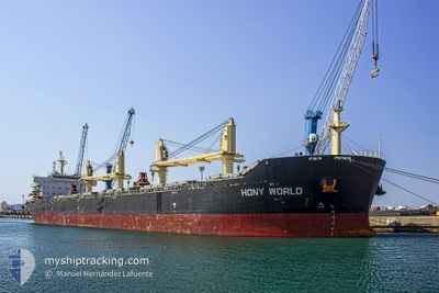
HONY WORLD
Cargo
Current Trip
ISTANBUL
| Time Travelled | 5 days |
|---|---|
| Remaining Time | --- |
| Distance Travelled | 13.29 nm |
| Remaining Distance | --- |
| AVG Speed | 5.5 Knopen |
| MAX Speed | 7.3 Knopen |
| AVG Wind | 12.5 knots |
| MAX Wind | 21 knots |
| MIN Temp | 13.8°C / 56.84°F |
| MAX Temp | 21.6°C / 70.88°F |
| Diepgang | 6.2 M |
| Positie ontvangen | 2 d geleden |
Current Position
| Lengtegraad | 28.86217° |
|---|---|
| Breedtegraat | 40.93200° |
| Status | At anchor |
| Snelheid | 0.3 Knopen |
| Koers | 7° |
| Gebied | Sea of Marmara |
| Station | T-AIS |
| Positie ontvangen | 2 d geleden |
Info
Information
The current position of HONY WORLD is in Sea of Marmara with coordinates 40.93200° / 28.86217° as reported on 2024-05-11 07:53 by AIS to our vessel tracker app. The vessel's current speed is 0.3 Knopen
The vessel HONY WORLD (IMO: 9583835, MMSI: 477938900) is a Cargo It's sailing under the flag of [HK] Hong Kong.
In this page you can find informations about the vessels current position, last detected port calls, and current voyage information. If the vessels is not in coverage by AIS you will find the latest position.
The current position of HONY WORLD is detected by our AIS receivers and we are not responsible for the reliability of the data. The last position was recorded while the vessel was in Coverage by the Ais receivers of our vessel tracking app.
The current draught of HONY WORLD as reported by AIS is 6.2 meters
Weather
| Temperature | 14.7°C / 58.46°F |
|---|---|
| Wind Speed | 16 knots |
| Direction | 15° NNE |
| Pressure | 1011.9 hPa |
| Humidity | 76 % |
| Cloud Coverage | 100 % |
Featured Company
Last Port Calls
| Port | Arrival | Departure | Time In Port |
|---|---|---|---|
| 2024-05-08 05:09 | 2024-05-08 06:22 | 1 h | |
| 2024-04-29 16:40 | 2024-05-03 20:17 | 4 d | |
| 2024-04-24 07:29 | 2024-04-26 05:16 | 1 d | |
| 2024-04-21 05:43 | 2024-04-23 12:19 | 2 d | |
| 2024-04-12 02:57 | 2024-04-17 21:45 | 5 d | |
| 2024-04-06 05:51 | 2024-04-06 14:53 | 9 h | |
| 2024-03-02 03:48 | 2024-03-09 19:27 | 7 d |
Most Visited Ports (Last year)
| Port | Arrivals | |
|---|---|---|
| 3 | ||
| 3 | ||
| 2 | ||
| 2 | ||
| 2 | ||
| 2 |
Last Trips
| Origin | Departure | Destination | Arrival | Distance | |
|---|---|---|---|---|---|
| 2024-05-03 23:17 | 2024-05-08 08:09 | 196.18 nm | |||
| 2024-04-26 08:16 | 2024-04-29 19:40 | 247.84 nm | |||
| 2024-04-23 15:19 | 2024-04-24 10:29 | 22.37 nm | |||
| 2024-04-18 00:45 | 2024-04-21 08:43 | 86.07 nm | |||
| 2024-03-10 04:27 | 2024-04-12 05:57 | 8451.78 nm | |||
| 2024-03-10 04:27 | 2024-04-06 07:51 | 7522.31 nm | |||
| 2024-02-23 17:45 | 2024-03-02 12:48 | 259.66 nm |
Events
| Tijd | Evenement | Details | Positie / Bestemming | Info |
|---|---|---|---|---|
| 2024-05-11 07:53 | Buitenbereik |
40.93200 / 28.86217
Sea of Marmara
|
Snelheid: 0.3 kn Koers: 239.9° |
|
| 2024-05-11 06:29 | Status Changed | At anchor Default |
40.93223 / 28.86172
ISTANBUL
|
Snelheid: 0.2 kn Koers: 41° |
| 2024-05-11 06:26 | Status Changed | Default At anchor |
40.93231 / 28.86161
ISTANBUL
|
Snelheid: Koers: 51° |
| 2024-05-10 09:46 | Draught Changed | 6.2 6.3 |
40.93339 / 28.86064
ISTANBUL
|
Snelheid: Koers: 61° |
| 2024-05-08 19:23 | Status Changed | At anchor Default |
40.93514 / 28.86078
ISTANBUL
|
Snelheid: Koers: 89° |
| 2024-05-08 19:17 | Status Changed | Default At anchor |
40.93508 / 28.86067
ISTANBUL
|
Snelheid: Koers: 89° |
| 2024-05-08 08:02 | Stop beweging | 1.97 nm, South East of YESILKOY |
40.93838 / 28.86278
ISTANBUL
|
Snelheid: 0.3 kn Koers: 152° |
| 2024-05-08 08:02 | Status Changed | At anchor Under way using engine |
40.93841 / 28.86280
ISTANBUL
|
Snelheid: 0.4 kn Koers: 154° |
| 2024-05-08 06:22 | Vertrekhaven |
|
41.00091 / 28.99306
ISTANBUL
|
Snelheid: 11.1 kn Koers: 185° |
| 2024-05-08 05:09 | Aankomsthaven |
|
41.20210 / 29.11125
[TR] ISTANBUL
|
Snelheid: 8.4 kn Koers: 210.9° |