
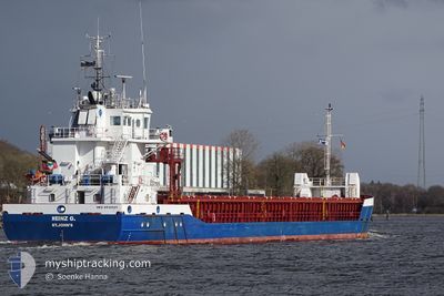
HEINZ G
General Cargo
Current Trip
| Time Travelled | 6 days |
|---|---|
| Remaining Time | 1 day |
| Distance Travelled | 1012.32 nm |
| Remaining Distance | 385.49 nm |
| AVG Speed | 8.7 Knopen |
| MAX Speed | 13.8 Knopen |
| AVG Wind | 11.4 knots |
| MAX Wind | 29.8 knots |
| MIN Temp | -3.1°C / 26.42°F |
| MAX Temp | 6.6°C / 43.88°F |
| Diepgang | 3.5 M |
| Positie ontvangen | Nu |
Current Position
| Lengtegraad | --- |
|---|---|
| Breedtegraat | --- |
| Status | Under way using engine |
| Snelheid | 9.4 Knopen |
| Koers | 37.8° |
| Gebied | Kattegat |
| Station | T-AIS |
| Positie ontvangen | Nu |
Info
Information
The current position of HEINZ G is in Kattegat with coordinates 55.24565° / 14.47025° as reported on 2025-01-13 17:47 by AIS to our vessel tracker app. The vessel's current speed is 9.4 Knopen and is heading at the port of RIGA. The estimated time of arrival as calculated by MyShipTracking vessel tracking app is 2025-01-15 14:20 LT
The vessel HEINZ G (IMO: 9536521, MMSI: 305612000) is a General Cargo that was built in 2010 ( 15 Jaar oud ). It's sailing under the flag of [AG] Antigua Barbuda.
In this page you can find informations about the vessels current position, last detected port calls, and current voyage information. If the vessels is not in coverage by AIS you will find the latest position.
The current position of HEINZ G is detected by our AIS receivers and we are not responsible for the reliability of the data. The last position was recorded while the vessel was in Coverage by the Ais receivers of our vessel tracking app.
The current draught of HEINZ G as reported by AIS is 3.5 meters
Weather
| Temperature | 3.6°C / 38.48°F |
|---|---|
| Wind Speed | 25 knots |
| Direction | 251° WSW |
| Pressure | 1034.7 hPa |
| Humidity | 77.4 % |
| Cloud Coverage | 100 % |
Featured Company
Last Port Calls
| Port | Arrival | Departure | Time In Port |
|---|---|---|---|
| 2025-01-07 14:58 | 2025-01-07 15:48 | 49 m | |
| 2025-01-02 17:33 | 2025-01-03 21:11 | 1 d | |
| 2024-12-26 20:50 | 2024-12-31 04:42 | 4 d | |
| 2024-12-17 04:02 | 2024-12-18 10:01 | 1 d | |
| 2024-12-10 00:24 | 2024-12-10 20:24 | 20 h | |
| 2024-12-04 00:20 | 2024-12-05 01:14 | 1 d | |
| 2024-11-27 21:44 | 2024-12-02 18:55 | 4 d | |
| 2024-11-12 06:02 | 2024-11-12 07:34 | 1 h | |
| 2024-11-09 11:44 | 2024-11-12 01:11 | 2 d | |
| 2024-11-09 05:45 | 2024-11-09 06:06 | 20 m |
Most Visited Ports (Last year)
| Port | Arrivals | |
|---|---|---|
| 5 | ||
| 4 | ||
| 4 | ||
| 3 | ||
| 3 | ||
| 2 |
Last Trips
| Origin | Departure | Destination | Arrival | Distance | |
|---|---|---|---|---|---|
| 2025-01-03 21:11 | 2025-01-07 14:58 | 549.74 nm | |||
| 2024-12-31 04:42 | 2025-01-02 17:33 | 582.28 nm | |||
| 2024-12-18 10:01 | 2024-12-26 20:50 | 872.07 nm | |||
| 2024-12-10 20:24 | 2024-12-17 04:02 | 1242.96 nm | |||
| 2024-12-05 01:14 | 2024-12-10 00:24 | 478.56 nm | |||
| 2024-12-02 18:55 | 2024-12-04 00:20 | 210.83 nm | |||
| 2024-11-12 07:34 | 2024-11-27 21:44 | 1711.86 nm | |||
| 2024-11-12 01:11 | 2024-11-12 06:02 | 49.45 nm | |||
| 2024-11-09 06:06 | 2024-11-09 11:44 | 49.31 nm | |||
| 2024-11-05 04:58 | 2024-11-09 05:45 | 793.56 nm |
Events
| Tijd | Evenement | Details | Positie / Bestemming | Info |
|---|---|---|---|---|
| 2025-01-13 15:19 | Gevonden in zee | Danish part of the Kattegat |
54.98287 / 14.02229
Kattegat
LVRIX
|
Snelheid: 9.4 kn Koers: 69.3° |
| 2025-01-13 15:07 | Gevonden in zee | Swedish part of the Baltic Sea |
54.97190 / 13.97056
Baltic Sea
LVRIX
|
Snelheid: 9.3 kn Koers: 69.6° |
| 2025-01-13 07:01 | ETA Changed | 2025/01/15 12:00 2025/01/15 20:00 |
54.39611 / 12.14087
LVRIX
|
Snelheid: 9.5 kn Koers: 78.2° |
| 2025-01-13 06:44 | Gevonden in zee | German part of the Baltic Sea |
54.39551 / 12.06040
Baltic Sea
LVRIX
|
Snelheid: 9.7 kn Koers: 89.2° |
| 2025-01-13 04:26 | Gevonden in zee | Danish part of the Baltic Sea |
54.49265 / 11.45698
Baltic Sea
LVRIX
|
Snelheid: 9.5 kn Koers: 117.5° |
| 2025-01-13 01:47 | Wijzig zee gebeid | German part of the Baltic Sea Danish part of the Baltic Sea |
54.56126 / 10.76369
Baltic Sea
LVRIX
|
Snelheid: 9.7 kn Koers: 84.2° |
| 2025-01-13 01:17 | Wijzig zee gebeid | Danish part of the Baltic Sea German part of the Baltic Sea |
54.55055 / 10.62430
Baltic Sea
LVRIX
|
Snelheid: 9.8 kn Koers: 86.2° |
| 2025-01-12 23:53 | Wijzig zee gebeid | German part of the Baltic Sea German part of the North Sea |
54.46358 / 10.27763
Baltic Sea
LVRIX
|
Snelheid: 9.5 kn Koers: 40.6° |
| 2025-01-12 23:01 | Start beweging | 1.32 nm, South West of STICKENHΟRN SPORT |
54.36570 / 10.14464
LVRIX
|
Snelheid: 4.4 kn Koers: 97° |
| 2025-01-12 22:35 | Stop beweging | 1.37 nm, South West of STICKENHΟRN SPORT |
54.36607 / 10.14136
LVRIX
|
Snelheid: 0.3 kn Koers: 101° |