
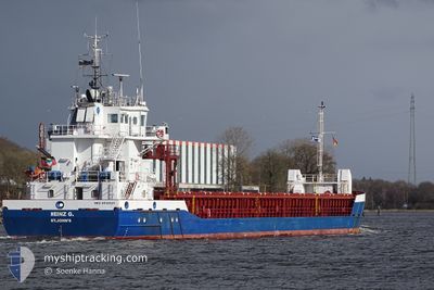
HEINZ G
General Cargo
Current Trip
GBBAW
| Time Travelled | 9 days |
|---|---|
| Remaining Time | --- |
| Distance Travelled | 1193.53 nm |
| Remaining Distance | --- |
| AVG Speed | 7.6 Noeuds |
| MAX Speed | 10.5 Noeuds |
| AVG Wind | 9.9 knots |
| MAX Wind | 19.7 knots |
| MIN Temp | 4°C / 39.2°F |
| MAX Temp | 19.9°C / 67.82°F |
| Tirant d eau | 5.5 m |
| Position reçue | Maintenant |
Current Position
| Longitude | 9.32909° |
|---|---|
| Latitude | 54.09974° |
| Etat | Under way using engine |
| Vitesse | 6.8 Noeuds |
| Parcours | 190.5° |
| Zone | Baltic Sea |
| Station | T-AIS |
| Position reçue | Maintenant |
Info
Information
The current position of HEINZ G is in Baltic Sea with coordinates 54.09974° / 9.32909° as reported on 2024-05-06 01:40 by AIS to our vessel tracker app. The vessel's current speed is 6.8 Noeuds
The vessel HEINZ G (IMO: 9536521, MMSI: 305612000) is a General Cargo that was built in 2010 ( 14 Age ). It's sailing under the flag of [AG] Antigua Barbuda.
In this page you can find informations about the vessels current position, last detected port calls, and current voyage information. If the vessels is not in coverage by AIS you will find the latest position.
The current position of HEINZ G is detected by our AIS receivers and we are not responsible for the reliability of the data. The last position was recorded while the vessel was in Coverage by the Ais receivers of our vessel tracking app.
The current draught of HEINZ G as reported by AIS is 5.5 meters
Weather
| Temperature | 8.9°C / 48.02°F |
|---|---|
| Wind Speed | 8 knots |
| Direction | 302° WNW |
| Pressure | 1007.7 hPa |
| Humidity | 79.7 % |
| Cloud Coverage | 44 % |
Featured Company
Most Visited Ports (Last year)
| Port | Arrivals | |
|---|---|---|
| 6 | ||
| 5 | ||
| 5 | ||
| 4 | ||
| 3 | ||
| 3 |
Last Trips
| Origin | Departure | Destination | Arrival | Distance | |
|---|---|---|---|---|---|
| 2024-02-29 16:23 | 2024-03-03 23:46 | 655.83 nm |
Events
| Heure | Evenement | Détails | Position/ Destination | Info |
|---|---|---|---|---|
| 2024-05-06 01:35 | Etat Changé | Under way using engine Default |
54.10954 / 9.32919
GBBAW
|
Vitesse: 6.7 kn Parcours: 176° |
| 2024-05-06 01:32 | Etat Changé | Default Under way using engine |
54.11507 / 9.32805
GBBAW
|
Vitesse: 6.7 kn Parcours: 188.5° |
| 2024-05-05 21:18 | Démarrage | 5.9 nm, East of BORGSTEDT |
54.35750 / 9.87932
GBBAW
|
Vitesse: 3.1 kn Parcours: 290° |
| 2024-05-05 21:07 | Arret | 5.99 nm, East of BORGSTEDT |
54.35670 / 9.88223
GBBAW
|
Vitesse: 0.3 kn Parcours: 298° |
| 2024-05-05 19:34 | Démarrage | 1.45 nm, South West of STICKENHΟRN SPORT |
54.36605 / 10.13837
GBBAW
|
Vitesse: 3.5 kn Parcours: 282° |
| 2024-05-05 18:57 | Arret | 1.38 nm, South West of STICKENHΟRN SPORT |
54.36576 / 10.14167
GBBAW
|
Vitesse: 0.3 kn Parcours: 284° |
| 2024-05-05 15:56 | Changement de zone | German part of the Baltic Sea Danish part of the Baltic Sea |
54.56611 / 10.55992
Baltic Sea
GBBAW
|
Vitesse: 6.6 kn Parcours: 248.2° |
| 2024-05-05 14:38 | Detecté en mer | Danish part of the Baltic Sea |
54.58619 / 10.80369
Baltic Sea
GBBAW
|
Vitesse: 7 kn Parcours: 265.9° |
| 2024-05-05 12:11 | Detecté en mer | German part of the Baltic Sea |
54.56651 / 11.32697
Baltic Sea
GBBAW
|
Vitesse: 7.3 kn Parcours: 295.8° |
| 2024-05-05 06:19 | Detecté en mer | Danish part of the Baltic Sea |
54.68482 / 12.43860
Baltic Sea
GBBAW
|
Vitesse: 8.5 kn Parcours: 236.2° |