
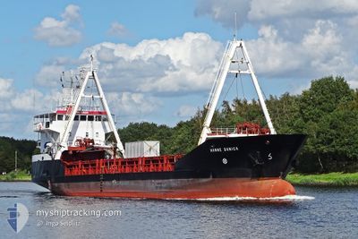
HANNE DANICA
General Cargo
Current Trip
| Time Travelled | 6 h, 58 mins |
|---|---|
| Remaining Time | 6 days |
| Distance Travelled | 62.07 nm |
| Remaining Distance | 1397.99 nm |
| AVG Speed | 9 Knopen |
| MAX Speed | 11.2 Knopen |
| AVG Wind | 17.5 knots |
| MAX Wind | 19 knots |
| MIN Temp | 22.4°C / 72.32°F |
| MAX Temp | 24°C / 75.2°F |
| Diepgang | 3.4 M |
| Positie ontvangen | 2024-03-17 13:59 |
Current Position
| Lengtegraad | -17.59879° |
|---|---|
| Breedtegraat | 22.34722° |
| Status | Under way using engine |
| Snelheid | 10.8 Knopen |
| Koers | 196.7° |
| Gebied | North Atlantic Ocean |
| Station | T-AIS |
| Positie ontvangen | 2024-03-17 13:59 |
Info
Information
The current position of HANNE DANICA is in North Atlantic Ocean with coordinates 22.34722° / -17.59879° as reported on 2024-03-17 13:59 by AIS to our vessel tracker app. The vessel's current speed is 10.8 Knopen and is heading at the port of TAKORADI. The estimated time of arrival as calculated by MyShipTracking vessel tracking app is 2024-05-04 00:00 LT
The vessel HANNE DANICA (IMO: 9006239, MMSI: 219363000) is a General Cargo that was built in 1992 ( 32 Jaar oud ). It's sailing under the flag of [DK] Denmark.
In this page you can find informations about the vessels current position, last detected port calls, and current voyage information. If the vessels is not in coverage by AIS you will find the latest position.
The current position of HANNE DANICA is detected by our AIS receivers and we are not responsible for the reliability of the data. The last position was recorded while the vessel was in Coverage by the Ais receivers of our vessel tracking app.
The current draught of HANNE DANICA as reported by AIS is 3.4 meters
Weather
| Temperature | 22.4°C / 72.32°F |
|---|---|
| Wind Speed | 18 knots |
| Direction | 358° N |
| Pressure | 1007.3 hPa |
| Humidity | 87.6 % |
| Cloud Coverage | 74 % |
Featured Company
Most Visited Ports (Last year)
| Port | Arrivals | |
|---|---|---|
| 2 | ||
| 2 | ||
| 2 | ||
| 2 | ||
| 2 | ||
| 1 |
Last Trips
| Origin | Departure | Destination | Arrival | Distance | |
|---|---|---|---|---|---|
| 2024-04-19 21:25 | 2024-04-26 17:02 | 1344.89 nm | |||
| 2024-03-05 21:57 | 2024-04-19 11:47 | 3706.20 nm | |||
| 2024-02-20 20:48 | 2024-02-28 18:57 | 1167.76 nm | |||
| 2024-02-16 13:41 | 2024-02-16 13:57 | 1.06 nm | |||
| 2024-01-17 00:46 | 2024-02-02 08:59 | 3697.78 nm |
Events
| Tijd | Evenement | Details | Positie / Bestemming | Info |
|---|---|---|---|---|
| 2024-04-26 21:18 | Vertrekhaven |
|
14.67760 / -17.41669
GH TKD
|
Snelheid: 4.6 kn Koers: 90° |
| 2024-04-26 21:10 | Start beweging |
14.68154 / -17.42652
[SN] DAKAR
|
Snelheid: 5.6 kn Koers: 153° |
|
| 2024-04-26 17:06 | Stop beweging |
14.68409 / -17.42602
[SN] DAKAR
|
Snelheid: Koers: -1° |
|
| 2024-04-26 17:02 | Aankomsthaven |
|
14.68417 / -17.42602
[SN] DAKAR
|
Snelheid: 4 kn Koers: -1° |
| 2024-04-26 14:34 | Start beweging | 3.71 nm, East of GOREE |
14.64845 / -17.33795
GH TKD
|
Snelheid: 5.2 kn Koers: 330° |
| 2024-04-25 14:02 | Stop beweging | 4.01 nm, South East of GOREE |
14.64285 / -17.33472
GH TKD
|
Snelheid: 0.1 kn Koers: -1° |
| 2024-04-19 21:25 | Vertrekhaven |
|
4.89954 / -1.73180
GH TKD
|
Snelheid: 5 kn Koers: -1° |
| 2024-04-19 21:16 | Start beweging |
4.88667 / -1.73333
[GH] TAKORADI
|
Snelheid: 4 kn Koers: -1° |
|
| 2024-04-19 11:47 | Aankomsthaven |
|
4.89736 / -1.73265
[GH] TAKORADI
|
Snelheid: 3.9 kn Koers: -1° |
| 2024-04-18 15:21 | Stop beweging | 2.22 nm, East of TAKORADI |
4.89391 / -1.69828
GH TKD
|
Snelheid: 0.1 kn Koers: 201° |