

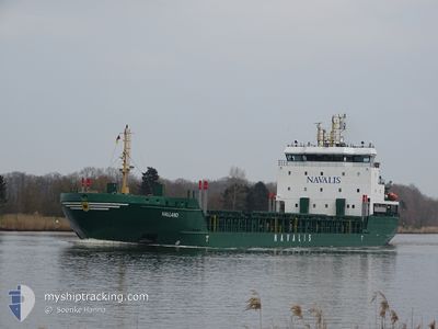
HALLAND
General Cargo

Current Trip
VENTSPILS
| Time Travelled | 2 h, 17 mins |
|---|---|
| Remaining Time | --- |
| Distance Travelled | 19.99 nm |
| Remaining Distance | --- |
| AVG Speed | 9.7 Knopen |
| MAX Speed | 9.8 Knopen |
| AVG Wind | 19.1 knots |
| MAX Wind | 21.5 knots |
| MIN Temp | 4.2°C / 39.56°F |
| MAX Temp | 4.3°C / 39.74°F |
| Diepgang | 4.6 M |
| Positie ontvangen | 1 d geleden |
Current Position
| Lengtegraad | --- |
|---|---|
| Breedtegraat | --- |
| Status | Under way using engine |
| Snelheid | 10.3 Knopen |
| Koers | 167.9° |
| Gebied | Baltic Sea |
| Station | T-AIS |
| Positie ontvangen | 1 d geleden |
Information
The current position of HALLAND is in Baltic Sea with coordinates 59.40789° / 20.13274° as reported on 2025-03-26 06:35 by AIS to our vessel tracker app. The vessel's current speed is 10.3 Knopen
The vessel HALLAND (IMO: 9436238, MMSI: 212536000) is a General Cargo that was built in 2008 ( 17 Jaar oud ). It's sailing under the flag of [CY] Cyprus.
In this page you can find informations about the vessels current position, last detected port calls, and current voyage information. If the vessels is not in coverage by AIS you will find the latest position.
The current position of HALLAND is detected by our AIS receivers and we are not responsible for the reliability of the data. The last position was recorded while the vessel was in Coverage by the Ais receivers of our vessel tracking app.
The current draught of HALLAND as reported by AIS is 4.6 meters
Weather
| Temperature | 4.2°C / 39.56°F |
|---|---|
| Wind Speed | 21 knots |
| Direction | 208° SSW |
| Pressure | 1014.2 hPa |
| Humidity | 86.6 % |
| Cloud Coverage | 100 % |


Featured Company
Last Port Calls
| Port | Arrival | Departure | Time In Port |
|---|---|---|---|
| 2025-03-26 22:21 | 2025-03-27 14:34 | 16 h | |
| 2025-03-23 11:30 | 2025-03-24 15:22 | 1 d | |
| 2025-03-19 15:18 | 2025-03-20 23:26 | 1 d | |
| 2025-03-13 17:02 | 2025-03-15 08:35 | 1 d | |
| 2025-03-09 15:10 | 2025-03-11 18:47 | 2 d | |
| 2025-03-04 02:13 | 2025-03-06 13:09 | 2 d | |
| 2025-03-01 18:05 | 2025-03-02 11:21 | 17 h | |
| 2025-02-27 17:28 | 2025-02-28 12:11 | 18 h | |
| 2025-02-25 19:49 | 2025-02-26 14:25 | 18 h | |
| 2025-02-23 17:43 | 2025-02-24 22:51 | 1 d |
Last Trips
| Origin | Departure | Destination | Arrival | Distance | |
|---|---|---|---|---|---|
| 2025-03-24 15:22 | 2025-03-26 22:21 | 507.46 nm | |||
| 2025-03-20 23:26 | 2025-03-23 11:30 | 577.12 nm | |||
| 2025-03-15 08:35 | 2025-03-19 15:18 | 681.56 nm | |||
| 2025-03-11 18:47 | 2025-03-13 17:02 | 386.12 nm | |||
| 2025-03-06 13:09 | 2025-03-09 15:10 | 725.81 nm | |||
| 2025-03-02 11:21 | 2025-03-04 02:13 | 376.80 nm | |||
| 2025-02-28 12:11 | 2025-03-01 18:05 | 284.97 nm | |||
| 2025-02-26 14:25 | 2025-02-27 17:28 | 283.97 nm | |||
| 2025-02-24 22:51 | 2025-02-25 19:49 | 193.10 nm | |||
| 2025-02-21 01:05 | 2025-02-23 17:43 | 304.14 nm |
Events
| Tijd | Evenement | Details | Positie / Bestemming | Info |
|---|---|---|---|---|
| 2025-03-27 12:34 | Vertrekhaven |
|
57.41533 / 21.51432
VENTSPILS
|
Snelheid: 8.8 kn Koers: 323° |
| 2025-03-27 12:02 | Start beweging |
57.39290 / 21.58418
[LV] VENTSPILS
|
Snelheid: 5 kn Koers: 345° |
|
| 2025-03-26 21:06 | Stop beweging |
57.38749 / 21.59094
[LV] VENTSPILS
|
Snelheid: 0.2 kn Koers: 60° |
|
| 2025-03-26 20:21 | Aankomsthaven |
|
57.40532 / 21.52741
[LV] VENTSPILS
|
Snelheid: 7.4 kn Koers: 144° |
| 2025-03-26 06:42 | Status Changed | Default Under way using engine |
59.39075 / 20.14410
VENTSPILS
|
Snelheid: 10.3 kn Koers: 167.9° |
| 2025-03-26 06:35 | Buitenbereik |
59.40789 / 20.13274
Baltic Sea
VENTSPILS
|
Snelheid: 10.3 kn Koers: 167.9° |
|
| 2025-03-26 06:32 | Draught Changed | 4.6 4.5 |
59.41724 / 20.12894
VENTSPILS
|
Snelheid: 10.3 kn Koers: 168.6° |
| 2025-03-26 06:32 | ETA Changed | 2025/03/26 18:30 2025/03/26 19:30 |
59.41724 / 20.12894
VENTSPILS
|
Snelheid: 10.3 kn Koers: 168.6° |
| 2025-03-26 06:21 | Status Changed | Under way using engine Default |
59.44952 / 20.11468
VENTSPILS
|
Snelheid: 10.5 kn Koers: 159° |
| 2025-03-26 06:10 | Status Changed | Default Under way using engine |
59.48009 / 20.09319
VENTSPILS
|
Snelheid: 10.6 kn Koers: 162.5° |