
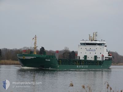
HALLAND
General Cargo
Current Trip
| Time Travelled | 2 days |
|---|---|
| Remaining Time | 8 h, 53 mins |
| Distance Travelled | 364.88 nm |
| Remaining Distance | 86.06 nm |
| AVG Speed | 9.7 Knots |
| MAX Speed | 11.2 Knots |
| AVG Wind | 8 knots |
| MAX Wind | 18.3 knots |
| MIN Temp | 5.6°C / 42.08°F |
| MAX Temp | 11.2°C / 52.16°F |
| Dybgang | 4.5 m |
| Position Modtaget | 2 d siden |
Current Position
| Longitude | 18.20118° |
|---|---|
| Latitude | 58.48399° |
| Status | Under way using engine |
| Fart | 10.2 Knots |
| Kurs | 109° |
| Område | Baltic Sea |
| Station | T-AIS |
| Position Modtaget | 2 d siden |
Info
Information
The current position of HALLAND is in Baltic Sea with coordinates 58.48399° / 18.20118° as reported on 2024-05-09 12:26 by AIS to our vessel tracker app. The vessel's current speed is 10.2 Knots and is heading at the port of RIGA. The estimated time of arrival as calculated by MyShipTracking vessel tracking app is 2024-05-12 08:34 LT
The vessel HALLAND (IMO: 9436238, MMSI: 212536000) is a General Cargo that was built in 2008 ( 16 år gamle ). It's sailing under the flag of [CY] Cyprus.
In this page you can find informations about the vessels current position, last detected port calls, and current voyage information. If the vessels is not in coverage by AIS you will find the latest position.
The current position of HALLAND is detected by our AIS receivers and we are not responsible for the reliability of the data. The last position was recorded while the vessel was in Coverage by the Ais receivers of our vessel tracking app.
The current draught of HALLAND as reported by AIS is 4.5 meters
Weather
| Temperature | 7°C / 44.6°F |
|---|---|
| Wind Speed | 7 knots |
| Direction | 315° NW |
| Pressure | 1025.3 hPa |
| Humidity | 71.3 % |
| Cloud Coverage | 20 % |
Featured Company
Last Port Calls
| Port | Arrival | Departure | Time In Port |
|---|---|---|---|
| 2024-05-08 02:55 | 2024-05-09 06:16 | 1 d | |
| 2024-05-05 05:24 | 2024-05-06 17:15 | 1 d | |
| 2024-04-27 12:52 | 2024-04-29 20:00 | 2 d | |
| 2024-04-25 14:20 | 2024-04-27 01:56 | 1 d | |
| 2024-04-16 09:27 | 2024-04-17 05:31 | 20 h | |
| 2024-04-14 21:54 | 2024-04-15 17:51 | 19 h | |
| 2024-04-07 12:29 | 2024-04-09 14:23 | 2 d | |
| 2024-03-29 14:45 | 2024-04-04 09:53 | 5 d | |
| 2024-03-26 19:11 | 2024-03-27 15:14 | 20 h | |
| 2024-03-22 17:21 | 2024-03-24 14:13 | 1 d |
Last Trips
| Origin | Departure | Destination | Arrival | Distance | |
|---|---|---|---|---|---|
| 2024-05-06 20:15 | 2024-05-08 04:55 | 332.84 nm | |||
| 2024-04-29 22:00 | 2024-05-05 08:24 | 695.79 nm | |||
| 2024-04-27 04:56 | 2024-04-27 14:52 | 110.83 nm | |||
| 2024-04-17 07:31 | 2024-04-25 17:20 | 1352.24 nm | |||
| 2024-04-15 19:51 | 2024-04-16 11:27 | 153.08 nm | |||
| 2024-04-09 16:23 | 2024-04-14 23:54 | 969.30 nm | |||
| 2024-04-04 11:53 | 2024-04-07 14:29 | 715.44 nm | |||
| 2024-03-27 17:14 | 2024-03-29 15:45 | 412.27 nm | |||
| 2024-03-24 15:13 | 2024-03-26 21:11 | 552.81 nm | |||
| 2024-03-18 21:27 | 2024-03-22 18:21 | 585.48 nm |
Events
| Tid | Hændelsen | Detaljer | Position / Dest | Info |
|---|---|---|---|---|
| 2024-05-11 14:16 | START Sejllads | 4.63 nm, North of RIGA |
57.02507 / 24.10751
RIGA
|
Fart: 5.6 kn Kurs: 292° |
| 2024-05-10 12:53 | STOP Sejllads | 4.55 nm, North of RIGA |
57.02280 / 24.11987
RIGA
|
Fart: Kurs: 56° |
| 2024-05-10 11:41 | START Sejllads | 10.59 nm, North West of RIGA |
57.09449 / 23.91676
RIGA
|
Fart: 9 kn Kurs: 90° |
| 2024-05-10 09:31 | STOP Sejllads | 10.94 nm, North West of RIGA |
57.09384 / 23.89659
RIGA
|
Fart: 0.2 kn Kurs: 332° |
| 2024-05-09 12:32 | Status er ændret | Default Under way using engine |
58.47789 / 18.23438
RIGA
|
Fart: 10.2 kn Kurs: 109° |
| 2024-05-09 12:26 | Udenfor Dækning |
58.48399 / 18.20118
Baltic Sea
RIGA
|
Fart: 10.2 kn Kurs: 109° |
|
| 2024-05-09 11:10 | ETA er ændret | 2024/05/10 09:00 2024/05/10 10:00 |
58.55465 / 17.80138
RIGA
|
Fart: 10.2 kn Kurs: 109.9° |
| 2024-05-09 06:16 | START Sejllads |
58.62072 / 16.25854
[SE] NORRKOPING
|
Fart: 4.6 kn Kurs: 89° |
|
| 2024-05-09 06:16 | Afsejlet fra sidste havn |
|
58.62070 / 16.25883
RIGA
|
Fart: 4.6 kn Kurs: 89° |
| 2024-05-09 06:13 | STOP Sejllads |
58.62085 / 16.25496
[SE] NORRKOPING
|
Fart: 0.3 kn Kurs: 34° |