
GUNERLER
General Cargo
Current Trip
| Time Travelled | 2 days |
|---|---|
| Remaining Time | --- |
| Distance Travelled | 19.19 nm |
| Remaining Distance | --- |
| AVG Speed | 9.3 Knopen |
| MAX Speed | 11.1 Knopen |
| AVG Wind | 11.6 knots |
| MAX Wind | 20 knots |
| MIN Temp | 7.8°C / 46.04°F |
| MAX Temp | 12.1°C / 53.78°F |
| Diepgang | 3.9 M |
| Positie ontvangen | 2 d geleden |
Current Position
| Lengtegraad | -8.26611° |
|---|---|
| Breedtegraat | 43.40044° |
| Status | Under way using engine |
| Snelheid | 4.5 Knopen |
| Koers | 118° |
| Gebied | North Atlantic Ocean |
| Station | T-AIS |
| Positie ontvangen | 2 d geleden |
Info
Information
The current position of GUNERLER is in North Atlantic Ocean with coordinates 43.40044° / -8.26611° as reported on 2024-04-30 19:44 by AIS to our vessel tracker app. The vessel's current speed is 4.5 Knopen
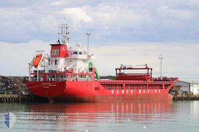
The vessel GUNERLER (IMO: 9598684, MMSI: 314686000) is a General Cargo that was built in 2011 ( 13 Jaar oud ). It's sailing under the flag of [BB] Barbados.
In this page you can find informations about the vessels current position, last detected port calls, and current voyage information. If the vessels is not in coverage by AIS you will find the latest position.
The current position of GUNERLER is detected by our AIS receivers and we are not responsible for the reliability of the data. The last position was recorded while the vessel was in Coverage by the Ais receivers of our vessel tracking app.
The current draught of GUNERLER as reported by AIS is 3.9 meters
Weather
| Temperature | 11.8°C / 53.24°F |
|---|---|
| Wind Speed | 9 knots |
| Direction | 185° S |
| Pressure | 1014.5 hPa |
| Humidity | 90.5 % |
| Cloud Coverage | 100 % |
Featured Company
Last Port Calls
| Port | Arrival | Departure | Time In Port |
|---|---|---|---|
| 2024-04-27 10:32 | 2024-04-30 18:04 | 3 d | |
| 2024-04-10 13:54 | 2024-04-13 20:02 | 3 d | |
| 2024-04-08 07:04 | 2024-04-08 17:52 | 10 h | |
| 2024-04-03 10:27 | 2024-04-04 14:44 | 1 d | |
| 2024-04-02 09:42 | 2024-04-03 03:37 | 17 h | |
| 2024-04-01 06:36 | 2024-04-01 23:13 | 16 h | |
| 2024-03-27 20:53 | 2024-03-28 18:55 | 22 h | |
| 2024-03-16 07:32 | 2024-03-16 12:19 | 4 h | |
| 2024-03-12 20:19 |
Most Visited Ports (Last year)
| Port | Arrivals | |
|---|---|---|
| 3 | ||
| 3 | ||
| 2 | ||
| 2 | ||
| 2 | ||
| 1 |
Last Trips
| Origin | Departure | Destination | Arrival | Distance | |
|---|---|---|---|---|---|
| 2024-04-13 23:02 | 2024-04-27 12:32 | 2644.64 nm | |||
| 2024-04-08 20:52 | 2024-04-10 16:54 | 207.67 nm | |||
| 2024-04-04 17:44 | 2024-04-08 10:04 | 164.06 nm | |||
| 2024-04-03 06:37 | 2024-04-03 13:27 | 60.52 nm | |||
| 2024-04-02 02:13 | 2024-04-02 12:42 | 45.20 nm | |||
| 2024-03-28 21:55 | 2024-04-01 09:36 | 839.44 nm | |||
| 2024-03-16 13:19 | 2024-03-27 23:53 | 2055.88 nm | |||
| 2024-03-12 21:19 | 2024-03-16 08:32 | 798.46 nm |
Events
| Tijd | Evenement | Details | Positie / Bestemming | Info |
|---|---|---|---|---|
| 2024-04-30 20:21 | Stop beweging | 2.04 nm, South of ARES |
43.38952 / -8.25286
ESBIO
|
Snelheid: 0.1 kn Koers: 263° |
| 2024-04-30 19:50 | Status Changed | Default Under way using engine |
43.39750 / -8.25853
ESBIO
|
Snelheid: 4.5 kn Koers: 118° |
| 2024-04-30 19:44 | Status Changed | Under way using engine Default |
43.40044 / -8.26611
ESBIO
|
Snelheid: 4.9 kn Koers: 118° |
| 2024-04-30 19:44 | Buitenbereik |
43.40044 / -8.26611
North Atlantic Ocean
ESBIO
|
Snelheid: 4.5 kn Koers: 118° |
|
| 2024-04-30 19:34 | Status Changed | Default Under way using engine |
43.40790 / -8.28432
ESBIO
|
Snelheid: 10.9 kn Koers: 115.8° |
| 2024-04-30 18:26 | Status Changed | Under way using engine Moored |
43.36597 / -8.52434
ESBIO
|
Snelheid: 10 kn Koers: 51.8° |
| 2024-04-30 18:04 | Vertrekhaven |
|
43.33966 / -8.52801
ESBIO
|
Snelheid: 6.8 kn Koers: 256° |
| 2024-04-30 17:56 | Start beweging |
43.35083 / -8.51434
[ES] PUNTA LANGOSTEIRA
|
Snelheid: 3.8 kn Koers: 208° |
|
| 2024-04-30 17:55 | Status Changed | Moored Default |
43.35178 / -8.51373
[ES] PUNTA LANGOSTEIRA
|
Snelheid: 0.7 kn Koers: 285° |
| 2024-04-30 17:52 | Status Changed | Default Moored |
43.35151 / -8.51103
[ES] PUNTA LANGOSTEIRA
|
Snelheid: 0.6 kn Koers: 294° |