
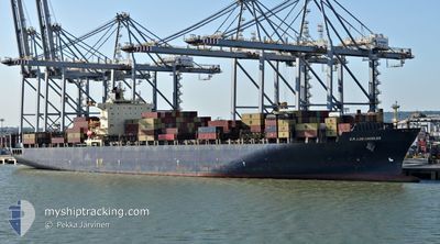
GSL TEGEA
Container Ship
Current Trip
| Time Travelled | 21 days |
|---|---|
| Remaining Time | 12 h, 52 mins |
| Distance Travelled | 8593.63 nm |
| Remaining Distance | 167.32 nm |
| AVG Speed | 16.7 Knopen |
| MAX Speed | 21.7 Knopen |
| AVG Wind | 11.8 knots |
| MAX Wind | 33.9 knots |
| MIN Temp | -0.6°C / 30.92°F |
| MAX Temp | 31.2°C / 88.16°F |
| Diepgang | 12.2 M |
| Positie ontvangen | 20 h, 45 m geleden |
Current Position
| Lengtegraad | 128.06243° |
|---|---|
| Breedtegraat | 32.92655° |
| Status | Under way using engine |
| Snelheid | 13.5 Knopen |
| Koers | 223.2° |
| Gebied | Japan Sea |
| Station | T-AIS |
| Positie ontvangen | 20 h, 45 m geleden |
Info
Information
The current position of GSL TEGEA is in Japan Sea with coordinates 32.92655° / 128.06243° as reported on 2024-04-27 06:53 by AIS to our vessel tracker app. The vessel's current speed is 13.5 Knopen and is heading at the port of NINGBO. The estimated time of arrival as calculated by MyShipTracking vessel tracking app is 2024-04-28 16:31 LT
The vessel GSL TEGEA (IMO: 9222986, MMSI: 636020770) is a Container Ship that was built in 2001 ( 23 Jaar oud ). It's sailing under the flag of [LR] Liberia.
In this page you can find informations about the vessels current position, last detected port calls, and current voyage information. If the vessels is not in coverage by AIS you will find the latest position.
The current position of GSL TEGEA is detected by our AIS receivers and we are not responsible for the reliability of the data. The last position was recorded while the vessel was in Coverage by the Ais receivers of our vessel tracking app.
The current draught of GSL TEGEA as reported by AIS is 12.2 meters
Weather
| Temperature | 17.6°C / 63.68°F |
|---|---|
| Wind Speed | 11 knots |
| Direction | 134° SE |
| Pressure | 1011.6 hPa |
| Humidity | 98.2 % |
| Cloud Coverage | 100 % |
Featured Company
Last Port Calls
| Port | Arrival | Departure | Time In Port |
|---|---|---|---|
| 2024-04-06 16:57 | 2024-04-06 17:09 | 12 m | |
| 2024-04-05 15:11 | 2024-04-06 16:56 | 1 d | |
| 2024-03-30 09:27 | 2024-03-31 01:47 | 16 h | |
| 2024-03-28 15:39 | 2024-03-29 15:35 | 23 h | |
| 2024-03-25 12:21 | 2024-03-26 15:14 | 1 d | |
| 2024-03-20 19:15 | 2024-03-22 00:13 | 1 d | |
| 2024-03-16 09:02 | 2024-03-17 00:41 | 15 h | |
| 2024-02-18 05:21 | 2024-02-19 08:01 | 1 d |
Most Visited Ports (Last year)
| Port | Arrivals | |
|---|---|---|
| 7 | ||
| 5 | ||
| 5 | ||
| 5 | ||
| 5 | ||
| 5 |
Last Trips
| Origin | Departure | Destination | Arrival | Distance | |
|---|---|---|---|---|---|
| 2024-04-06 11:56 | 2024-04-06 11:57 | 0.01 nm | |||
| 2024-03-30 21:47 | 2024-04-05 10:11 | 1309.04 nm | |||
| 2024-03-29 11:35 | 2024-03-30 05:27 | 100.34 nm | |||
| 2024-03-26 10:14 | 2024-03-28 11:39 | 763.69 nm | |||
| 2024-03-21 19:13 | 2024-03-25 07:21 | 456.03 nm | |||
| 2024-03-16 19:41 | 2024-03-20 14:15 | 562.87 nm | |||
| 2024-02-19 17:01 | 2024-03-16 04:02 | 9709.26 nm | |||
| 2024-01-20 13:15 | 2024-02-18 14:21 | 9721.92 nm |
Events
| Tijd | Evenement | Details | Positie / Bestemming | Info |
|---|---|---|---|---|
| 2024-04-27 06:58 | Status Changed | Default Under way using engine |
32.91498 / 128.04880
CNNPO
|
Snelheid: 13.5 kn Koers: 223.2° |
| 2024-04-27 06:53 | Wijzig zee gebeid | Joint Japan - Korea part of the Japan Sea Japanese part of the Japan Sea |
32.92655 / 128.06243
Japan Sea
CNNPO
|
Snelheid: 13.5 kn Koers: 223.2° |
| 2024-04-27 06:53 | Status Changed | Under way using engine Default |
32.92655 / 128.06243
CNNPO
|
Snelheid: 13.6 kn Koers: 224° |
| 2024-04-27 06:53 | Buitenbereik |
32.92655 / 128.06243
Japan Sea
CNNPO
|
Snelheid: 13.5 kn Koers: 223.2° |
|
| 2024-04-27 06:33 | Status Changed | Default Under way using engine |
32.98210 / 128.12566
CNNPO
|
Snelheid: 13.6 kn Koers: 226.5° |
| 2024-04-27 06:31 | Status Changed | Under way using engine Default |
32.98732 / 128.13217
CNNPO
|
Snelheid: 13.5 kn Koers: 226° |
| 2024-04-27 06:28 | Status Changed | Default Under way using engine |
32.99380 / 128.14023
CNNPO
|
Snelheid: 13.5 kn Koers: 226.1° |
| 2024-04-27 06:05 | Status Changed | Under way using engine Default |
33.05573 / 128.21537
CNNPO
|
Snelheid: 13.4 kn Koers: 226° |
| 2024-04-27 05:44 | Status Changed | Default Under way using engine |
33.10700 / 128.28047
CNNPO
|
Snelheid: 13.3 kn Koers: 227.8° |
| 2024-04-27 05:25 | Draught Changed | 12.2 12 |
33.16000 / 128.34950
CNNPO
|
Snelheid: 13.1 kn Koers: 227.6° |