
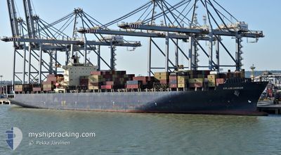
GSL TEGEA
Container Ship
Current Trip
| Time Travelled | 4 days |
|---|---|
| Remaining Time | --- |
| Distance Travelled | 1957.84 nm |
| Remaining Distance | --- |
| AVG Speed | 16.6 Knots |
| MAX Speed | 20.4 Knots |
| AVG Wind | 12.9 knots |
| MAX Wind | 24 knots |
| MIN Temp | 1.3°C / 34.34°F |
| MAX Temp | 16.4°C / 61.52°F |
| Dybgang | 13.2 m |
| Position Modtaget | 2 d siden |
Current Position
| Longitude | 142.18918° |
|---|---|
| Latitude | 41.62745° |
| Status | Under way using engine |
| Fart | 17 Knots |
| Kurs | 91° |
| Område | North Pacific Ocean |
| Station | T-AIS |
| Position Modtaget | 2 d siden |
Info
Information
The current position of GSL TEGEA is in North Pacific Ocean with coordinates 41.62745° / 142.18918° as reported on 2024-05-09 03:35 by AIS to our vessel tracker app. The vessel's current speed is 17 Knots and is heading at the port of PANAMA CITY. The estimated time of arrival as calculated by MyShipTracking vessel tracking app is 2024-05-28 03:00 LT
The vessel GSL TEGEA (IMO: 9222986, MMSI: 636020770) is a Container Ship that was built in 2001 ( 23 år gamle ). It's sailing under the flag of [LR] Liberia.
In this page you can find informations about the vessels current position, last detected port calls, and current voyage information. If the vessels is not in coverage by AIS you will find the latest position.
The current position of GSL TEGEA is detected by our AIS receivers and we are not responsible for the reliability of the data. The last position was recorded while the vessel was in Coverage by the Ais receivers of our vessel tracking app.
The current draught of GSL TEGEA as reported by AIS is 13.2 meters
Weather
| Temperature | 3.5°C / 38.3°F |
|---|---|
| Wind Speed | 17 knots |
| Direction | 344° NNW |
| Pressure | 1018.6 hPa |
| Humidity | 82 % |
| Cloud Coverage | 100 % |
Featured Company
Last Port Calls
| Port | Arrival | Departure | Time In Port |
|---|---|---|---|
| 2024-05-05 23:40 | 2024-05-07 04:42 | 1 d | |
| 2024-04-06 16:57 | 2024-04-06 17:09 | 12 m | |
| 2024-04-05 15:11 | 2024-04-06 16:56 | 1 d | |
| 2024-03-30 09:27 | 2024-03-31 01:47 | 16 h | |
| 2024-03-28 15:39 | 2024-03-29 15:35 | 23 h | |
| 2024-03-25 12:21 | 2024-03-26 15:14 | 1 d | |
| 2024-03-20 19:15 | 2024-03-22 00:13 | 1 d | |
| 2024-03-16 09:02 | 2024-03-17 00:41 | 15 h |
Most Visited Ports (Last year)
| Port | Arrivals | |
|---|---|---|
| 8 | ||
| 5 | ||
| 5 | ||
| 5 | ||
| 4 | ||
| 4 |
Last Trips
| Origin | Departure | Destination | Arrival | Distance | |
|---|---|---|---|---|---|
| 2024-04-06 12:09 | 2024-05-06 08:40 | 9481.08 nm | |||
| 2024-04-06 11:56 | 2024-04-06 11:57 | 0.01 nm | |||
| 2024-03-30 21:47 | 2024-04-05 10:11 | 1309.04 nm | |||
| 2024-03-29 11:35 | 2024-03-30 05:27 | 100.34 nm | |||
| 2024-03-26 10:14 | 2024-03-28 11:39 | 763.69 nm | |||
| 2024-03-21 19:13 | 2024-03-25 07:21 | 456.03 nm | |||
| 2024-03-16 19:41 | 2024-03-20 14:15 | 562.87 nm | |||
| 2024-02-19 17:01 | 2024-03-16 04:02 | 9709.26 nm |
Events
| Tid | Hændelsen | Detaljer | Position / Dest | Info |
|---|---|---|---|---|
| 2024-05-09 03:38 | Status er ændret | Default Under way using engine |
41.62712 / 142.20857
PAPTY
|
Fart: 17 kn Kurs: 91° |
| 2024-05-09 03:35 | Udenfor Dækning |
41.62745 / 142.18918
North Pacific Ocean
PAPTY
|
Fart: 17 kn Kurs: 91° |
|
| 2024-05-09 03:26 | Status er ændret | Under way using engine Default |
41.62697 / 142.13500
PAPTY
|
Fart: 17.1 kn Kurs: 89° |
| 2024-05-09 03:20 | Status er ændret | Default Under way using engine |
41.62667 / 142.09718
PAPTY
|
Fart: 17.2 kn Kurs: 89.5° |
| 2024-05-09 01:23 | Ændre havområde | Japanese part of the North Pacific Ocean Japanese part of the Japan Sea |
41.62968 / 141.29788
North Pacific Ocean
PAPTY
|
Fart: 18.1 kn Kurs: 94.2° |
| 2024-05-09 00:16 | Status er ændret | Under way using engine Default |
41.60232 / 140.83753
PAPTY
|
Fart: 19.1 kn Kurs: 51° |
| 2024-05-09 00:08 | Status er ændret | Default Under way using engine |
41.57812 / 140.79634
PAPTY
|
Fart: 19.5 kn Kurs: 54.5° |
| 2024-05-08 22:38 | Status er ændret | Under way using engine Default |
41.31193 / 140.24575
PAPTY
|
Fart: 18.7 kn Kurs: 47° |
| 2024-05-08 22:36 | Status er ændret | Default Under way using engine |
41.30608 / 140.23712
PAPTY
|
Fart: 18.3 kn Kurs: 50.4° |
| 2024-05-08 22:29 | Status er ændret | Under way using engine Default |
41.28257 / 140.20123
PAPTY
|
Fart: 18.6 kn Kurs: 64° |