
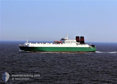
GREENLAND
Ro-Ro Cargo
Current Trip
| Time Travelled | 14 days |
|---|---|
| Remaining Time | 8 h, 26 mins |
| Distance Travelled | 2754.87 nm |
| Remaining Distance | 174.71 nm |
| AVG Speed | 9.8 Knopen |
| MAX Speed | 19.9 Knopen |
| AVG Wind | 12.3 knots |
| MAX Wind | 30.7 knots |
| MIN Temp | 17.5°C / 63.5°F |
| MAX Temp | 31.2°C / 88.16°F |
| Diepgang | 5.8 M |
| Positie ontvangen | 7 d geleden |
Current Position
| Lengtegraad | 39.28016° |
|---|---|
| Breedtegraat | 18.52879° |
| Status | Under way using engine |
| Snelheid | 9.7 Knopen |
| Koers | 147.9° |
| Gebied | Red Sea |
| Station | T-AIS |
| Positie ontvangen | 7 d geleden |
Info
Information
The current position of GREENLAND is in Red Sea with coordinates 18.52879° / 39.28016° as reported on 2024-04-25 03:44 by AIS to our vessel tracker app. The vessel's current speed is 9.7 Knopen and is heading at the port of FUJAIRAH. The estimated time of arrival as calculated by MyShipTracking vessel tracking app is 2024-05-03 06:03 LT
The vessel GREENLAND (IMO: 8222111, MMSI: 341139000) is a Ro-Ro Cargo that was built in 1984 ( 40 Jaar oud ). It's sailing under the flag of [KN] St Kitts Nevis.
In this page you can find informations about the vessels current position, last detected port calls, and current voyage information. If the vessels is not in coverage by AIS you will find the latest position.
The current position of GREENLAND is detected by our AIS receivers and we are not responsible for the reliability of the data. The last position was recorded while the vessel was in Coverage by the Ais receivers of our vessel tracking app.
The current draught of GREENLAND as reported by AIS is 5.8 meters
Weather
| Temperature | 26.4°C / 79.52°F |
|---|---|
| Wind Speed | 3 knots |
| Direction | 230° SW |
| Pressure | 1007.4 hPa |
| Humidity | 67.8 % |
| Cloud Coverage | 100 % |
Featured Company
Last Port Calls
| Port | Arrival | Departure | Time In Port |
|---|---|---|---|
| 2024-04-19 10:39 | 2024-04-19 12:58 | 2 h | |
| 2024-04-16 10:16 | 2024-04-18 08:39 | 1 d | |
| 2024-04-06 06:57 | 2024-04-16 10:13 | 10 d | |
| 2024-04-05 03:17 | 2024-04-05 12:01 | 8 h | |
| 2024-03-12 07:50 | 2024-03-13 11:27 | 1 d |
Most Visited Ports (Last year)
| Port | Arrivals | |
|---|---|---|
| 18 | ||
| 4 | ||
| 2 | ||
| 1 |
Last Trips
| Origin | Departure | Destination | Arrival | Distance | |
|---|---|---|---|---|---|
| 2024-04-18 10:39 | 2024-04-19 12:39 | 105.20 nm | |||
| 2024-04-16 12:13 | 2024-04-16 12:16 | 0.97 nm | |||
| 2024-03-13 14:27 | 2024-04-06 08:57 | 3633.45 nm | |||
| 2024-03-13 14:27 | 2024-04-05 05:17 | 3436.38 nm | |||
| 2024-02-28 08:44 | 2024-03-12 10:50 | 2003.78 nm |
Events
| Tijd | Evenement | Details | Positie / Bestemming | Info |
|---|---|---|---|---|
| 2024-04-25 03:51 | Status Changed | Default Under way using engine |
18.50833 / 39.29333
FUJAIRAH
|
Snelheid: 9.7 kn Koers: 147.9° |
| 2024-04-25 03:44 | Buitenbereik |
18.52879 / 39.28016
Red Sea
FUJAIRAH
|
Snelheid: 9.7 kn Koers: 147.9° |
|
| 2024-04-25 03:26 | Status Changed | Under way using engine Default |
18.59204 / 39.23949
FUJAIRAH
|
Snelheid: 9.8 kn Koers: 148° |
| 2024-04-25 02:53 | Status Changed | Default Under way using engine |
18.64167 / 39.20667
FUJAIRAH
|
Snelheid: 9.7 kn Koers: 147.6° |
| 2024-04-25 02:43 | Status Changed | Under way using engine Default |
18.66791 / 39.18870
FUJAIRAH
|
Snelheid: 9.7 kn Koers: 146° |
| 2024-04-25 02:36 | Status Changed | Default Under way using engine |
18.68042 / 39.18010
FUJAIRAH
|
Snelheid: 9.8 kn Koers: 146.1° |
| 2024-04-25 02:14 | Status Changed | Under way using engine Default |
18.75066 / 39.13016
FUJAIRAH
|
Snelheid: 10 kn Koers: 146° |
| 2024-04-25 01:50 | Status Changed | Default Under way using engine |
18.78333 / 39.10667
FUJAIRAH
|
Snelheid: 9.7 kn Koers: 144.4° |
| 2024-04-25 01:42 | Status Changed | Under way using engine Default |
18.80286 / 39.09179
FUJAIRAH
|
Snelheid: 9.8 kn Koers: 145° |
| 2024-04-25 01:07 | Status Changed | Default Under way using engine |
18.87923 / 39.03411
FUJAIRAH
|
Snelheid: 10.2 kn Koers: 145.6° |