
GOUTAMARU
Cargo
Current Trip
| Time Travelled | 9 days |
|---|---|
| Remaining Time | --- |
| Distance Travelled | 2444.44 nm |
| Remaining Distance | --- |
| AVG Speed | 12.7 Knopen |
| MAX Speed | 15.7 Knopen |
| AVG Wind | 14.7 knots |
| MAX Wind | 43.8 knots |
| MIN Temp | 18.1°C / 64.58°F |
| MAX Temp | 29.7°C / 85.46°F |
| Diepgang | 5.7 M |
| Positie ontvangen | 7 d geleden |
Current Position
| Lengtegraad | 139.75328° |
|---|---|
| Breedtegraat | 35.16335° |
| Status | Under way using engine |
| Snelheid | 13.6 Knopen |
| Koers | 195.7° |
| Gebied | North Pacific Ocean |
| Station | T-AIS |
| Positie ontvangen | 7 d geleden |
Info
Information
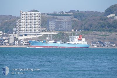
The current position of GOUTAMARU is in North Pacific Ocean with coordinates 35.16335° / 139.75328° as reported on 2024-05-29 02:51 by AIS to our vessel tracker app. The vessel's current speed is 13.6 Knopen and is heading at the port of PORT LINCOLN. The estimated time of arrival as calculated by MyShipTracking vessel tracking app is 2024-06-16 09:30 LT
The vessel GOUTAMARU (IMO: 9746827, MMSI: 431263000) is a Cargo It's sailing under the flag of [JP] Japan.
In this page you can find informations about the vessels current position, last detected port calls, and current voyage information. If the vessels is not in coverage by AIS you will find the latest position.
The current position of GOUTAMARU is detected by our AIS receivers and we are not responsible for the reliability of the data. The last position was recorded while the vessel was in Coverage by the Ais receivers of our vessel tracking app.
The current draught of GOUTAMARU as reported by AIS is 5.7 meters
Weather
| Temperature | 28.8°C / 83.84°F |
|---|---|
| Wind Speed | 9 knots |
| Direction | 79° E |
| Pressure | 1011.9 hPa |
| Humidity | 75.7 % |
| Cloud Coverage | 66 % |
Featured Company
Last Port Calls
| Port | Arrival | Departure | Time In Port |
|---|---|---|---|
| 2024-05-27 14:47 | 2024-05-27 14:52 | 4 m | |
| 2024-04-24 08:47 | 2024-05-27 12:51 | ||
| 2024-04-21 08:24 | 2024-04-22 12:12 | 1 d |
Most Visited Ports (Last year)
| Port | Arrivals | |
|---|---|---|
| 10 | ||
| 5 | ||
| 2 | ||
| 1 | ||
| 1 | ||
| 1 |
Last Trips
| Origin | Departure | Destination | Arrival | Distance | |
|---|---|---|---|---|---|
| 2024-05-27 12:51 | 2024-05-27 14:47 | 12.17 nm | |||
| 2024-04-22 12:12 | 2024-04-24 08:47 | 545.65 nm | |||
| 2024-03-21 13:12 | 2024-04-21 08:24 | 8256.22 nm |
Events
| Tijd | Evenement | Details | Positie / Bestemming | Info |
|---|---|---|---|---|
| 2024-05-29 02:54 | Status Changed | Default Under way using engine |
35.15368 / 139.74989
AU PLO
|
Snelheid: 13.6 kn Koers: 195.7° |
| 2024-05-29 02:51 | Buitenbereik |
35.16335 / 139.75328
North Pacific Ocean
AU PLO
|
Snelheid: 13.6 kn Koers: 195.7° |
|
| 2024-05-29 02:04 | Draught Changed | 5.7 6.1 |
35.31770 / 139.71001
AU PLO
|
Snelheid: 10.4 kn Koers: 128.3° |
| 2024-05-29 02:04 | Destination Changed | AU PLO JP YOS |
35.31770 / 139.71001
AU PLO
|
Snelheid: 10.4 kn Koers: 128.3° |
| 2024-05-29 02:04 | ETA Changed | 2024/06/16 00:00 2024/05/27 23:00 |
35.31770 / 139.71001
AU PLO
|
Snelheid: 10.4 kn Koers: 128.3° |
| 2024-05-29 01:54 | Start beweging | 1.86 nm, North East of YOKOSUKA |
35.33176 / 139.69278
JP YOS
|
Snelheid: 3.1 kn Koers: 138° |
| 2024-05-29 01:54 | Status Changed | Under way using engine Default |
35.33206 / 139.69271
JP YOS
|
Snelheid: 0.7 kn Koers: 121° |
| 2024-05-29 01:44 | Status Changed | Default At anchor |
35.33477 / 139.69431
JP YOS
|
Snelheid: Koers: 83° |
| 2024-05-29 01:29 | Status Changed | At anchor Default |
35.33480 / 139.69385
JP YOS
|
Snelheid: 0.2 kn Koers: 69° |
| 2024-05-29 01:23 | Status Changed | Default At anchor |
35.33444 / 139.69383
JP YOS
|
Snelheid: 0.1 kn Koers: 79° |