
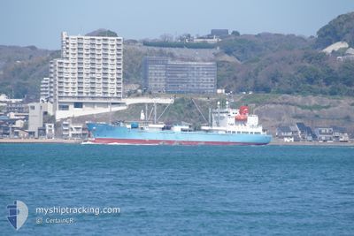
GOUTAMARU
Cargo
Current Trip
| Time Travelled | 7 days |
|---|---|
| Remaining Time | 11 days |
| Distance Travelled | 2539.39 nm |
| Remaining Distance | 3671.92 nm |
| AVG Speed | 13.3 Noeuds |
| MAX Speed | 14.9 Noeuds |
| AVG Wind | 10.5 knots |
| MAX Wind | 22 knots |
| MIN Temp | 12°C / 53.6°F |
| MAX Temp | 20.2°C / 68.36°F |
| Tirant d eau | 6.1 m |
| Position reçue | 2 d depuis |
Current Position
| Longitude | --- |
|---|---|
| Latitude | --- |
| Etat | Under way using engine |
| Vitesse | 14 Noeuds |
| Parcours | 198.4° |
| Zone | North Atlantic Ocean |
| Station | T-AIS |
| Position reçue | 2 d depuis |
Info
Information
The current position of GOUTAMARU is in North Atlantic Ocean with coordinates 27.64621° / -16.45703° as reported on 2025-02-15 04:51 by AIS to our vessel tracker app. The vessel's current speed is 14 Noeuds and is heading at the port of CAPE TOWN. The estimated time of arrival as calculated by MyShipTracking vessel tracking app is 2025-02-28 17:07 LT
The vessel GOUTAMARU (IMO: 9746827, MMSI: 431263000) is a Cargo It's sailing under the flag of [JP] Japan.
In this page you can find informations about the vessels current position, last detected port calls, and current voyage information. If the vessels is not in coverage by AIS you will find the latest position.
The current position of GOUTAMARU is detected by our AIS receivers and we are not responsible for the reliability of the data. The last position was recorded while the vessel was in Coverage by the Ais receivers of our vessel tracking app.
The current draught of GOUTAMARU as reported by AIS is 6.1 meters
Weather
| Temperature | 20.2°C / 68.36°F |
|---|---|
| Wind Speed | 17 knots |
| Direction | 13° NNE |
| Pressure | 1013.4 hPa |
| Humidity | 82.8 % |
| Cloud Coverage | 13 % |
Featured Company
Events
| Heure | Evenement | Détails | Position/ Destination | Info |
|---|---|---|---|---|
| 2025-02-15 04:51 | Etat Changé | Default Under way using engine |
27.64436 / -16.45775
ZA CPT
|
Vitesse: 14 kn Parcours: 198.4° |
| 2025-02-15 04:51 | Etat Changé | Under way using engine Default |
27.64621 / -16.45703
ZA CPT
|
Vitesse: 14 kn Parcours: 199° |
| 2025-02-15 04:51 | Hors de la zone couverte |
27.64621 / -16.45703
North Atlantic Ocean
ZA CPT
|
Vitesse: 14 kn Parcours: 198.4° |
|
| 2025-02-15 04:47 | Etat Changé | Default Under way using engine |
27.65994 / -16.45171
ZA CPT
|
Vitesse: 14.1 kn Parcours: 198.9° |
| 2025-02-15 04:40 | Etat Changé | Under way using engine Default |
27.68478 / -16.44210
ZA CPT
|
Vitesse: 14.1 kn Parcours: 199° |
| 2025-02-15 04:39 | Etat Changé | Default Under way using engine |
27.68883 / -16.44051
ZA CPT
|
Vitesse: 14 kn Parcours: 199.4° |
| 2025-02-15 04:25 | Etat Changé | Under way using engine Default |
27.74108 / -16.42052
ZA CPT
|
Vitesse: 14.1 kn Parcours: 200° |
| 2025-02-15 04:23 | Etat Changé | Default Under way using engine |
27.74776 / -16.41794
ZA CPT
|
Vitesse: 14.1 kn Parcours: 199.9° |
| 2025-02-15 04:16 | Etat Changé | Under way using engine Default |
27.77736 / -16.40638
ZA CPT
|
Vitesse: 14 kn Parcours: 199° |
| 2025-02-15 04:11 | Etat Changé | Default Under way using engine |
27.79255 / -16.40033
ZA CPT
|
Vitesse: 13.9 kn Parcours: 199.6° |