
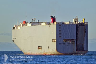
GEORGIA HIGHWAY
Vehicles Carrier
Current Trip
| Time Travelled | 18 h, 49 mins |
|---|---|
| Remaining Time | 17 h, 13 mins |
| Distance Travelled | 287.42 nm |
| Remaining Distance | 281.14 nm |
| AVG Speed | 13.6 Knopen |
| MAX Speed | 17.2 Knopen |
| AVG Wind | 22.9 knots |
| MAX Wind | 30 knots |
| MIN Temp | 5.6°C / 42.08°F |
| MAX Temp | 10.8°C / 51.44°F |
| Diepgang | 8.9 M |
| Positie ontvangen | 10 m geleden |
Current Position
| Lengtegraad | --- |
|---|---|
| Breedtegraat | --- |
| Status | Under way using engine |
| Snelheid | 16.1 Knopen |
| Koers | 87° |
| Gebied | English Channel |
| Station | T-AIS |
| Positie ontvangen | 10 m geleden |
Info
Information
The current position of GEORGIA HIGHWAY is in English Channel with coordinates 49.81368° / -3.25355° as reported on 2024-12-23 15:50 by AIS to our vessel tracker app. The vessel's current speed is 16.1 Knopen and is heading at the port of ZEEBRUGGE. The estimated time of arrival as calculated by MyShipTracking vessel tracking app is 2024-12-24 10:13 LT
The vessel GEORGIA HIGHWAY (IMO: 9339820, MMSI: 432629000) is a Vehicles Carrier that was built in 2007 ( 17 Jaar oud ). It's sailing under the flag of [JP] Japan.
In this page you can find informations about the vessels current position, last detected port calls, and current voyage information. If the vessels is not in coverage by AIS you will find the latest position.
The current position of GEORGIA HIGHWAY is detected by our AIS receivers and we are not responsible for the reliability of the data. The last position was recorded while the vessel was in Coverage by the Ais receivers of our vessel tracking app.
The current draught of GEORGIA HIGHWAY as reported by AIS is 8.9 meters
Weather
| Temperature | 10.5°C / 50.9°F |
|---|---|
| Wind Speed | 15 knots |
| Direction | 276° W |
| Pressure | 1026.9 hPa |
| Humidity | 76.5 % |
| Cloud Coverage | 100 % |
Featured Company
Last Port Calls
| Port | Arrival | Departure | Time In Port |
|---|---|---|---|
| 2024-12-21 22:55 | 2024-12-22 21:11 | 22 h | |
| 2024-12-15 05:21 | 2024-12-15 18:05 | 12 h | |
| 2024-11-08 17:44 | 2024-11-11 16:14 | 2 d | |
| 2024-11-05 13:37 | 2024-11-08 14:44 | 3 d | |
| 2024-10-15 23:57 | 2024-10-16 18:11 | 18 h | |
| 2024-10-14 21:52 | 2024-10-15 06:48 | 8 h | |
| 2024-10-12 23:39 | 2024-10-13 15:11 | 15 h | |
| 2024-10-12 00:35 | 2024-10-12 20:05 | 19 h | |
| 2024-10-09 18:37 | 2024-10-09 23:57 | 5 h | |
| 2024-10-01 16:47 | 2024-10-02 01:28 | 8 h |
Last Trips
| Origin | Departure | Destination | Arrival | Distance | |
|---|---|---|---|---|---|
| 2024-12-15 18:05 | 2024-12-21 22:55 | 1844.67 nm | |||
| 2024-11-11 16:14 | 2024-12-15 05:21 | 14077.22 nm | |||
| 2024-11-08 14:44 | 2024-11-08 17:44 | 41.98 nm | |||
| 2024-10-16 18:11 | 2024-11-05 13:37 | 7174.62 nm | |||
| 2024-10-15 06:48 | 2024-10-15 23:57 | 297.83 nm | |||
| 2024-10-13 15:11 | 2024-10-14 21:52 | 359.91 nm | |||
| 2024-10-12 20:05 | 2024-10-12 23:39 | 39.14 nm | |||
| 2024-10-09 23:57 | 2024-10-12 00:35 | 292.37 nm | |||
| 2024-10-02 01:28 | 2024-10-09 18:37 | 3358.78 nm | |||
| 2024-09-29 14:05 | 2024-10-01 16:47 | 826.28 nm |
Events
| Tijd | Evenement | Details | Positie / Bestemming | Info |
|---|---|---|---|---|
| 2024-12-23 15:55 | Status Changed | Default Under way using engine |
49.81381 / -3.21599
BEZEE
|
Snelheid: 16.1 kn Koers: 87° |
| 2024-12-23 10:55 | Status Changed | Under way using engine Default |
49.82296 / -5.29783
BEZEE
|
Snelheid: 16.4 kn Koers: 90° |
| 2024-12-23 10:47 | Status Changed | Default Under way using engine |
49.82370 / -5.35786
BEZEE
|
Snelheid: 16.4 kn Koers: 90° |
| 2024-12-23 10:37 | Wijzig zee gebeid | United Kingdom part of the English Channel United Kingdom part of the Celtic Sea |
49.82571 / -5.42860
English Channel
BEZEE
|
Snelheid: 16.6 kn Koers: 92° |
| 2024-12-23 10:35 | Status Changed | Under way using engine Default |
49.82610 / -5.43904
BEZEE
|
Snelheid: 16.5 kn Koers: 93° |
| 2024-12-23 10:11 | Status Changed | Default Under way using engine |
49.83186 / -5.61687
BEZEE
|
Snelheid: 16.9 kn Koers: 92° |
| 2024-12-23 10:04 | Status Changed | Under way using engine Default |
49.83336 / -5.66299
BEZEE
|
Snelheid: 17 kn Koers: 95° |
| 2024-12-23 09:23 | Status Changed | Default Under way using engine |
49.88524 / -5.94237
BEZEE
|
Snelheid: 16.2 kn Koers: 151° |
| 2024-12-23 09:16 | Status Changed | Under way using engine Default |
49.90990 / -5.97024
BEZEE
|
Snelheid: 16.2 kn Koers: 153° |
| 2024-12-23 09:15 | Status Changed | Default Under way using engine |
49.91468 / -5.97430
BEZEE
|
Snelheid: 16.1 kn Koers: 168° |