
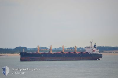
GENCO WARRIOR
Bulk Carrier
Current Trip
SANTAREM
| Time Travelled | 33 days |
|---|---|
| Remaining Time | --- |
| Distance Travelled | 3813.49 nm |
| Remaining Distance | --- |
| AVG Speed | 10.3 Knopen |
| MAX Speed | 16.1 Knopen |
| AVG Wind | 8.2 knots |
| MAX Wind | 20 knots |
| MIN Temp | 20.5°C / 68.9°F |
| MAX Temp | 31.4°C / 88.52°F |
| Diepgang | 6.4 M |
| Positie ontvangen | 8 m geleden |
Current Position
| Lengtegraad | -54.82558° |
|---|---|
| Breedtegraat | -2.38935° |
| Status | At anchor |
| Snelheid | 0.3 Knopen |
| Koers | 124° |
| Gebied | South Atlantic Ocean |
| Station | T-AIS |
| Positie ontvangen | 8 m geleden |
Info
Information
The current position of GENCO WARRIOR is in South Atlantic Ocean with coordinates -2.38935° / -54.82558° as reported on 2024-05-21 22:14 by AIS to our vessel tracker app. The vessel's current speed is 0.3 Knopen
The vessel GENCO WARRIOR (IMO: 9316153, MMSI: 538002808) is a Bulk Carrier that was built in 2005 ( 19 Jaar oud ). It's sailing under the flag of [MH] Marshall Is.
In this page you can find informations about the vessels current position, last detected port calls, and current voyage information. If the vessels is not in coverage by AIS you will find the latest position.
The current position of GENCO WARRIOR is detected by our AIS receivers and we are not responsible for the reliability of the data. The last position was recorded while the vessel was in Coverage by the Ais receivers of our vessel tracking app.
The current draught of GENCO WARRIOR as reported by AIS is 6.4 meters
Weather
| Temperature | 25.3°C / 77.54°F |
|---|---|
| Wind Speed | 3 knots |
| Direction | 96° E |
| Pressure | 1010.3 hPa |
| Humidity | 88 % |
| Cloud Coverage | 75 % |
Featured Company
Last Port Calls
| Port | Arrival | Departure | Time In Port |
|---|---|---|---|
| 2024-04-15 13:11 | 2024-04-18 09:07 | 2 d | |
| 2024-03-29 01:36 | 2024-04-09 06:07 | 11 d | |
| 2024-03-01 20:16 |
Most Visited Ports (Last year)
| Port | Arrivals | |
|---|---|---|
| 9 | ||
| 2 | ||
| 2 | ||
| 1 | ||
| 1 | ||
| 1 |
Last Trips
| Origin | Departure | Destination | Arrival | Distance | |
|---|---|---|---|---|---|
| 2024-04-09 01:07 | 2024-04-15 08:11 | 467.47 nm | |||
| 2024-03-01 23:16 | 2024-03-28 20:36 | 6632.58 nm |
Events
| Tijd | Evenement | Details | Positie / Bestemming | Info |
|---|---|---|---|---|
| 2024-05-20 02:06 | Status Changed | At anchor Under way using engine |
-2.39109 / -54.82201
SANTAREM
|
Snelheid: 0.5 kn Koers: 286° |
| 2024-05-20 02:02 | Stop beweging | 6.81 nm, West of SANTAREM |
-2.39127 / -54.82240
SANTAREM
|
Snelheid: 0.3 kn Koers: 282° |
| 2024-05-19 21:08 | Status Changed | Under way using engine Default |
-2.37375 / -54.13471
SANTAREM
|
Snelheid: 10.2 kn Koers: 254° |
| 2024-05-19 21:04 | Status Changed | Default Under way using engine |
-2.37102 / -54.12566
SANTAREM
|
Snelheid: 10.3 kn Koers: 254.4° |
| 2024-05-19 20:59 | Status Changed | Under way using engine Default |
-2.36694 / -54.11155
SANTAREM
|
Snelheid: 10.3 kn Koers: 254° |
| 2024-05-19 20:53 | Status Changed | Default Under way using engine |
-2.36142 / -54.09423
SANTAREM
|
Snelheid: 9.9 kn Koers: 230° |
| 2024-05-19 20:39 | Status Changed | Under way using engine Default |
-2.34462 / -54.05911
SANTAREM
|
Snelheid: 10.2 kn Koers: 217° |
| 2024-05-19 20:28 | Status Changed | Default Under way using engine |
-2.31672 / -54.04386
SANTAREM
|
Snelheid: 10 kn Koers: 168.7° |
| 2024-05-19 20:19 | Status Changed | Under way using engine Default |
-2.29170 / -54.04650
SANTAREM
|
Snelheid: 9.9 kn Koers: 170° |
| 2024-05-19 20:09 | Status Changed | Default Under way using engine |
-2.26415 / -54.04943
SANTAREM
|
Snelheid: 9.8 kn Koers: 182.2° |