

RAMIRA
Tanker

Current Trip
| Time Travelled | 3 days |
|---|---|
| Remaining Time | --- |
| Distance Travelled | 565.32 nm |
| Remaining Distance | --- |
| AVG Speed | 10.2 Knopen |
| MAX Speed | 12.6 Knopen |
| AVG Wind | 16.2 knots |
| MAX Wind | 26 knots |
| MIN Temp | 5.5°C / 41.9°F |
| MAX Temp | 11.1°C / 51.98°F |
| Diepgang | 9.3 M |
| Positie ontvangen | 2 m geleden |
Current Position
| Lengtegraad | --- |
|---|---|
| Breedtegraat | --- |
| Status | At anchor |
| Snelheid | 0.1 Knopen |
| Koers | 344° |
| Gebied | North Sea |
| Station | T-AIS |
| Positie ontvangen | 2 m geleden |
Information
The current position of RAMIRA is in North Sea with coordinates 51.49987° / 1.50021° as reported on 2025-03-28 18:04 by AIS to our vessel tracker app. The vessel's current speed is 0.1 Knopen
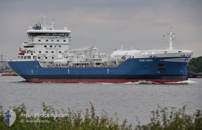
The vessel RAMIRA (IMO: 9890599, MMSI: 265007000) is a Tanker It's sailing under the flag of [SE] Sweden.
In this page you can find informations about the vessels current position, last detected port calls, and current voyage information. If the vessels is not in coverage by AIS you will find the latest position.
The current position of RAMIRA is detected by our AIS receivers and we are not responsible for the reliability of the data. The last position was recorded while the vessel was in Coverage by the Ais receivers of our vessel tracking app.
The current draught of RAMIRA as reported by AIS is 9.3 meters
Weather
| Temperature | 9.5°C / 49.1°F |
|---|---|
| Wind Speed | 10 knots |
| Direction | 322° NW |
| Pressure | 1011.9 hPa |
| Humidity | 71.6 % |
| Cloud Coverage | 100 % |


Featured Company
Last Port Calls
| Port | Arrival | Departure | Time In Port |
|---|---|---|---|
| 2025-03-22 10:05 | 2025-03-25 06:31 | 2 d | |
| 2025-03-13 11:09 | 2025-03-15 11:13 | 2 d | |
| 2025-03-06 07:13 | 2025-03-08 01:11 | 1 d | |
| 2025-02-27 10:03 | 2025-02-28 09:41 | 23 h | |
| 2025-02-21 23:09 | 2025-02-23 17:10 | 1 d | |
| 2025-02-20 04:34 | 2025-02-20 05:10 | 35 m | |
| 2025-02-18 19:32 | 2025-02-20 03:44 | 1 d | |
| 2025-02-18 17:38 | 2025-02-18 18:05 | 26 m | |
| 2025-02-13 16:12 | 2025-02-16 12:08 | 2 d | |
| 2025-02-09 04:46 | 2025-02-11 00:24 | 1 d |
Last Trips
| Origin | Departure | Destination | Arrival | Distance | |
|---|---|---|---|---|---|
| 2025-03-15 11:13 | 2025-03-22 10:05 | 479.28 nm | |||
| 2025-03-08 01:11 | 2025-03-13 11:09 | 704.25 nm | |||
| 2025-02-28 09:41 | 2025-03-06 07:13 | 138.46 nm | |||
| 2025-02-23 17:10 | 2025-02-27 10:03 | 715.61 nm | |||
| 2025-02-20 05:10 | 2025-02-21 23:09 | 143.82 nm | |||
| 2025-02-20 03:44 | 2025-02-20 04:34 | 4.25 nm | |||
| 2025-02-18 18:05 | 2025-02-18 19:32 | 8.02 nm | |||
| 2025-02-16 12:08 | 2025-02-18 17:38 | 502.63 nm | |||
| 2025-02-11 00:24 | 2025-02-13 16:12 | 523.96 nm | |||
| 2025-02-08 20:13 | 2025-02-09 04:46 | 96.42 nm |
Events
| Tijd | Evenement | Details | Positie / Bestemming | Info |
|---|---|---|---|---|
| 2025-03-27 12:07 | Status Changed | At anchor Default |
51.50329 / 1.50128
GB IOG
|
Snelheid: 0.3 kn Koers: 182° |
| 2025-03-27 12:04 | Status Changed | Default At anchor |
51.50341 / 1.50108
GB IOG
|
Snelheid: 0.3 kn Koers: 180° |
| 2025-03-27 11:31 | Status Changed | At anchor Under way using engine |
51.50287 / 1.49973
GB IOG
|
Snelheid: 0.5 kn Koers: 171° |
| 2025-03-27 11:28 | Stop beweging | 11.01 nm, North of RAMSGATE |
51.50243 / 1.49934
GB IOG
|
Snelheid: 0.3 kn Koers: 160° |
| 2025-03-27 08:20 | Gevonden in zee | United Kingdom part of the North Sea |
51.65071 / 2.29759
North Sea
GB IOG
|
Snelheid: 12.1 kn Koers: 223.1° |
| 2025-03-27 07:08 | Wijzig zee gebeid | Belgian part of the North Sea Dutch part of the North Sea |
51.84909 / 2.54057
North Sea
GB IOG
|
Snelheid: 12.5 kn Koers: 218.2° |
| 2025-03-27 06:07 | Status Changed | Under way using engine Default |
52.00627 / 2.76392
GB IOG
|
Snelheid: 12.5 kn Koers: 219° |
| 2025-03-27 06:06 | Status Changed | Default Under way using engine |
52.01025 / 2.76935
GB IOG
|
Snelheid: 12.3 kn Koers: 219.7° |
| 2025-03-27 05:22 | Status Changed | Under way using engine Default |
52.12424 / 2.91982
GB IOG
|
Snelheid: 11.7 kn Koers: 219° |
| 2025-03-27 05:18 | Status Changed | Default Under way using engine |
52.13624 / 2.93525
GB IOG
|
Snelheid: 11.6 kn Koers: 218.9° |