
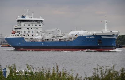
FURE VINGA
Tanker
Current Trip
| Time Travelled | 2 h, 34 mins |
|---|---|
| Remaining Time | 10 h, 20 mins |
| Distance Travelled | 30.66 nm |
| Remaining Distance | 121.58 nm |
| AVG Speed | 11.9 Noeuds |
| MAX Speed | 13.4 Noeuds |
| AVG Wind | 3.2 knots |
| MAX Wind | 4.4 knots |
| MIN Temp | -2.5°C / 27.5°F |
| MAX Temp | 0.3°C / 32.54°F |
| Tirant d eau | 6.6 m |
| Position reçue | 1 m depuis |
Current Position
| Longitude | --- |
|---|---|
| Latitude | --- |
| Etat | Under way using engine |
| Vitesse | 9.6 Noeuds |
| Parcours | 327.7° |
| Zone | Norwegian Sea |
| Station | T-AIS |
| Position reçue | 1 m depuis |
Info
Information
The current position of FURE VINGA is in Norwegian Sea with coordinates 69.66017° / 18.86994° as reported on 2024-10-06 03:02 by AIS to our vessel tracker app. The vessel's current speed is 9.6 Noeuds and is heading at the port of ALTA. The estimated time of arrival as calculated by MyShipTracking vessel tracking app is 2024-10-06 13:24 LT
The vessel FURE VINGA (IMO: 9890599, MMSI: 265007000) is a Tanker It's sailing under the flag of [SE] Sweden.
In this page you can find informations about the vessels current position, last detected port calls, and current voyage information. If the vessels is not in coverage by AIS you will find the latest position.
The current position of FURE VINGA is detected by our AIS receivers and we are not responsible for the reliability of the data. The last position was recorded while the vessel was in Coverage by the Ais receivers of our vessel tracking app.
The current draught of FURE VINGA as reported by AIS is 6.6 meters
Weather
| Temperature | 2.3°C / 36.14°F |
|---|---|
| Wind Speed | 6 knots |
| Direction | 34° NE |
| Pressure | 1012.1 hPa |
| Humidity | 79 % |
| Cloud Coverage | 99 % |
Featured Company
Last Port Calls
| Port | Arrival | Departure | Time In Port |
|---|---|---|---|
| 2024-10-05 18:40 | 2024-10-06 00:30 | 5 h | |
| 2024-10-04 20:53 | 2024-10-05 10:19 | 13 h | |
| 2024-09-30 19:31 | 2024-10-02 05:19 | 1 d | |
| 2024-09-26 10:15 | 2024-09-27 11:15 | 1 d | |
| 2024-09-24 02:00 | 2024-09-24 23:09 | 21 h | |
| 2024-09-19 17:58 | 2024-09-20 02:45 | 8 h | |
| 2024-09-15 21:41 | 2024-09-17 01:56 | 1 d | |
| 2024-09-10 14:12 | 2024-09-11 02:19 | 12 h | |
| 2024-09-08 22:52 | 2024-09-09 17:19 | 18 h | |
| 2024-09-05 03:38 | 2024-09-06 21:32 | 1 d |
Last Trips
| Origin | Departure | Destination | Arrival | Distance | |
|---|---|---|---|---|---|
| 2024-10-05 12:19 | 2024-10-05 20:40 | 101.21 nm | |||
| 2024-10-02 07:19 | 2024-10-04 22:53 | 639.93 nm | |||
| 2024-09-27 13:15 | 2024-09-30 21:31 | 408.17 nm | |||
| 2024-09-25 01:09 | 2024-09-26 12:15 | 416.64 nm | |||
| 2024-09-20 04:45 | 2024-09-24 04:00 | 982.62 nm | |||
| 2024-09-17 03:56 | 2024-09-19 19:58 | 595.87 nm | |||
| 2024-09-11 04:19 | 2024-09-15 23:41 | 899.28 nm | |||
| 2024-09-09 19:19 | 2024-09-10 16:12 | 260.97 nm | |||
| 2024-09-06 23:32 | 2024-09-09 00:52 | 604.19 nm | |||
| 2024-09-01 01:22 | 2024-09-05 05:38 | 536.49 nm |
Events
| Heure | Evenement | Détails | Position/ Destination | Info |
|---|---|---|---|---|
| 2024-10-06 02:32 | Tirant d'eau modifié | 6.6 6 |
69.56906 / 18.87097
NO ALF
|
Vitesse: 13 kn Parcours: 334° |
| 2024-10-06 02:32 | Changement d'ETA | 2024/10/06 10:00 |
69.56906 / 18.87097
NO ALF
|
Vitesse: 13 kn Parcours: 334° |
| 2024-10-06 02:26 | Tirant d'eau modifié | 6 6.6 |
69.54964 / 18.89756
NO ALF
|
Vitesse: 13.3 kn Parcours: 335.8° |
| 2024-10-06 00:40 | Etat Changé | Under way using engine Moored |
69.25593 / 19.37013
NO ALF
|
Vitesse: 9.7 kn Parcours: 6.5° |
| 2024-10-06 00:34 | Démarrage | 0.23 nm, North of BERGNESET |
69.24203 / 19.36394
NO ALF
|
Vitesse: 4.4 kn Parcours: 18° |
| 2024-10-06 00:30 | PORT DE DEPART |
|
69.24110 / 19.35927
NO ALF
|
Vitesse: 3.1 kn Parcours: 218° |
| 2024-10-05 23:50 | Tirant d'eau modifié | 6.6 6.4 |
69.23807 / 19.35513
[NO] BERGNESET
|
Vitesse: Parcours: 231° |
| 2024-10-05 22:54 | Tirant d'eau modifié | 6.4 6.8 |
69.23804 / 19.35515
[NO] BERGNESET
|
Vitesse: Parcours: 231° |
| 2024-10-05 22:54 | Changement de destination | NO ALF NO BAF |
69.23804 / 19.35515
[NO] BERGNESET
|
Vitesse: Parcours: 231° |
| 2024-10-05 22:54 | Changement d'ETA | 2024/10/06 10:00 2024/10/05 20:00 |
69.23804 / 19.35515
[NO] BERGNESET
|
Vitesse: Parcours: 231° |