

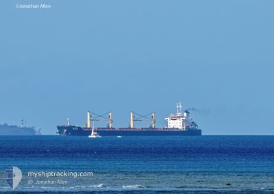
FUHAIHONG
Bulk Carrier

Current Trip
| Time Travelled | --- |
|---|---|
| Remaining Time | 1 day |
| Distance Travelled | 9494.27 nm |
| Remaining Distance | 634.76 nm |
| AVG Speed | 9.5 Knopen |
| MAX Speed | 12.9 Knopen |
| AVG Wind | 11.1 knots |
| MAX Wind | 25 knots |
| MIN Temp | 13.2°C / 55.76°F |
| MAX Temp | 29.2°C / 84.56°F |
| Diepgang | 13 M |
| Positie ontvangen | 23 d geleden |
Current Position
| Lengtegraad | --- |
|---|---|
| Breedtegraat | --- |
| Status | Under way using engine |
| Snelheid | 10.5 Knopen |
| Koers | 156.1° |
| Gebied | Red Sea |
| Station | T-AIS |
| Positie ontvangen | 23 d geleden |
Information
The current position of FUHAIHONG is in Red Sea with coordinates 23.41278° / 36.73471° as reported on 2025-03-04 12:37 by AIS to our vessel tracker app. The vessel's current speed is 10.5 Knopen and is heading at the port of MUNDRA. The estimated time of arrival as calculated by MyShipTracking vessel tracking app is 2025-03-29 23:53 LT
The vessel FUHAIHONG (IMO: 9613666, MMSI: 414500000) is a Bulk Carrier that was built in 2011 ( 14 Jaar oud ). It's sailing under the flag of [CN] China.
In this page you can find informations about the vessels current position, last detected port calls, and current voyage information. If the vessels is not in coverage by AIS you will find the latest position.
The current position of FUHAIHONG is detected by our AIS receivers and we are not responsible for the reliability of the data. The last position was recorded while the vessel was in Coverage by the Ais receivers of our vessel tracking app.
The current draught of FUHAIHONG as reported by AIS is 13 meters
Weather
| Temperature | 29.1°C / 84.38°F |
|---|---|
| Wind Speed | 9 knots |
| Direction | 353° N |
| Pressure | 1010.2 hPa |
| Humidity | 68.8 % |
| Cloud Coverage | 13 % |


Featured Company
Last Port Calls
| Port | Arrival | Departure | Time In Port |
|---|---|---|---|
| 2025-03-02 05:53 | 2025-03-02 17:52 | 11 h | |
| 2025-01-02 16:49 |
Most Visited Ports (Last year)
| Port | Arrivals | |
|---|---|---|
| 4 | ||
| 3 | ||
| 2 | ||
| 1 | ||
| 1 | ||
| 1 |
Last Trips
| Origin | Departure | Destination | Arrival | Distance | |
|---|---|---|---|---|---|
| 2025-01-02 16:49 | 2025-03-02 05:53 | 5604.76 nm |
Events
| Tijd | Evenement | Details | Positie / Bestemming | Info |
|---|---|---|---|---|
| 2025-03-24 14:02 | Start beweging | 3.45 nm, North of OKHA |
22.52463 / 69.07736
MUNDRA
|
Snelheid: 3.9 kn Koers: 353° |
| 2025-03-21 12:57 | Stop beweging | 3.21 nm, North of OKHA |
22.52068 / 69.07778
MUNDRA
|
Snelheid: 0.1 kn Koers: 264° |
| 2025-03-21 12:02 | Start beweging | 0.9 nm, North East of OKHA |
22.47877 / 69.08948
MUNDRA
|
Snelheid: 4.5 kn Koers: 18° |
| 2025-03-19 11:22 | Stop beweging | 0.48 nm, North East of OKHA |
22.47285 / 69.08514
MUNDRA
|
Snelheid: 0.3 kn Koers: 208° |
| 2025-03-19 10:20 | Start beweging | 2.7 nm, North of OKHA |
22.51220 / 69.07825
MUNDRA
|
Snelheid: 4.7 kn Koers: 141° |
| 2025-03-18 17:20 | Stop beweging | 3.15 nm, North of OKHA |
22.51957 / 69.07748
MUNDRA
|
Snelheid: 0.2 kn Koers: 269° |
| 2025-03-18 12:36 | Start beweging | 20.74 nm, South West of OKHA |
22.30782 / 68.74797
MUNDRA
|
Snelheid: 3.8 kn Koers: 105° |
| 2025-03-18 04:27 | Stop beweging | 20.87 nm, South West of OKHA |
22.30866 / 68.74493
MUNDRA
|
Snelheid: 0.2 kn Koers: 307° |