
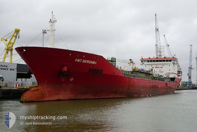
FMT BERGAMA
Oil/Chemical Tanker
Current Trip
| Time Travelled | 15 days |
|---|---|
| Remaining Time | 3 days |
| Distance Travelled | 3033.39 nm |
| Remaining Distance | 901.57 nm |
| AVG Speed | 10.2 Knopen |
| MAX Speed | 10.2 Knopen |
| AVG Wind | 12.3 knots |
| MAX Wind | 29.3 knots |
| MIN Temp | 12.4°C / 54.32°F |
| MAX Temp | 24.9°C / 76.82°F |
| Diepgang | 8.7 M |
| Positie ontvangen | 5 h, 59 m geleden |
Current Position
| Lengtegraad | -9.94197° |
|---|---|
| Breedtegraat | 41.64234° |
| Status | Under way using engine |
| Snelheid | 8.9 Knopen |
| Koers | 2° |
| Gebied | North Atlantic Ocean |
| Station | T-AIS |
| Positie ontvangen | 5 h, 59 m geleden |
Info
Information
The current position of FMT BERGAMA is in North Atlantic Ocean with coordinates 41.64234° / -9.94197° as reported on 2024-04-26 09:54 by AIS to our vessel tracker app. The vessel's current speed is 8.9 Knopen and is heading at the port of ANTWERP. The estimated time of arrival as calculated by MyShipTracking vessel tracking app is 2024-04-30 05:06 LT
The vessel FMT BERGAMA (IMO: 9427988, MMSI: 248058000) is a Oil/Chemical Tanker that was built in 2009 ( 15 Jaar oud ). It's sailing under the flag of [MT] Malta.
In this page you can find informations about the vessels current position, last detected port calls, and current voyage information. If the vessels is not in coverage by AIS you will find the latest position.
The current position of FMT BERGAMA is detected by our AIS receivers and we are not responsible for the reliability of the data. The last position was recorded while the vessel was in Coverage by the Ais receivers of our vessel tracking app.
The current draught of FMT BERGAMA as reported by AIS is 8.7 meters
Weather
| Temperature | 12.9°C / 55.22°F |
|---|---|
| Wind Speed | 9 knots |
| Direction | 284° WNW |
| Pressure | 1006.4 hPa |
| Humidity | 72.4 % |
| Cloud Coverage | 100 % |
Featured Company
Last Port Calls
| Port | Arrival | Departure | Time In Port |
|---|---|---|---|
| 2024-04-09 15:53 | 2024-04-11 09:21 | 1 d | |
| 2024-03-28 09:05 | 2024-03-29 09:39 | 1 d | |
| 2024-03-26 09:59 | 2024-03-28 07:16 | 1 d | |
| 2024-03-04 04:21 | 2024-03-06 00:03 | 1 d | |
| 2024-02-23 17:31 | 2024-02-23 17:35 | 4 m | |
| 2024-02-22 23:11 | 2024-02-23 08:51 | 9 h | |
| 2024-02-14 21:25 | 2024-02-16 01:17 | 1 d | |
| 2024-02-13 14:31 | 2024-02-14 08:43 | 18 h | |
| 2024-02-07 11:36 | 2024-02-09 12:52 | 2 d | |
| 2024-02-07 10:10 | 2024-02-07 10:52 | 42 m |
Last Trips
| Origin | Departure | Destination | Arrival | Distance | |
|---|---|---|---|---|---|
| 2024-03-29 12:39 | 2024-04-09 19:53 | 844.46 nm | |||
| 2024-03-28 10:16 | 2024-03-28 12:05 | 16.69 nm | |||
| 2024-03-06 03:03 | 2024-03-26 12:59 | 4704.10 nm | |||
| 2024-02-23 18:35 | 2024-03-04 07:21 | 890.93 nm | |||
| 2024-02-23 09:51 | 2024-02-23 18:31 | 47.32 nm | |||
| 2024-02-16 02:17 | 2024-02-23 00:11 | 1067.82 nm | |||
| 2024-02-14 09:43 | 2024-02-14 22:25 | 120.28 nm | |||
| 2024-02-09 13:52 | 2024-02-13 15:31 | 836.43 nm | |||
| 2024-02-07 11:52 | 2024-02-07 12:36 | 5.50 nm | |||
| 2024-02-06 23:11 | 2024-02-07 11:10 | 88.98 nm |
Events
| Tijd | Evenement | Details | Positie / Bestemming | Info |
|---|---|---|---|---|
| 2024-04-26 09:54 | Buitenbereik |
41.64234 / -9.94197
North Atlantic Ocean
ANTWERP FOR ORDERS
|
Snelheid: 8.9 kn Koers: 2° |
|
| 2024-04-26 02:23 | Status Changed | Under way using engine Default |
40.44749 / -9.92712
ANTWERP FOR ORDERS
|
Snelheid: 10.5 kn Koers: 359° |
| 2024-04-26 02:23 | Binnenbereik |
40.44749 / -9.92712
North Atlantic Ocean
ANTWERP FOR ORDERS
|
Snelheid: 10.5 kn Koers: 0° |
|
| 2024-04-26 01:10 | Status Changed | Default Under way using engine |
40.25887 / -9.94445
ANTWERP FOR ORDERS
|
Snelheid: 10.7 kn Koers: 1.7° |
| 2024-04-26 01:01 | Status Changed | Under way using engine Default |
40.22641 / -9.94453
ANTWERP FOR ORDERS
|
Snelheid: 10.7 kn Koers: 1° |
| 2024-04-26 01:01 | Buitenbereik |
40.22641 / -9.94453
North Atlantic Ocean
ANTWERP FOR ORDERS
|
Snelheid: 10.7 kn Koers: 1.7° |
|
| 2024-04-26 00:49 | Binnenbereik |
40.22641 / -9.94453
North Atlantic Ocean
ANTWERP FOR ORDERS
|
Snelheid: 10.7 kn Koers: 1.7° |
|
| 2024-04-25 23:18 | Status Changed | Default Under way using engine |
39.93745 / -9.94585
ANTWERP FOR ORDERS
|
Snelheid: 10 kn Koers: 1.5° |
| 2024-04-25 23:12 | Buitenbereik |
39.91976 / -9.94648
North Atlantic Ocean
ANTWERP FOR ORDERS
|
Snelheid: 10 kn Koers: 1.5° |
|
| 2024-04-25 07:43 | Status Changed | Under way using engine Default |
37.54039 / -9.60768
ANTWERP FOR ORDERS
|
Snelheid: 8.5 kn Koers: 347° |