
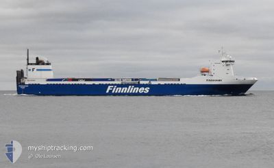
FINNHAWK
Ro-Ro Cargo
Current Trip
| Time Travelled | 1 day |
|---|---|
| Remaining Time | 1 day |
| Distance Travelled | 536.81 nm |
| Remaining Distance | 638.05 nm |
| AVG Speed | 18 Knopen |
| MAX Speed | 18.8 Knopen |
| AVG Wind | 11.2 knots |
| MAX Wind | 18.9 knots |
| MIN Temp | 1.5°C / 34.7°F |
| MAX Temp | 7.3°C / 45.14°F |
| Diepgang | 7 M |
| Positie ontvangen | 1 m geleden |
Current Position
| Lengtegraad | 12.66418° |
|---|---|
| Breedtegraat | 55.32150° |
| Status | Under way using engine |
| Snelheid | 16.5 Knopen |
| Koers | 347° |
| Gebied | Baltic Sea |
| Station | T-AIS |
| Positie ontvangen | 1 m geleden |
Info
Information
The current position of FINNHAWK is in Baltic Sea with coordinates 55.32150° / 12.66418° as reported on 2024-04-26 17:19 by AIS to our vessel tracker app. The vessel's current speed is 16.5 Knopen and is heading at the port of HULL. The estimated time of arrival as calculated by MyShipTracking vessel tracking app is 2024-04-28 04:50 LT
The vessel FINNHAWK (IMO: 9207895, MMSI: 230007000) is a Ro-Ro Cargo that was built in 2001 ( 23 Jaar oud ). It's sailing under the flag of [FI] Finland.
In this page you can find informations about the vessels current position, last detected port calls, and current voyage information. If the vessels is not in coverage by AIS you will find the latest position.
The current position of FINNHAWK is detected by our AIS receivers and we are not responsible for the reliability of the data. The last position was recorded while the vessel was in Coverage by the Ais receivers of our vessel tracking app.
The current draught of FINNHAWK as reported by AIS is 7 meters
Weather
| Temperature | 6.6°C / 43.88°F |
|---|---|
| Wind Speed | 12 knots |
| Direction | 196° SSW |
| Pressure | 1005.6 hPa |
| Humidity | 88.4 % |
| Cloud Coverage | 100 % |
Featured Company
Last Port Calls
| Port | Arrival | Departure | Time In Port |
|---|---|---|---|
| 2024-04-24 15:26 | 2024-04-25 11:43 | 20 h | |
| 2024-04-21 13:03 | 2024-04-22 02:42 | 13 h | |
| 2024-04-17 12:11 | 2024-04-18 15:32 | 1 d | |
| 2024-04-14 09:35 | 2024-04-14 20:36 | 11 h | |
| 2024-04-09 03:02 | 2024-04-11 11:08 | 2 d | |
| 2024-03-14 08:20 | 2024-04-06 06:06 | 22 d | |
| 2024-03-10 08:20 | 2024-03-11 09:16 | 1 d | |
| 2024-03-07 03:03 | 2024-03-07 16:49 | 13 h | |
| 2024-03-02 15:08 | 2024-03-03 20:10 | 1 d | |
| 2024-02-28 10:48 | 2024-02-28 23:18 | 12 h |
Most Visited Ports (Last year)
| Port | Arrivals | |
|---|---|---|
| 44 | ||
| 43 | ||
| 1 | ||
| 1 | ||
| 1 |
Last Trips
| Origin | Departure | Destination | Arrival | Distance | |
|---|---|---|---|---|---|
| 2024-04-22 03:42 | 2024-04-24 18:26 | 1176.29 nm | |||
| 2024-04-18 18:32 | 2024-04-21 14:03 | 1183.11 nm | |||
| 2024-04-14 21:36 | 2024-04-17 15:11 | 1172.54 nm | |||
| 2024-04-11 14:08 | 2024-04-14 10:35 | 1189.57 nm | |||
| 2024-04-06 07:06 | 2024-04-09 06:02 | 1182.01 nm | |||
| 2024-03-11 11:16 | 2024-03-14 08:20 | 1174.71 nm | |||
| 2024-03-07 16:49 | 2024-03-10 10:20 | 1173.53 nm | |||
| 2024-03-03 22:10 | 2024-03-07 03:03 | 1184.69 nm | |||
| 2024-02-28 23:18 | 2024-03-02 17:08 | 1175.73 nm | |||
| 2024-02-25 12:23 | 2024-02-28 10:48 | 1174.92 nm |
Events
| Tijd | Evenement | Details | Positie / Bestemming | Info |
|---|---|---|---|---|
| 2024-04-26 13:11 | Wijzig zee gebeid | Swedish part of the Baltic Sea Danish part of the Kattegat |
55.44570 / 14.66051
Baltic Sea
HULL
|
Snelheid: 18.2 kn Koers: 240.3° |
| 2024-04-26 11:56 | Wijzig zee gebeid | Danish part of the Kattegat Swedish part of the Baltic Sea |
55.63308 / 15.24454
Kattegat
HULL
|
Snelheid: 18 kn Koers: 239° |
| 2024-04-26 09:18 | ETA Changed | 2024/04/28 05:45 2024/04/28 06:45 |
56.06090 / 16.44664
HULL
|
Snelheid: 18.5 kn Koers: 238.7° |
| 2024-04-26 09:07 | Status Changed | Under way using engine Default |
56.09112 / 16.53594
HULL
|
Snelheid: 18.3 kn Koers: 239° |
| 2024-04-26 08:56 | Status Changed | Default Under way using engine |
56.11816 / 16.61620
HULL
|
Snelheid: 18.2 kn Koers: 237.6° |
| 2024-04-26 08:46 | Wijzig zee gebeid | Swedish part of the Baltic Sea Finnish part of the Baltic Sea |
56.14567 / 16.69337
Baltic Sea
HULL
|
Snelheid: 18.1 kn Koers: 228.4° |
| 2024-04-26 08:46 | Status Changed | Under way using engine Default |
56.14634 / 16.69471
HULL
|
Snelheid: 18 kn Koers: 218° |
| 2024-04-26 08:36 | Binnenbereik |
56.14567 / 16.69337
Baltic Sea
HULL
|
Snelheid: 18.1 kn Koers: 228.4° |
|
| 2024-04-25 17:52 | Status Changed | Default Under way using engine |
59.38890 / 22.18010
HULL
|
Snelheid: 18 kn Koers: 238.5° |
| 2024-04-25 17:38 | Buitenbereik |
59.42428 / 22.29832
Baltic Sea
HULL
|
Snelheid: 18 kn Koers: 238.5° |